|
The village of Armaillé is a small village located north west of France. The town of Armaillé is located in the department of Maine-et-Loire of the french region Pays de la Loire. The town of Armaillé is located in the township of Pouancé part of the district of Segré. The area code for Armaillé is 49010 (also known as code INSEE), and the Armaillé zip code is 49420.
Geography and map of Armaillé :
The altitude of the city hall of Armaillé is approximately 50 meters. The Armaillé surface is 16.78 km ². The latitude and longitude of Armaillé are 47.715 degrees North and 1.127 degrees West.
Nearby cities and towns of Armaillé are :
Vergonnes (49420) at 3.45 km, Noëllet (49520) at 3.58 km, Saint-Michel-et-Chanveaux (49420) at 3.83 km, La Prévière (49420) at 3.85 km, Pouancé (49420) at 4.38 km, Chazé-Henry (49860) at 4.50 km, Juigné-des-Moutiers (44670) at 5.72 km, La Chapelle-Hullin (49860) at 6.50 km.
(The distances to these nearby towns of Armaillé are calculated as the crow flies)
Population and housing of Armaillé :
The population of Armaillé was 289 in 1999, 298 in 2006 and 294 in 2007. The population density of Armaillé is 17.52 inhabitants per km². The number of housing of Armaillé was 134 in 2007. These homes of Armaillé consist of 113 main residences, 9 second or occasional homes and 12 vacant homes. |
|
|
Hotel Armaillé
|
|
|
Book now ! Best Price Guaranteed, no booking fees, pay at the hotel with our partner Booking.com, leader in online hotel reservation.
Find all hotels of Armaillé : Hotel Armaillé
| |
|
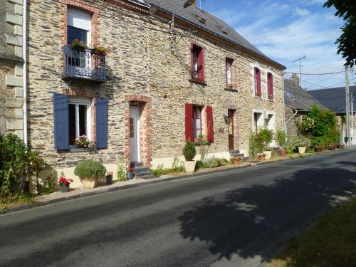
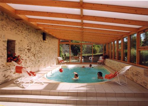
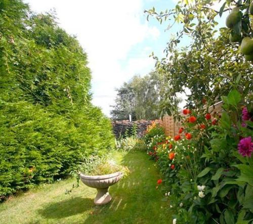
Guest accommodation : maison de vacances -Gîte
Featuring barbecue facilities, maison de vacances -Gîte provides accommodation in La Prévière with free WiFi and garden views. The accommodation is 49 km from Ancenis. The holi...
Address : 6 place de l'église 49420 La Prévière
Distance Guest accommodation - Armaillé : 3.85 km
|
|
|
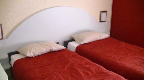
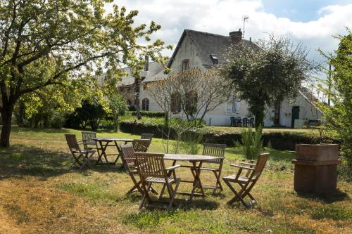
Hotel : La Porte Angevine

Located in Pouance, La Porte Angevine offers accommodation just a 5 minute walk from the lake of Pouancé and 17 from Chateaubriant. It features a terrace, free Wi-Fi and free pr...
Price : from 58.00 €
to 66.00 €
Contact : 1 rue Roger Pironneau 49420 Pouancé
Distance Hotel - Armaillé : 4.24 km
|
|
|
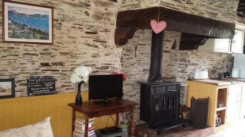
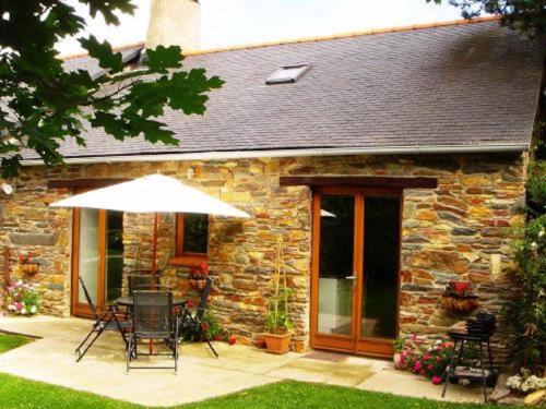
Guest accommodation : Le Pigeonnier

Boasting barbecue facilities, Le Pigeonnier is situated in Pouancé. The property has a garden, as well as a shared lounge. Free WiFi is included. At the guest house, all rooms ...
Prices : from 40.00 €
to 65.00 €
Contact : La Saulnerie 49420 Pouancé
Distance Guest accommodation - Armaillé : 5.04 km
|
|
|
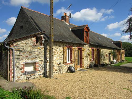
Guest accommodation : Les Chaumieres Campagnardes
Providing a seasonal outdoor swimming pool, Les Chaumieres Campagnardes features accommodation in Châteaubriant. Free WiFi is available. Each unit is fitted with a dishwasher, ...
Contact : La Riolais, St Julien de Vouvantes 44760 Châteaubriant
Distance Guest accommodation - Armaillé : 9.70 km
|
|
|
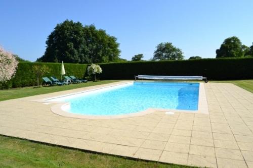
Bed and Breakfast : La Roulais
Offering a seasonal heated outdoor pool and set in a 25-acre park, La Roulais is located near Soudan. In this traditional-style guest house, guests can relax on the sun terrace ...
Address : La Roulais 44110 Soudan
Distance Bed and Breakfast - Armaillé : 9.99 km
|
|
|
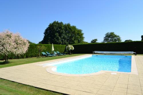
Guest accommodation : La Roulais Holiday Cottages
Offering an outdoor pool, La Roulais Holiday Cottages is located in Soudan, just a 20-minute drive from Châteaubriant. The self-catering accommodation is set in 25-acres of priv...
Contact : La Roulais 44110 Soudan
Distance Guest accommodation - Armaillé : 10.00 km
|
|
|
Hotel : Logis Auberge De L'ombrée
This former police station, built in the early 20th-century is located 5 minutes from Segré City Centre. Auberge De L'ombrée has a large floral garden with a furnished terrace. ...
Rate : from 75.00 €
to 93.00 €
Contact : Rue De Bretagne 49520 Combrée
Distance Hotel - Armaillé : 10.36 km
|
|
|
Guest accommodation : Le Hardas Mercure
Set in Saint-Saturnin-du-Limet, Le Hardas Mercure features free bikes and BBQ facilities. Featuring room service, this property also provides guests with a sun terrace. Free WiF...
Price : from 65.00 €
to 140.00 €
Contact : Le Hardas 53800 Saint-Saturnin-du-Limet
Distance Guest accommodation - Armaillé : 10.79 km
|
|
|
Guest accommodation : French Gites At Le Tertre
French Gites At Le Tertre is situated in Soudan, 10 km from Chateaubriant. It features an outdoor pool, a terrace and a garden. Featuring free WiFi is provided throughout the pr...
Address : Le Tertre 44110 Soudan
Distance Guest accommodation - Armaillé : 10.82 km
|
|
|
Apartment : La Butte Gites
With garden views, La Butte Gites is set in Renazé and has free WiFi. The accommodation comes with a flat-screen TV and a private bathroom with shower and free toiletries, whil...
Rate : from 75.00 €
Contact : La Butte de l'Esperance 53800 Renazé
Distance Apartment - Armaillé : 10.97 km
|
|
Find another hotel near Armaillé : Armaillé hotels list
|
Map of Armaillé
|
|
Map of Armaillé :
At right you can find the localization of Armaillé on the map of France. Below, this is the satellite map of Armaillé. A road map, and maps templates of Armaillé are available here : "road map of Armaillé". This map show Armaillé seen by the satellite of Google Map. To see the streets of Armaillé or move on another zone, use the buttons "zoom" and "map" on top of this dynamic map.
Search on the map of Armaillé :
To search hotels, housings, tourist information office, administrations or other services, use the Google search integrated to the map on the following page : "map Armaillé".
Hotels of Armaillé are listed on the map with the following icons: 
The map of Armaillé is centred in the following coordinates :
|

|
|
|
|
Print the map of Armaillé

Print the map of Armaillé : map of Armaillé
|
Photos Armaillé
|
See all photos of Armaillé :
Other photos of Armaillé and nearby towns can be found here: photos Armaillé
|
|
Armaillé weather forecast
Find next hours and 7 days weather forecast for Armaillé here : weather Armaillé (with english metrics)
This is the last weather forecast for Armaillé collected by the nearest observation station of Pouancé.
Week Forecast:
The latest weather data for Armaillé were collected Wednesday, 24 April 2024 at 06:00 from the nearest observation station of Pouancé.
| Wednesday, April 24th |
13°C 5°C
23%
91%
|
Mostly cloudy
Temperature Max: 13°C Temperature Min: 5°C
Precipitation Probability: 23% (Rain)
Percentage of sky occluded by clouds: 91%
Wind speed: 5 km/h South-East
Humidity: 74%° UV Index: 3
Sunrise: 06:58 Sunset: 21:08 |
|
| | Thursday, April 25th |
14°C 5°C
14%
81%
|
Mostly cloudy
Temperature Max: 14°C Temperature Min: 5°C
Precipitation Probability: 14% (Rain)
Percentage of sky occluded by clouds: 81%
Wind speed: 7 km/h South-East
Humidity: 68%° UV Index: 3
Sunrise: 06:56 Sunset: 21:09 |
|
| | Friday, April 26th |
15°C 5°C
39%
83%
|
Drizzle
Temperature Max: 15°C Temperature Min: 5°C
Precipitation Probability: 39% (Rain)
Percentage of sky occluded by clouds: 83%
Wind speed: 10 km/h North-East
Humidity: 74%° UV Index: 3
Sunrise: 06:55 Sunset: 21:10 |
|
| | Saturday, April 27th |
14°C 7°C
61%
96%
|
Rain
Temperature Max: 14°C Temperature Min: 7°C
Precipitation Probability: 61% (Rain)
Percentage of sky occluded by clouds: 96%
Wind speed: 16 km/h North-West
Humidity: 83%° UV Index: 3
Sunrise: 06:53 Sunset: 21:12 |
|
|
Attribution: 
|
|
Other maps, hotels and towns in france
Find another town, zip code, department, region, ...
Quick links Armaillé :
Make a link to this page of Armaillé with the following code :
|
|
|
 French Version : http://www.cartesfrance.fr/carte-france-ville/49010_Armaille.html