|
The village of Ens is a small village located south of France. The town of Ens is located in the department of Hautes-Pyrénées of the french region Midi-Pyrénées. The town of Ens is located in the township of Vielle-Aure part of the district of Bagnères-de-Bigorre. The area code for Ens is 65157 (also known as code INSEE), and the Ens zip code is 65170.
Geography and map of Ens :
The altitude of the city hall of Ens is approximately 1 200 meters. The Ens surface is 3.49 km ². The latitude and longitude of Ens are 42.806 degrees North and 0.341 degrees East.
Nearby cities and towns of Ens are :
Azet (65170) at 1.15 km, Estensan (65170) at 1.56 km, Sailhan (65170) at 1.60 km, Saint-Lary-Soulan (65170) at 1.92 km, Bourisp (65170) at 2.50 km, Vignec (65170) at 2.81 km, Vielle-Aure (65170) at 2.90 km, Cadeilhan-Trachère (65170) at 3.80 km.
(The distances to these nearby towns of Ens are calculated as the crow flies)
Population and housing of Ens :
The population of Ens was 16 in 1999, 24 in 2006 and 25 in 2007. The population density of Ens is 7.16 inhabitants per km². The number of housing of Ens was 29 in 2007. These homes of Ens consist of 11 main residences, 18 second or occasional homes and 0 vacant homes. |
|
|
Hotel Ens
|
|
|
Book now ! Best Price Guaranteed, no booking fees, pay at the hotel with our partner Booking.com, leader in online hotel reservation.
Find all hotels of Ens : Hotel Ens
| |
|
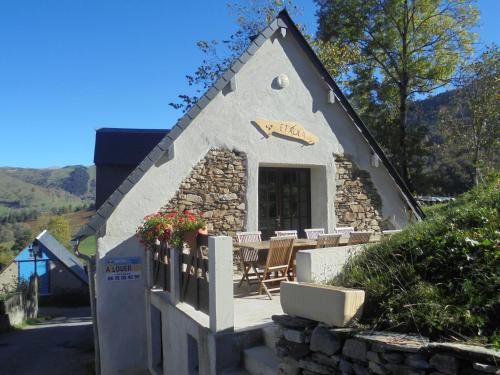
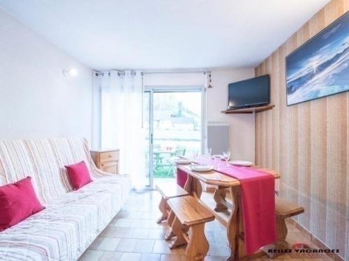
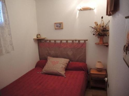
Guest accommodation : Chalet Etxola

Situated in Ens, 5 km from Saint-Lary-Soulan, Chalet Etxola offers self-catering accommodation with free WiFi. It provides free private parking. There is a seating area and a k...
Address : Le village 65170 Ens
Distance Guest accommodation - Ens : 0.11 km
|
|
|
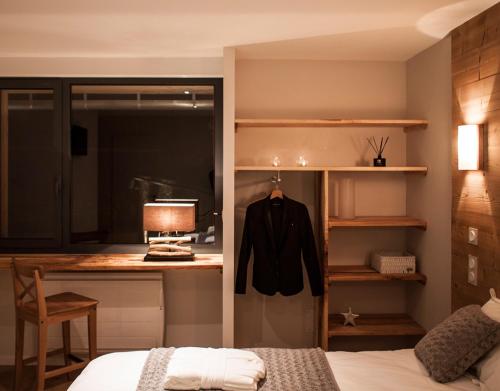
Bed and Breakfast : Maison Seignou
Set in Azet, 6 km from Saint-Lary-Soulan, Maison Seignou features views of the mountain, a spa centre, a sauna and free WiFi. The bed and breakfast offers a flat-screen TV and ...
Price : from 90.00 €
to 160.00 €
Contact : 8 cami du sarradet 65170 Azet
Distance Bed and Breakfast - Ens : 1.10 km
|
|
|
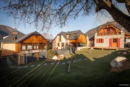
Guest accommodation : Les Hauts de Saint-Lary

Offering a spa centre and a ski pass sales point, Les Hauts de Saint-Lary is located in Sailhan in the Midi-Pyrénées Region, 44 km from Lourdes. Saint-Lary-Soulan is 1 km away. ...
Contact : Route de Sailhan 65170 Sailhan
Distance Guest accommodation - Ens : 1.59 km
|
|
|
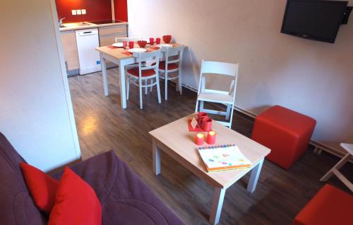
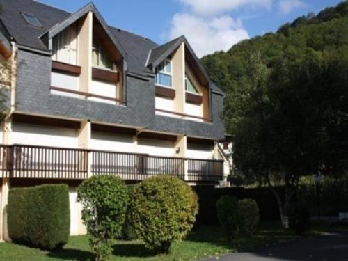
Guest accommodation : VVF Villages « L'Aure Pyrénéen » Saint-Lary-Soulan
Offering a restaurant, VVF Villages Saint-Lary-Soulan is located in Saint-Lary-Soulan, 1 km from the cable car leading to Saint-Lary ski resort. Free WiFi access is available in...
Rate : from 129.00 €
to 159.00 €
Contact : L'Auregon - Rue de L'oasis 65170 Saint-Lary-Soulan
Distance Guest accommodation - Ens : 1.63 km
|
|
|
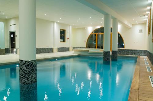
Guest accommodation : Madame Vacances Résidence Cami Real
Madame Vacances Résidence Cami Real offers spacious apartments on 2 levels. It also has an indoor pool, whirlpool, sauna and steam room. There is free WiFi access at the recepti...
Price : from 66.96 €
to 299.80 €
Address : Rue du Chemin de Sailhan 65170 Saint-Lary-Soulan
Distance Guest accommodation - Ens : 1.67 km
|
|
|
Apartment : Apartment Pic d espade i
Apartment Pic d espade i is located in Saint-Lary-Soulan, 300 metres from Saint-Lary-Soulan Ski School. Pic Lumiere Gondola is 400 metres from the property. The accommodation i...
Contact : Rés. LE PIC D'ESPADE I N°21 Rue des Fougères Impasse Lalanne 65170 Saint-Lary-Soulan
Distance Apartment - Ens : 1.68 km
|
|
|
Apartment : Apartment Pic d espade ii
Apartment Pic d espade ii offers accommodation in Saint-Lary-Soulan, 300 metres from Saint-Lary-Soulan Ski School and 400 metres from Pic Lumiere Gondola. The unit is 2.7 km fro...
Contact : Rés.LE PIC D'ESPADE II N°4 Impasse Lalanne 65170 Saint-Lary-Soulan
Distance Apartment - Ens : 1.68 km
|
|
|
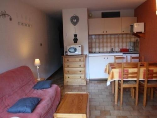
Apartment : Apartment Le lustou b
Apartment Le lustou b offers accommodation in Saint-Lary-Soulan. Saint-Lary-Soulan Ski School is 300 metres away. The accommodation has a TV. There is also a kitchen, equipped ...
Contact : Rés Le Lustou Bât B Ruedes Fougères 4Impasse desPics 65170 Saint-Lary-Soulan
Distance Apartment - Ens : 1.68 km
|
|
|
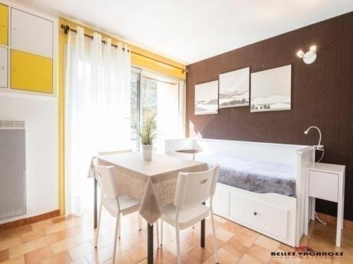
Apartment : Apartment Pic d'espade i
Apartment Pic d'espade i offers accommodation in Saint-Lary-Soulan. Saint-Lary-Soulan Ski School is 300 metres away. All units feature a TV. There is also a kitchen, fitted wit...
Address : Rés. LE PIC D'ESPADE I N°4 Impasse Lalanne 65170 Saint-Lary-Soulan
Distance Apartment - Ens : 1.68 km
|
|
|
Apartment : Apartment Pic d espade ii
Located a 4-minute walk from Saint-Lary-Soulan Ski School, Apartment Pic d espade ii offers accommodation with a balcony. All units are equipped with a TV and a fully equipped ...
Contact : Résidence Le Pic d'Espade II Impasse des Pics 65170 Saint-Lary-Soulan
Distance Apartment - Ens : 1.68 km
|
|
Find another hotel near Ens : Ens hotels list
|
Map of Ens
|
|
Map of Ens :
At right you can find the localization of Ens on the map of France. Below, this is the satellite map of Ens. A road map, and maps templates of Ens are available here : "road map of Ens". This map show Ens seen by the satellite of Google Map. To see the streets of Ens or move on another zone, use the buttons "zoom" and "map" on top of this dynamic map.
Search on the map of Ens :
To search hotels, housings, tourist information office, administrations or other services, use the Google search integrated to the map on the following page : "map Ens".
Hotels of Ens are listed on the map with the following icons: 
The map of Ens is centred in the following coordinates :
|

|
|
|
|
Print the map of Ens

Print the map of Ens : map of Ens
|
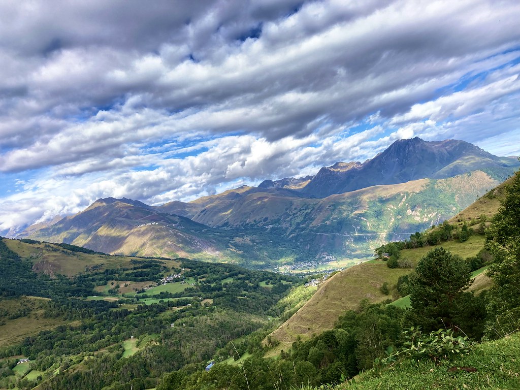
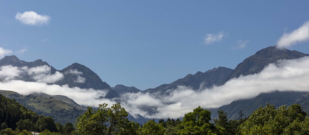
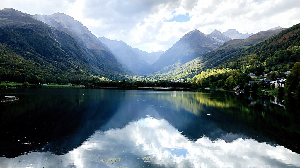
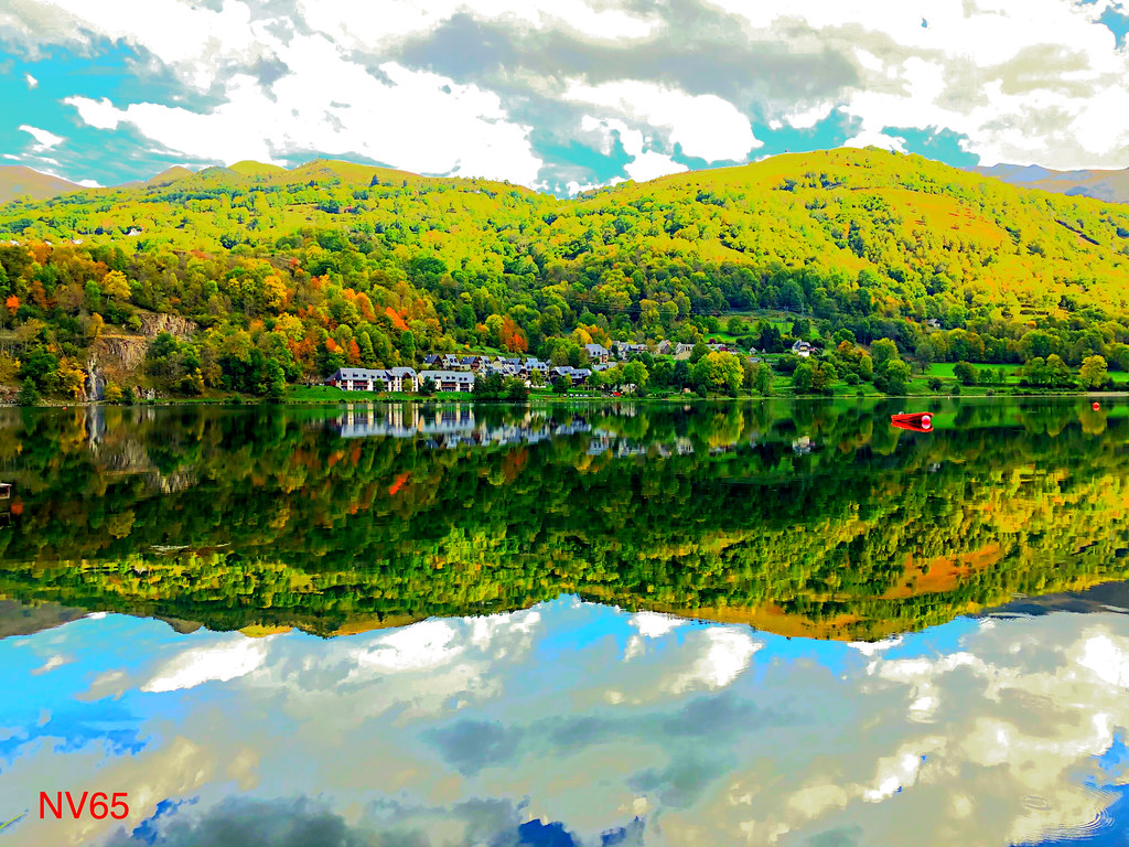
Photos Ens
|
See all photos of Ens :
Other photos of Ens and nearby towns can be found here: photos Ens
|
|
Ens weather forecast
Find next hours and 7 days weather forecast for Ens here : weather Ens (with english metrics)
This is the last weather forecast for Ens collected by the nearest observation station of Vielle-Aure.
Week Forecast:
The latest weather data for Ens were collected Friday, 19 April 2024 at 03:00 from the nearest observation station of Vielle-Aure.
| Friday, April 19th |
14°C -1°C
0%
1%
|
Clear
Temperature Max: 14°C Temperature Min: -1°C
Precipitation Probability: 0%
Percentage of sky occluded by clouds: 1%
Wind speed: 6 km/h South
Humidity: 36%° UV Index: 7
Sunrise: 07:10 Sunset: 20:46 |
|
| | Saturday, April 20th |
12°C 2°C
0%
11%
|
Mostly clear
Temperature Max: 12°C Temperature Min: 2°C
Precipitation Probability: 0%
Percentage of sky occluded by clouds: 11%
Wind speed: 8 km/h South
Humidity: 52%° UV Index: 7
Sunrise: 07:08 Sunset: 20:47 |
|
| | Sunday, April 21st |
11°C 1°C
0%
18%
|
Mostly clear
Temperature Max: 11°C Temperature Min: 1°C
Precipitation Probability: 0%
Percentage of sky occluded by clouds: 18%
Wind speed: 8 km/h South
Humidity: 52%° UV Index: 6
Sunrise: 07:07 Sunset: 20:48 |
|
| | Monday, April 22nd |
4°C -1°C
23%
73%
|
Mostly cloudy
Temperature Max: 4°C Temperature Min: -1°C
Precipitation Probability: 23% (Snow)
Percentage of sky occluded by clouds: 73%
Wind speed: 10 km/h South
Humidity: 66%° UV Index: 4
Sunrise: 07:05 Sunset: 20:49 |
|
|
Attribution: 
|
|
Other maps, hotels and towns in france
Find another town, zip code, department, region, ...
Quick links Ens :
Make a link to this page of Ens with the following code :
|
|
|
 French Version : http://www.cartesfrance.fr/carte-france-ville/65157_Ens.html