|
The city of Feurs is a french city located south east of France. The city of Feurs is located in the department of Loire of the french region Rhône-Alpes. The city of Feurs is located in the township of Feurs part of the district of Montbrison. The area code for Feurs is 42094 (also known as code INSEE), and the Feurs zip code is 42110.
Geography and map of Feurs :
The altitude of the city hall of Feurs is approximately 346 meters. The Feurs surface is 24.39 km ². The latitude and longitude of Feurs are 45.744 degrees North and 4.224 degrees East.
Nearby cities and towns of Feurs are :
Salvizinet (42110) at 4.35 km, Cleppé (42110) at 4.35 km, Civens (42110) at 4.36 km, Salt-en-Donzy (42110) at 5.06 km, Poncins (42110) at 5.07 km, Épercieux-Saint-Paul (42110) at 5.42 km, Pouilly-lès-Feurs (42110) at 6.12 km, Chambéon (42110) at 6.44 km.
(The distances to these nearby towns of Feurs are calculated as the crow flies)
Population and housing of Feurs :
The population of Feurs was 7 671 in 1999, 7 380 in 2006 and 7 376 in 2007. The population density of Feurs is 302.42 inhabitants per km². The number of housing of Feurs was 4 044 in 2007. These homes of Feurs consist of 3 547 main residences, 102 second or occasional homes and 395 vacant homes. |
|
|
Hotel Feurs
|
|
|
Book now ! Best Price Guaranteed, no booking fees, pay at the hotel with our partner Booking.com, leader in online hotel reservation.
Find all hotels of Feurs : Hotel Feurs
| |
|
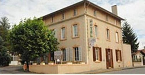
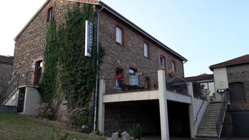
Hotel : Hôtel L'Astrée

Located in Feurs in the Rhône-Alpes region, this hotel offers free Wi-Fi internet access and a terrace. It is situated just 50 metres from Feurs Train Station and proposes moder...
Rate : from 56.00 €
to 88.00 €
Address : 2 chemin du Bout du Monde 42110 Feurs
Distance Hotel - Feurs : 0.55 km
|
|
|
Located in Feurs, Hotel Etesia offers a terrace and bar. Saint-Étienne is only a 35-minute drive away and Golf de Savigneux is 20 km from the property. All rooms feature a flat...
Price : from 72.00 €
to 86.00 €
Contact : 4 Chemin des Monts 42110 Feurs
Distance Hotel - Feurs : 0.98 km
|
|
|
Hotel : O´Lodge

Featuring a seasonal outdoor pool and a sun terrace, O´Lodge offers accommodation in Cleppé, 45 km from Saint-Étienne. Guests can enjoy the on-site bar. Free private parking is ...
Prices : from 70.00 €
to 178.00 €
Contact : Lieu Dit Naconne 42110 Cleppé
Distance Hotel - Feurs : 3.21 km
|
|
|
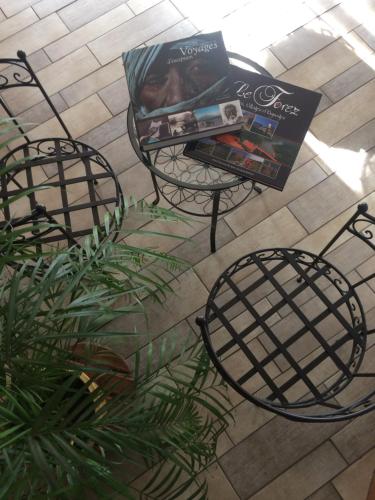
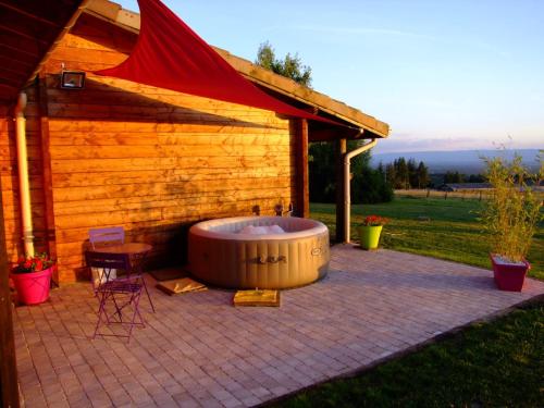
Bed and Breakfast : Chambres d'hôtes des Rôties
With lake views, Chambres d'hôtes des Rôties has accommodation with a kitchen set in Poncins. Free WiFi is provided. All units come with a dishwasher, oven, a coffee machine, a...
Rate : from 100.00 €
to 200.00 €
Contact : Les Rôties 42110 Poncins
Distance Bed and Breakfast - Feurs : 5.95 km
|
|
|
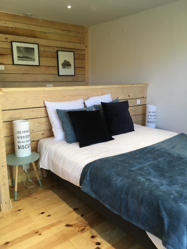
Bed and Breakfast : Les Barabans
Featuring free WiFi, a terrace and a seasonal hot tub, Les Barabans offers pet-friendly accommodation in Jas. Free private parking is available on site. Continental breakfast is...
Price : from 67.00 €
to 103.00 €
Address : Croix Charmette 42110 Jas
Distance Bed and Breakfast - Feurs : 6.61 km
|
|
|
Bed and Breakfast : Les Pierres Folles
Set in Rozier-en-Donzy, Les Pierres Folles offers accommodation with free WiFi and a garden. Fitted with a terrace, the units feature a flat-screen TV and a private bathroom wi...
Prices : from 55.00 €
to 83.00 €
Contact : 61 Rue du Vieux Lavoir 42810 Rozier-en-Donzy
Distance Bed and Breakfast - Feurs : 7.35 km
|
|

|
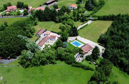
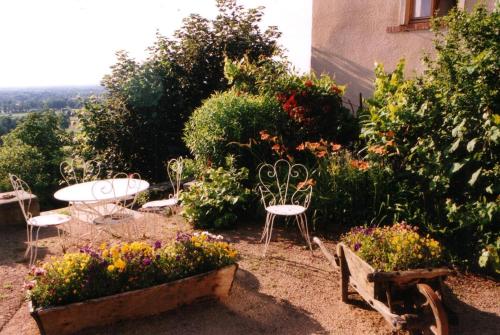
Bed and Breakfast : Chateau de Sugny
Situated in Nervieux, Chateau de Sugny offers accommodation with an outdoor pool, a garden and a terrace. The accommodation features a hot tub. A continental breakfast is avail...
Rate : from 135.00 €
to 190.00 €
Contact : 53 Route de Mizerieux 42510 Nervieux
Distance Bed and Breakfast - Feurs : 8.00 km
|
|
|
Bed and Breakfast : Chambres d'hôtes Le Presbytère
Set in a renovated 18th-century building, this B&B is located at the foot of the Lyonnais mountain range, offering a view of the field and Forez Mountains. It features a cottage...
Price : from 85.00 €
Contact : Le Bourg 42210 Saint-Cyr-les-Vignes
Distance Bed and Breakfast - Feurs : 9.50 km
|
|
|
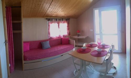
Guest accommodation : Les Chalets du Piou
Featuring accommodation with a terrace, Les Chalets du Piou is set in Bussières. This chalet provides barbecue facilities. The chalet is fitted with 2 bedrooms, a living room, ...
Address : hautes fenêtres 42510 Bussières
Distance Guest accommodation - Feurs : 9.95 km
|
|
|
Hotel : Les Jardins du Forez
Les Jardins du Forez is located in the spa town of Montrond-les-Bains, 1.5 km from Montrond Casino and 1.2 km from the train station. It offers a floral garden with a terrace an...
Rate : from 75.00 €
to 100.00 €
Contact : 440 avenue de la route bleue 42210 Montrond-les-Bains
Distance Hotel - Feurs : 10.69 km
|
|
Find another hotel near Feurs : Feurs hotels list
|
Map of Feurs
|
|
Map of Feurs :
At right you can find the localization of Feurs on the map of France. Below, this is the satellite map of Feurs. A road map, and maps templates of Feurs are available here : "road map of Feurs". This map show Feurs seen by the satellite of Google Map. To see the streets of Feurs or move on another zone, use the buttons "zoom" and "map" on top of this dynamic map.
Search on the map of Feurs :
To search hotels, housings, tourist information office, administrations or other services, use the Google search integrated to the map on the following page : "map Feurs".
Hotels of Feurs are listed on the map with the following icons: 
The map of Feurs is centred in the following coordinates :
|

|
|
|
|
Print the map of Feurs

Print the map of Feurs : map of Feurs
|
Photos Feurs
|
See all photos of Feurs :
Other photos of Feurs and nearby towns can be found here: photos Feurs
|
|
Feurs weather forecast
Find next hours and 7 days weather forecast for Feurs here : weather Feurs (with english metrics)
This is the last weather forecast for Feurs collected by the nearest observation station of Feurs.
Week Forecast:
The latest weather data for Feurs were collected Saturday, 20 April 2024 at 09:00 from the nearest observation station of Feurs.
| Saturday, April 20th |
10°C 4°C
39%
81%
|
Drizzle
Temperature Max: 10°C Temperature Min: 4°C
Precipitation Probability: 39% (Rain)
Percentage of sky occluded by clouds: 81%
Wind speed: 20 km/h South
Humidity: 63%° UV Index: 3
Sunrise: 06:48 Sunset: 20:36 |
|
| | Sunday, April 21st |
10°C 1°C
0%
76%
|
Partly cloudy
Temperature Max: 10°C Temperature Min: 1°C
Precipitation Probability: 0%
Percentage of sky occluded by clouds: 76%
Wind speed: 18 km/h South
Humidity: 63%° UV Index: 3
Sunrise: 06:46 Sunset: 20:38 |
|
| | Monday, April 22nd |
10°C 1°C
0%
76%
|
Mostly cloudy
Temperature Max: 10°C Temperature Min: 1°C
Precipitation Probability: 0%
Percentage of sky occluded by clouds: 76%
Wind speed: 24 km/h South
Humidity: 58%° UV Index: 3
Sunrise: 06:44 Sunset: 20:39 |
|
| | Tuesday, April 23rd |
10°C -1°C
0%
69%
|
Partly cloudy
Temperature Max: 10°C Temperature Min: -1°C
Precipitation Probability: 0%
Percentage of sky occluded by clouds: 69%
Wind speed: 17 km/h South
Humidity: 62%° UV Index: 3
Sunrise: 06:43 Sunset: 20:40 |
|
|
Attribution: 
|
|
Other maps, hotels and towns in france
Find another town, zip code, department, region, ...
Quick links Feurs :
Make a link to this page of Feurs with the following code :
|
|
|
 French Version : http://www.cartesfrance.fr/carte-france-ville/42094_Feurs.html