|
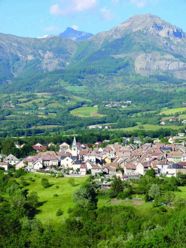
The village of Laye is a small village located south east of France. The town of Laye is located in the department of Hautes-Alpes of the french region Provence-Alpes-Côte d'Azur. The town of Laye is located in the township of Saint-Bonnet-en-Champsaur part of the district of Gap. The area code for Laye is 05072 (also known as code INSEE), and the Laye zip code is 05500.
Geography and map of Laye :
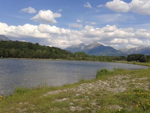
The altitude of the city hall of Laye is approximately 1 140 meters. The Laye surface is 10.55 km ². The latitude and longitude of Laye are 44.64 degrees North and 6.085 degrees East.
Nearby cities and towns of Laye are :
Saint-Laurent-du-Cros (05500) at 2.07 km, La Fare-en-Champsaur (05500) at 3.72 km, Forest-Saint-Julien (05260) at 3.75 km, Saint-Julien-en-Champsaur (05500) at 4.18 km, Saint-Bonnet-en-Champsaur (05500) at 4.83 km, Buissard (05500) at 5.11 km, Poligny (05500) at 6.46 km, Chabottes (05260) at 7.40 km.
(The distances to these nearby towns of Laye are calculated as the crow flies)
Population and housing of Laye :
The population of Laye was 208 in 1999, 217 in 2006 and 224 in 2007. The population density of Laye is 21.23 inhabitants per km². The number of housing of Laye was 314 in 2007. These homes of Laye consist of 100 main residences, 182 second or occasional homes and 33 vacant homes. |
|
|
Hotel Laye
|
|
|
Book now ! Best Price Guaranteed, no booking fees, pay at the hotel with our partner Booking.com, leader in online hotel reservation.
Find all hotels of Laye : Hotel Laye
| |
|
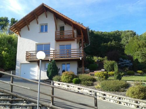
Hotel : Hôtel Aiguille
Hôtel Aiguille is set at the bottom of the ski station of Laye, right on the ski slopes. It offers attic rooms with free Wi-Fi and views of the valley or the mountains from thei...
Rate : from 70.00 €
Address : rue du plein vert 05500 Laye
Distance Hotel - Laye : 0.97 km
|
|
|
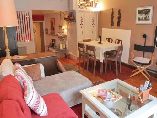
Apartment : La Collinette


La Collinette is situated in Saint-Laurent-du-Cros and offers barbecue facilities and a garden. Housed in a building dating from 2014, this apartment offers free WiFi. The apar...
Contact : Lotissement Les achard 05500 Saint-Laurent-du-Cros
Distance Apartment - Laye : 2.34 km
|
|
|
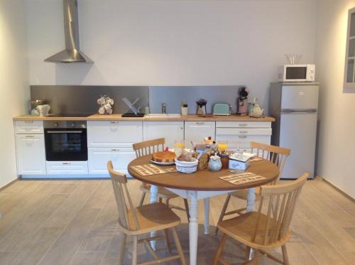
Guest accommodation : Au Studi'Ô
Au Studi'Ô is a holiday home located in Saint-Bonnet-en-Champsaur, 3.4 km from L'Exercice Ski Lift. The property is 3.5 km from Le Ruisseau Ski Lift and free private parking is ...
Prices : from 45.00 €
to 57.00 €
Contact : Lotissement du plan d'eau 1913c 05500 Saint-Bonnet-en-Champsaur
Distance Guest accommodation - Laye : 3.10 km
|
|
|
Hotel : Hotel Les Chenets
Located in Saint-Julien-en-Champsaur, this hotel is located in a quiet area, just 20 km from Ecrins National Park. Guests can dine at the on-site restaurant and have a drink at ...
Rate : from 61.00 €
to 67.00 €
Contact : 1 Rue du Four 05500 Saint-Julien-en-Champsaur
Distance Hotel - Laye : 4.08 km
|
|
|
Apartment : Appartement en montagne
Appartement en montagne offers pet-friendly accommodation in Saint-Julien-en-Champsaur. The property boasts views of the mountain. It is 8 km from Chaillot, 9 km from Ancelle an...
Address : lotissement Loum le Village 05500 Saint-Julien-en-Champsaur
Distance Apartment - Laye : 4.24 km
|
|
|
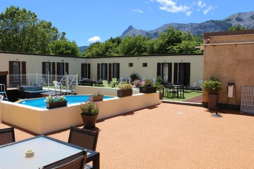
Hotel : Hotel Le Connetable
Hotel Le Connetable, set in the heart of Saint-Bonnet-en-Champsaur at the foot of the Ecrins National Park, features a terrace with panoramic views. The hotel offers a lounge ar...
Prices : from 72.00 €
to 145.00 €
Contact : Place du Champ de Foire 05500 Saint-Bonnet-en-Champsaur
Distance Hotel - Laye : 4.75 km
|
|

|
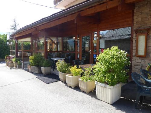
Bed and Breakfast : Le Cairn Chambres & Table d'hôtes
Rate : from 70.00 €
to 106.00 €
Contact : Charbillac 05500 Saint-Bonnet-en-Champsaur
Distance Bed and Breakfast - Laye : 4.81 km
|
|
|
Located in Saint-Bonnet-en-Champsaur, Honey Moon is a self-catering accommodation offering free Wi-Fi, only 4.5 km from Le Ruisseau and Le Grand Clot Ski Lifts. Gap Bayard Golf ...
Contact : 10 rue Faudon 05500 Saint-Bonnet-en-Champsaur
Distance Apartment - Laye : 4.87 km
|
|
|
Apartment : Apartment St Bonnet en Champsaur I
Set in Saint-Bonnet-en-Champsaur, 8 km from Le Ruisseau Ski Lift, Apartment St Bonnet en Champsaur I features a living room with a TV, and free WiFi. This property is 8 km from ...
Address : 5500 Saint-Bonnet-en-Champsaur
Distance Apartment - Laye : 4.90 km
|
|
|
Guest accommodation : Appart'hôtel "Le Cottage"
Boasting barbecue facilities as well as a garden, Appart'hôtel "Le Cottage" is located in Saint-Bonnet-en-Champsaur, within 8 km of Le Ruisseau Ski Lift and 8 km of Le Grand Clo...
Rate : from 85.00 €
to 100.00 €
Contact : 41 Rue de Chaillol 05500 Saint-Bonnet-en-Champsaur
Distance Guest accommodation - Laye : 4.94 km
|
|
Find another hotel near Laye : Laye hotels list
|
Map of Laye
|
|
Map of Laye :
At right you can find the localization of Laye on the map of France. Below, this is the satellite map of Laye. A road map, and maps templates of Laye are available here : "road map of Laye". This map show Laye seen by the satellite of Google Map. To see the streets of Laye or move on another zone, use the buttons "zoom" and "map" on top of this dynamic map.
Search on the map of Laye :
To search hotels, housings, tourist information office, administrations or other services, use the Google search integrated to the map on the following page : "map Laye".
Hotels of Laye are listed on the map with the following icons: 
The map of Laye is centred in the following coordinates :
|

|
|
|
|
Print the map of Laye

Print the map of Laye : map of Laye
|
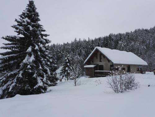
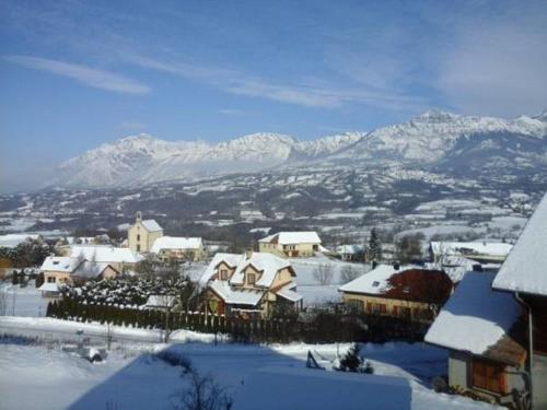
Photos Laye
|
See all photos of Laye :
Other photos of Laye and nearby towns can be found here: photos Laye
|
|
Laye weather forecast
Find next hours and 7 days weather forecast for Laye here : weather Laye (with english metrics)
This is the last weather forecast for Laye collected by the nearest observation station of Saint-Bonnet-en-Champsaur.
Week Forecast:
The latest weather data for Laye were collected Wednesday, 24 April 2024 at 17:00 from the nearest observation station of Saint-Bonnet-en-Champsaur.
| Wednesday, April 24th |
6°C -3°C
0%
35%
|
Mostly clear
Temperature Max: 6°C Temperature Min: -3°C
Precipitation Probability: 0%
Percentage of sky occluded by clouds: 35%
Wind speed: 14 km/h South-East
Humidity: 60%° UV Index: 5
Sunrise: 06:36 Sunset: 20:32 |
|
| | Thursday, April 25th |
8°C -3°C
0%
16%
|
Mostly clear
Temperature Max: 8°C Temperature Min: -3°C
Precipitation Probability: 0%
Percentage of sky occluded by clouds: 16%
Wind speed: 7 km/h East
Humidity: 51%° UV Index: 6
Sunrise: 06:34 Sunset: 20:33 |
|
| | Friday, April 26th |
6°C 0°C
55%
97%
|
Rain
Temperature Max: 6°C Temperature Min: 0°C
Precipitation Probability: 55% (Rain)
Percentage of sky occluded by clouds: 97%
Wind speed: 7 km/h North-West
Humidity: 80%° UV Index: 3
Sunrise: 06:33 Sunset: 20:35 |
|
| | Saturday, April 27th |
11°C 2°C
49%
92%
|
Rain
Temperature Max: 11°C Temperature Min: 2°C
Precipitation Probability: 49% (Rain)
Percentage of sky occluded by clouds: 92%
Wind speed: 14 km/h North-West
Humidity: 61%° UV Index: 3
Sunrise: 06:31 Sunset: 20:36 |
|
|
Attribution: 
|
|
Other maps, hotels and towns in france
Find another town, zip code, department, region, ...
Quick links Laye :
Make a link to this page of Laye with the following code :
|
|
|
 French Version : http://www.cartesfrance.fr/carte-france-ville/05072_Laye.html