|
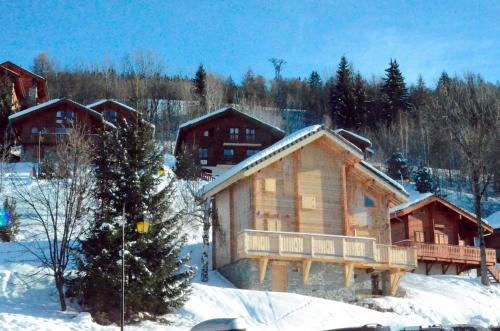
The village of Montgirod is a small village located south east of France. The town of Montgirod is located in the department of Savoie of the french region Rhône-Alpes. The town of Montgirod is located in the township of Aime part of the district of Albertville. The area code for Montgirod is 73169 (also known as code INSEE), and the Montgirod zip code is 73210.
Geography and map of Montgirod :
The altitude of the city hall of Montgirod is approximately 1 120 meters. The Montgirod surface is 13.62 km ². The latitude and longitude of Montgirod are 45.536 degrees North and 6.579 degrees East.
Nearby cities and towns of Montgirod are :
Saint-Marcel (73600) at 2.81 km, Notre-Dame-du-Pré (73600) at 2.89 km, Hautecour (73600) at 4.83 km, Aime (73210) at 6.07 km, Aigueblanche (73260) at 6.80 km, Moûtiers (73600) at 6.81 km, Granier (73210) at 6.97 km, Feissons-sur-Salins (73350) at 7.33 km.
(The distances to these nearby towns of Montgirod are calculated as the crow flies)
Population and housing of Montgirod :
The population of Montgirod was 378 in 1999, 426 in 2006 and 433 in 2007. The population density of Montgirod is 31.79 inhabitants per km². The number of housing of Montgirod was 265 in 2007. These homes of Montgirod consist of 183 main residences, 77 second or occasional homes and 5 vacant homes. |
|
|
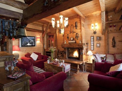
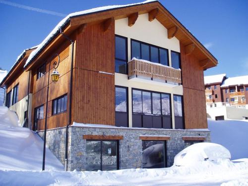
Hotel Montgirod
|
|
|
Book now ! Best Price Guaranteed, no booking fees, pay at the hotel with our partner Booking.com, leader in online hotel reservation.
Find all hotels of Montgirod : Hotel Montgirod
| |
|
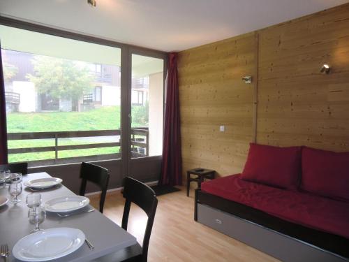
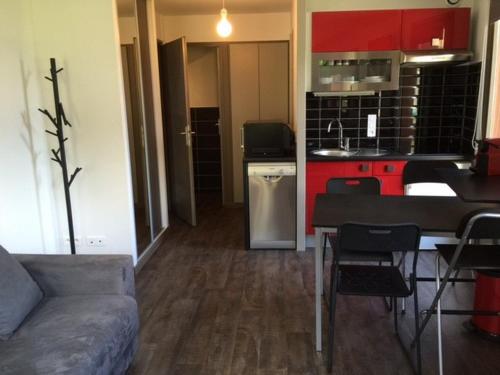
Apartment : Les Clarines
Les Clarines is a 180m² chalet with ski-to door access, set in Montalbert, 50 metres away from the nearest cable car and ski school. Providing free outdoor parking, the chalet f...
Address : Montalbert 73210 Montalbert
Distance Apartment - Montgirod : 3.52 km
|
|
|
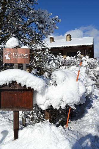
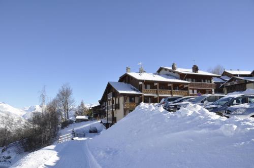
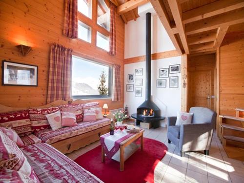
Hotel : Hôtel Restaurant L'Adray

Hôtel Restaurant L'Adray is located in Longefoy, 2 km from the ski slopes of Montalbert. The hotel has rooms, studios, apartments and a communal lounge-bar with fireplace. Each...
Price : from 80.00 €
to 189.00 €
Contact : 11 route de Notre Dame du Pré 73210 Longefoy
Distance Hotel - Montgirod : 3.77 km
|
|
|
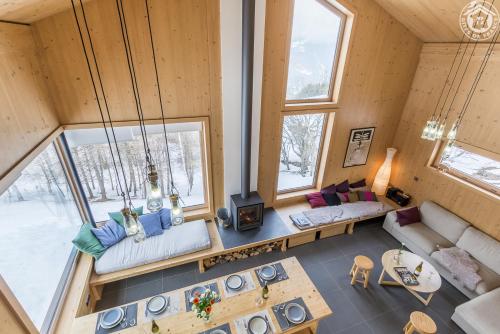
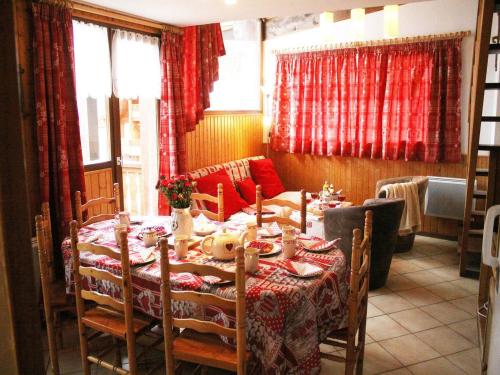
Guest accommodation : Le Refuge de Montgésin
Situated in the hamlet of Montgésin, 2 km from Plagne Montalbert, Le Refuge de Montgésin is a self-catering chalet built in 2015 with views of the valley and the mountains. The ...
Contact : Montgésin Plagne Montalbert 73210 Aime La Plagne
Distance Guest accommodation - Montgirod : 3.93 km
|
|
|
Guest accommodation : Chalet Phoenix
Chalet Phoenix offers pet-friendly accommodation in Plagne-Montalbert, 300 metres from Montalbert Gondola Lift, which offers access to Le Fornelet at 1970 metres altitude in jus...
Contact : Route de Montalbert 73210 Montalbert
Distance Guest accommodation - Montgirod : 4.25 km
|
|
|
Guest accommodation : Résidence La Marmottane
Residence La Marmottane offers spacious apartments at the foot of the slopes in La Plagne Montalbert. Après ski facilities include an indoor swimming pool, fitness centre, jacuz...
Price : from 97.00 €
Address : Plagne Montalbert 73210 Aime
Distance Guest accommodation - Montgirod : 4.27 km
|
|
|
Apartment : Les Grangettes
Featuring mountain views, Les Grangettes is set in Montalbert, 200 metres from Grangette. Guests staying at this apartment have access to a fully equipped kitchenette and a balc...
Contact : Résidence Les Grangettes 73210 Montalbert
Distance Apartment - Montgirod : 4.29 km
|
|
|
Hotel : L'Aigle Rouge
Set 100 metres from the centre of La Plagne Montalbert, this hotel is 70 metres from La Plagne Ski Lift in the Paradiski ski domain. There is an onsite bar. All rooms at L'Aigl...
Rate : from 80.00 €
to 175.00 €
Contact : Route de Montalbert 73210 Montalbert
Distance Hotel - Montgirod : 4.33 km
|
|
|
Apartment : L'Aubier

L'Aubier offers accommodation with ski-to-door access in Montalbert. The apartment is 50 metres away from the ski lifts and the ski school. Free WiFi is available. The three-be...
Contact : Vieux village montalbert 73210 Montalbert
Distance Apartment - Montgirod : 4.33 km
|
|
|
Apartment : L'Aubier 2
Located in the Paradiski Ski Area on the ski slopes of Montalbert, L'Aubier 2 offers accommodation 50 metres from the cable car and the ski school. The unit boasts two balconies...
Address : Montalbert 73210 Montalbert
Distance Apartment - Montgirod : 4.34 km
|
|
|
Apartment : Chalet Juliet
Featuring a balcony with views of the valley, Chalet Juliet offers accommodation in Montalbert, a 5-minutes walk from the nearest cable car. Guests benefit from free WiFi and pr...
Contact : Montalbert 73210 Montalbert
Distance Apartment - Montgirod : 4.43 km
|
|
Find another hotel near Montgirod : Montgirod hotels list
|
Map of Montgirod
|
|
Map of Montgirod :
At right you can find the localization of Montgirod on the map of France. Below, this is the satellite map of Montgirod. A road map, and maps templates of Montgirod are available here : "road map of Montgirod". This map show Montgirod seen by the satellite of Google Map. To see the streets of Montgirod or move on another zone, use the buttons "zoom" and "map" on top of this dynamic map.
Search on the map of Montgirod :
To search hotels, housings, tourist information office, administrations or other services, use the Google search integrated to the map on the following page : "map Montgirod".
Hotels of Montgirod are listed on the map with the following icons: 
The map of Montgirod is centred in the following coordinates :
|

|
|
|
|
Print the map of Montgirod

Print the map of Montgirod : map of Montgirod
|
Photos Montgirod
|
See all photos of Montgirod :
Other photos of Montgirod and nearby towns can be found here: photos Montgirod
|
|
Montgirod weather forecast
Find next hours and 7 days weather forecast for Montgirod here : weather Montgirod (with english metrics)
This is the last weather forecast for Montgirod collected by the nearest observation station of Aime.
Week Forecast:
The latest weather data for Montgirod were collected Monday, 08 June 2026 at 19:05 from the nearest observation station of Aime.
| Monday, June 8th |
25°C 12°C
72%
83%
|
Thunderstorms
Temperature Max: 25°C Temperature Min: 12°C
Precipitation Probability: 72% (Rain)
Percentage of sky occluded by clouds: 83%
Wind speed: 6 km/h East
Humidity: 46%° UV Index: 5
Sunrise: 05:45 Sunset: 21:20 |
|
| | Tuesday, June 9th |
20°C 13°C
76%
97%
|
Drizzle
Temperature Max: 20°C Temperature Min: 13°C
Precipitation Probability: 76% (Rain)
Percentage of sky occluded by clouds: 97%
Wind speed: 7 km/h East
Humidity: 66%° UV Index: 4
Sunrise: 05:44 Sunset: 21:21 |
|
| | Wednesday, June 10th |
17°C 10°C
61%
75%
|
Drizzle
Temperature Max: 17°C Temperature Min: 10°C
Precipitation Probability: 61% (Rain)
Percentage of sky occluded by clouds: 75%
Wind speed: 8 km/h East
Humidity: 62%° UV Index: 4
Sunrise: 05:44 Sunset: 21:21 |
|
| | Thursday, June 11th |
21°C 8°C
25%
51%
|
Partly cloudy
Temperature Max: 21°C Temperature Min: 8°C
Precipitation Probability: 25% (Rain)
Percentage of sky occluded by clouds: 51%
Wind speed: 8 km/h South-East
Humidity: 50%° UV Index: 6
Sunrise: 05:44 Sunset: 21:22 |
|
|
Attribution: 
|
|
Other maps, hotels and towns in france
Find another town, zip code, department, region, ...
Quick links Montgirod :
Make a link to this page of Montgirod with the following code :
|
|
|
 French Version : http://www.cartesfrance.fr/carte-france-ville/73169_Montgirod.html


