Map of France

Saint-Germain-d'Elle photos


Find a town, a zip code,
a department, a region... in France
I like Map-France.com !


Saint-Germain-d'Elle pictures


Here are the photos of the town of Saint-Germain-d'Elle and nearby towns. Saint-Germain-d'Elle is located in the department of Manche in the region of Basse-Normandie. You will find the satellite map of Saint-Germain-d'Elle under these photos.

To see photos of nearby towns of Saint-Germain-d'Elle, you can try the following links :
   - Photo of Montrabot (50810) : town located at 2.77 km
   - Photo of Bérigny (50810) : town located at 2.78 km
   - Photo of Rouxeville (50810) : town located at 2.80 km
   - Photo of Vidouville (50810) : town located at 3.05 km
   - Photo of Notre-Dame-d'Elle (50810) : town located at 3.12 km
   - Photo of Litteau (14490) : town located at 3.55 km
   - Photo of Lamberville (50160) : town located at 3.94 km
   - Photo of Saint-Georges-d'Elle (50680) : town located at 4.57 km
   - Photo of Biéville (50160) : town located at 4.79 km
   - Photo of Cormolain (14240) : town located at 4.79 km
   - Photo of Précorbin (50810) : town located at 4.88 km
   - Photo of Saint-Jean-des-Baisants (50810) : town located at 4.96 km

 - photos of the department prefecture of Manche : photos of Saint-Lô
 - pictures of others cities of Manche : Manche


To see Saint-Germain-d'Elle from the sky, here is the satellite map of the town of Saint-Germain-d'Elle : Saint-Germain-d'Elle map.

I like Saint-Germain-d'Elle !


Photos of the town of Saint-Germain-d'Elle

These photos taken near the town of Saint-Germain-d'Elle can be shown in full screen clicking on the thumbnails. Photos are copyrighted by their owners.

20100703-17h0713_Chateau des Matignon - Photo of Saint-Germain-d'Elle
20100703-17h0713_Chateau des Matignon

20100703-17h1222_Etangs de Torigni - Photo of Saint-Germain-d'Elle
20100703-17h1222_Etangs de Torigni

20100703-17h1121_Etangs de Torigni - Photo of Saint-Germain-d'Elle
20100703-17h1121_Etangs de Torigni

20100703-17h1019_Etangs de Torigni - Photo of Saint-Germain-d'Elle
20100703-17h1019_Etangs de Torigni

20100703-17h0197_Entrée de Torigni - Photo of Saint-Germain-d'Elle
20100703-17h0197_Entrée de Torigni

20100703-11h0254_Chateau de Torigni - Photo of Saint-Germain-d'Elle
20100703-11h0254_Chateau de Torigni

20100703-11h1158_Chateau des Matignon - Photo of Saint-Germain-d'Elle
20100703-11h1158_Chateau des Matignon

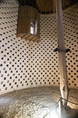
Interior of the colombier, showing the rotating gizmo - Photo of Saint-Germain-d'Elle
Interior of the colombier, showing the rotating gizmo

Inside of the colombier, showing the top of the rotating piece - Photo of Saint-Germain-d'Elle
Inside of the colombier, showing the top of the rotating piece

Abbey at Cerisy La Forêt - Photo of Saint-Germain-d'Elle
Abbey at Cerisy La Forêt

Gargouille de l-abbaye Saint Vigor (XIe) - Cerisy-la-Forêt - Normandie - Manche - France - Photo of Saint-Germain-d'Elle
Gargouille de l-abbaye Saint Vigor (XIe) - Cerisy-la-Forêt - Normandie - Manche - France

20100703-17h1018_Chateau des Matignon - Photo of Saint-Germain-d'Elle
20100703-17h1018_Chateau des Matignon

20100703-17h0711_Chateau des Matignon - Photo of Saint-Germain-d'Elle
20100703-17h0711_Chateau des Matignon

20100703-11h2465_Brectouville - Photo of Saint-Germain-d'Elle
20100703-11h2465_Brectouville


Saint-Germain-d'Elle from the sky


Old photos of the town of Saint-Germain-d'Elle

These photos taken near the town of Saint-Germain-d'Elle can be shown in full screen clicking on the thumbnails. Photos are copyrighted by their owners.


Other maps, hotels and towns in france


Find another town, zip code, department, region, ...


Quick links Saint-Germain-d'Elle :


Back to the menus Map of France :


Make a link to this page of Saint-Germain-d'Elle with the following code :


Map of France | Regions | Departments | Cities | Partners | Terms | Contact