|
The village of Saint-Sauvier is a small village located center of France. The town of Saint-Sauvier is located in the department of Allier of the french region Auvergne. The town of Saint-Sauvier is located in the township of Huriel part of the district of Montluçon. The area code for Saint-Sauvier is 03259 (also known as code INSEE), and the Saint-Sauvier zip code is 03370.
Geography and map of Saint-Sauvier :
The altitude of the city hall of Saint-Sauvier is approximately 460 meters. The Saint-Sauvier surface is 31.47 km ². The latitude and longitude of Saint-Sauvier are 46.387 degrees North and 2.33 degrees East.
Nearby cities and towns of Saint-Sauvier are :
Leyrat (23600) at 4.04 km, Treignat (03380) at 4.31 km, Saint-Pierre-le-Bost (23600) at 5.13 km, Mesples (03370) at 5.56 km, Saint-Palais (03370) at 6.16 km, Chambérat (03370) at 7.27 km, Archignat (03380) at 7.42 km, Préveranges (18370) at 7.68 km.
(The distances to these nearby towns of Saint-Sauvier are calculated as the crow flies)
Population and housing of Saint-Sauvier :
The population of Saint-Sauvier was 330 in 1999, 337 in 2006 and 338 in 2007. The population density of Saint-Sauvier is 10.74 inhabitants per km². The number of housing of Saint-Sauvier was 287 in 2007. These homes of Saint-Sauvier consist of 166 main residences, 45 second or occasional homes and 76 vacant homes. |
|
|
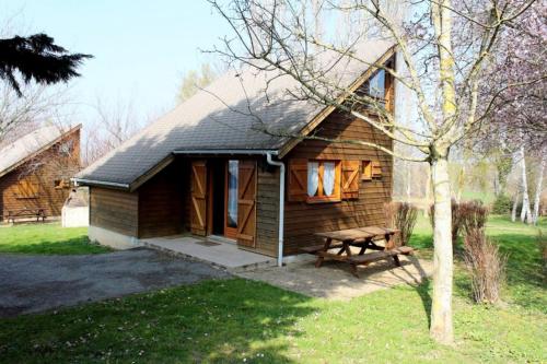
Hotel Saint-Sauvier
|
|
|
Book now ! Best Price Guaranteed, no booking fees, pay at the hotel with our partner Booking.com, leader in online hotel reservation.
Find all hotels of Saint-Sauvier : Hotel Saint-Sauvier
| |
|
Guest accommodation : Gîte La Brulette

Gîte La Brulette is situated in Saint-Rémy. The holiday home has garden views and is 27 km from Montluçon. This holiday home comes with 2 bedrooms, a living room and a fully eq...
Address : 3 Saint-Rémy 03370 Saint-Rémy
Distance Guest accommodation - Saint-Sauvier : 1.84 km
|
|
|
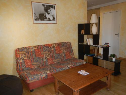
Guest accommodation : Chalet Les Maîtres Sonneurs
Situated in Herculat campsite on the shores of a pond, Chalet Les Maîtres Sonneurs is a chalet boasting a terrace and a barbecue. The unit is 20 km from Montluçon. Guests benefi...
Price : from 60.00 €
Contact : Camping d'Herculat 03380 Herculat
Distance Guest accommodation - Saint-Sauvier : 3.31 km
|
|

|
Guest accommodation : Chalet La Petite Fadette
Offering free WiFi and garden views, Chalet La Petite Fadette is an accommodation set in Treignat. This property offers access to a terrace. The chalet is fitted with 2 separat...
Contact : Camping d'Herculat rue Le Grand Étang 03380 Treignat
Distance Guest accommodation - Saint-Sauvier : 4.44 km
|
|
|
Guest accommodation : Gîte de groupe Les Dames Vertes
Situated in Mesples, Gîte de groupe Les Dames Vertes features accommodation with a terrace and free WiFi. The accommodation is 25 km from Montluçon. The holiday home is located...
Rate : from 270.00 €
Contact : Le Bourg 03370 Mesples
Distance Guest accommodation - Saint-Sauvier : 5.60 km
|
|

|
Guest accommodation : Chalet Thiennet
Situated in Mesples in the Auvergne region, Chalet Thiennet has a terrace. Guests staying at this chalet have access to a fully equipped kitchenette. The chalet features a flat...
Address : Le Bourg 03370 Mesples
Distance Guest accommodation - Saint-Sauvier : 5.73 km
|
|
|
Guest accommodation : Chalet Thérence à Mesples
Set in Mesples in the Auvergne region, Chalet Thérence à Mesples has a terrace. Guests staying at this chalet have access to a fully equipped kitchenette. The chalet features a...
Contact : Le Bourg 03370 Mesples
Distance Guest accommodation - Saint-Sauvier : 5.74 km
|
|
|
Apartment : Gîte Le Grand Bûcheux
Gîte Le Grand Bûcheux is situated in Saint-Palais. The accommodation is 32 km from Montluçon. The apartment includes 2 bedrooms and a kitchen with an oven and a microwave. A fl...
Rate : from 60.00 €
Contact : Le Bourg 03370 Saint-Palais
Distance Apartment - Saint-Sauvier : 6.25 km
|
|
|
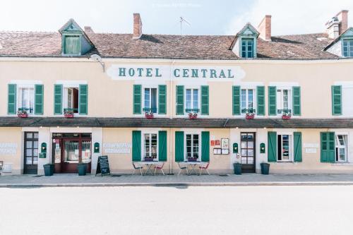
Hotel Le Central is offering accommodation in Boussac. This 3-star hotel offers free WiFi. The property has a restaurant. At the hotel, all rooms have a wardrobe, a flat-screen...
Price : from 60.00 €
to 75.00 €
Contact : 4 Rue Du Onze Novembre 23600 Boussac
Distance Hotel - Saint-Sauvier : 9.78 km
|
|
|
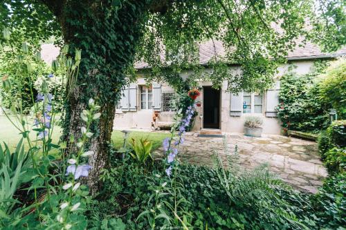
Bed and Breakfast : Chateau Vue Boussac Chambres d'Hôtes
Chateau Vue Boussac Chambres d'Hôtes is located in Boussac. Free WiFi access is available. Each room here will provide you with a terrace. Featuring a shower, private bathroom...
Address : 97 Gouby 23600 Boussac
Distance Bed and Breakfast - Saint-Sauvier : 10.17 km
|
|
|
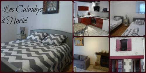
Guest accommodation : Les Calaubys
Offering free WiFi and city views, Les Calaubys is an accommodation set in Huriel. Guests staying at this holiday home have access to a fully equipped kitchen. This 2-bedroom h...
Rate : from 55.00 €
to 95.00 €
Contact : 35 grand rue 03380 Huriel
Distance Guest accommodation - Saint-Sauvier : 11.37 km
|
|
Find another hotel near Saint-Sauvier : Saint-Sauvier hotels list
|
Map of Saint-Sauvier
|
|
Map of Saint-Sauvier :
At right you can find the localization of Saint-Sauvier on the map of France. Below, this is the satellite map of Saint-Sauvier. A road map, and maps templates of Saint-Sauvier are available here : "road map of Saint-Sauvier". This map show Saint-Sauvier seen by the satellite of Google Map. To see the streets of Saint-Sauvier or move on another zone, use the buttons "zoom" and "map" on top of this dynamic map.
Search on the map of Saint-Sauvier :
To search hotels, housings, tourist information office, administrations or other services, use the Google search integrated to the map on the following page : "map Saint-Sauvier".
Hotels of Saint-Sauvier are listed on the map with the following icons: 
The map of Saint-Sauvier is centred in the following coordinates :
|

|
|
|
|
Print the map of Saint-Sauvier

Print the map of Saint-Sauvier : map of Saint-Sauvier
|
Photos Saint-Sauvier
|
See all photos of Saint-Sauvier :
Other photos of Saint-Sauvier and nearby towns can be found here: photos Saint-Sauvier
|
|
Saint-Sauvier weather forecast
Find next hours and 7 days weather forecast for Saint-Sauvier here : weather Saint-Sauvier (with english metrics)
This is the last weather forecast for Saint-Sauvier collected by the nearest observation station of Huriel.
Week Forecast:
The latest weather data for Saint-Sauvier were collected Friday, 19 April 2024 at 17:00 from the nearest observation station of Huriel.
| Friday, April 19th |
16°C -0°C
0%
31%
|
Partly cloudy
Temperature Max: 16°C Temperature Min: -0°C
Precipitation Probability: 0%
Percentage of sky occluded by clouds: 31%
Wind speed: 16 km/h East
Humidity: 58%° UV Index: 5
Sunrise: 06:55 Sunset: 20:43 |
|
| | Saturday, April 20th |
11°C 4°C
14%
64%
|
Mostly cloudy
Temperature Max: 11°C Temperature Min: 4°C
Precipitation Probability: 14% (Rain)
Percentage of sky occluded by clouds: 64%
Wind speed: 17 km/h South
Humidity: 62%° UV Index: 4
Sunrise: 06:53 Sunset: 20:45 |
|
| | Sunday, April 21st |
10°C 1°C
0%
82%
|
Partly cloudy
Temperature Max: 10°C Temperature Min: 1°C
Precipitation Probability: 0%
Percentage of sky occluded by clouds: 82%
Wind speed: 17 km/h South
Humidity: 64%° UV Index: 3
Sunrise: 06:52 Sunset: 20:46 |
|
| | Monday, April 22nd |
11°C 0°C
0%
52%
|
Partly cloudy
Temperature Max: 11°C Temperature Min: 0°C
Precipitation Probability: 0%
Percentage of sky occluded by clouds: 52%
Wind speed: 17 km/h South
Humidity: 60%° UV Index: 3
Sunrise: 06:50 Sunset: 20:47 |
|
|
Attribution: 
|
|
Other maps, hotels and towns in france
Find another town, zip code, department, region, ...
Quick links Saint-Sauvier :
Make a link to this page of Saint-Sauvier with the following code :
|
|
|
 French Version : http://www.cartesfrance.fr/carte-france-ville/03259_Saint-Sauvier.html