Map of France

Region La Réunion

French version French Version : La Réunion

Find a town, a zip code,
a department, a region... in France
I like Map-France.com !


Region of La Réunion


Region La Réunion

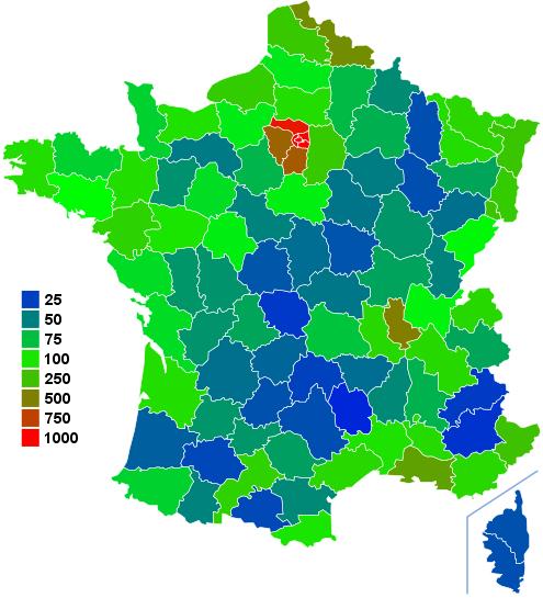
The region is the first level of administrative divisions on the France map. The region of La Réunion is an overseas region of France, composed of a single department of the same name. The region of La Réunion is both a region and a department.  The region of La Réunion has the number 4 and is divided into 1 departments, 4 districts, 49 townships and 24 municipalities. Below you will find the localization of La Réunion on the map of France, and the satellite map of La Réunion.


Population of La Réunion

Inhabitants of La Réunion were 706 180 in the 1999 census and 781 962 in the 2006 census. Area of region of La Réunion is 2 503,72 km ². Population density of La Réunion is 312,32 inhabitants per km².

Biggest cities of region of La Réunion, in number of inhabitants, are (2007 census): Saint-Denis (974), Saint-Paul (974), Saint-Pierre (974), Le Tampon (974), Saint-André (974), Saint-Louis (974), Le Port (974), Saint-Joseph (974), Saint-Benoît (974), Sainte-Marie (974), Saint-Leu (974), La Possession (974), Sainte-Suzanne (974), L'Étang-Salé (974), Petite-Île (974), Bras-Panon (974), Les Avirons (974), Salazie (974), Les Trois-Bassins (974), Sainte-Rose (974), Entre-Deux (974), Cilaos (974), Saint-Philippe (974).

You will find the towns list of La Réunion in the bottom on this page. You can consult the map of France, pictures, hotels, and all data of every town and village in the region of La Réunion clicking on these towns links.


I like the region of
La Réunion !
   
Biggest cities of La Réunion
Name of biggest cities
of La Réunion


Census
(2007)


Area
(km ²)


Density
(inh/km²)


Altitude
(m)


Saint-Denis (974)140 733142.79985.591 138 m
Saint-Paul (974)101 023241.28418.701 478 m
Saint-Pierre (974)75 26595.99784.09821 m
Le Tampon (974)70 539165.43426.401 353 m
Saint-André (974)51 96453.07979.16460 m
Saint-Louis (974)50 13198.90506.891 272 m
Le Port (974)38 31316.622 305.2355 m
Saint-Joseph (974)34 602178.50193.851 224 m
Saint-Benoît (974)33 485229.61145.831 239 m
Sainte-Marie (974)31 14387.21357.10900 m
Saint-Leu (974)29 422118.37248.561 391 m
La Possession (974)27 175118.35229.621 470 m
Sainte-Suzanne (974)21 85658.84371.45725 m
L'Étang-Salé (974)13 17938.65340.98891 m
Petite-Île (974)11 67233.93344.00791 m
Bras-Panon (974)11 21688.55126.661 046 m
Les Avirons (974)10 09326.27384.201 283 m
Salazie (974)7 181103.8269.171 651 m
Les Trois-Bassins (974)6 92942.58162.731 449 m
Sainte-Rose (974)6 680177.6037.611 312 m
Entre-Deux (974)5 86866.8387.801 231 m
Cilaos (974)5 79684.4068.671 721 m
Saint-Philippe (974)5 129153.9433.321 315 m
Statistics of region of La Réunion
Population 1999 706 180 inhabitants  
Population 2006 781 962 inhabitants  
Area 2 503.72 km ²  
Population density 312.32 inhabs/km² Map France population density
Variation of density +1.47 % Map France population variation density
     
Administration of region of La Réunion
Number 4  
Prefecture Saint-Denis  
Subprefectures Saint-Denis Map of France cities
Departments La Réunion (974) Map of France departments
     
Subdivisions of the region of La Réunion
Departments 1  
Districts 4  
Townships 49  
Municipalities 24  


Hotel La Réunion

Search hotels of La Réunion : Book your hotel now !

Where ? 

Check-in date 
calendar
Check-out date 
calendar


Map of La Réunion

MAP OF THE REGION LA REUNION
map region La Réunion

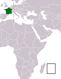
Where is located the La Réunion region ?
Réunion, previously Île Bourbon, is a French island with a population of about 800,000 located in the Indian Ocean, east of Madagascar, about 200 kilometres (120 mi) south west of Mauritius, the nearest island. You can find Réunion on the world map bellow.


What are the statistics and key data of La Réunion ?
The region of La Réunion has the number 4. It is composed of 1 departments, 4 districts ("arrondissements"), 49 townships ("cantons") and 24 towns ("communes").
The 1 departments of the region of La Réunion are: La Réunion (974)

Inhabitants of La Réunion were 706 180 in 1999 and 781 962 in 2006. The area of the region La Réunion is 2 503,72 km ². The population density of the region La Réunion is 312,32 inhabitants per km².


What are the largest cities of the region of La Réunion ?
The largest cities of the region of La Réunion (compared to the number of inhabitants in 2007) are : Saint-Denis (974), Saint-Paul (974), Saint-Pierre (974), Le Tampon (974), Saint-André (974), Saint-Louis (974), Le Port (974), Saint-Joseph (974), Saint-Benoît (974), Sainte-Marie (974), Saint-Leu (974), La Possession (974), Sainte-Suzanne (974), L'Étang-Salé (974), Petite-Île (974), Bras-Panon (974), Les Avirons (974), Salazie (974), Les Trois-Bassins (974), Sainte-Rose (974), Entre-Deux (974), Cilaos (974), Saint-Philippe (974).


Interactive map of the La Réunion region
You can zoom the satellite map of La Réunion to see a village or a city, for example Saint-Denis.

Search a town of region La Réunion


Records of the La Réunion region: Did you know ?


The town with the longest name of the region of La Réunion is: La Plaine-des-Palmistes
The town with the shortest name of the region of La Réunion is: Cilaos
The municipality with the highest altitude of the department region of La Réunion is: Cilaos with 1721 m
The municipality with the lowest altitude of the region of La Réunion is: Le Port with 55 m
The municipality with the largest area of the region of La Réunion is: Saint-Paul with 241.28 km ²
The municipality with the smallest area of the region of La Réunion is: Le Port with 16.62 km ²


Towns list of the La Réunion region

Follow the links of towns and cities of the La Réunion region and see photos, maps, and informations for these towns.


Towns of region La Réunion in B
Bras-Panon


Towns of region La Réunion in C
Cilaos


Towns of region La Réunion in E
Entre-Deux


Towns of region La Réunion in L
L'Étang-SaléLa Plaine-des-PalmistesLa PossessionLe Port
Le TamponLes AvironsLes Trois-Bassins


Towns of region La Réunion in P
Petite-Île


Towns of region La Réunion in S
Saint-AndréSaint-BenoîtSaint-DenisSaint-Joseph
Saint-LeuSaint-LouisSaint-PaulSaint-Philippe
Saint-PierreSainte-MarieSainte-RoseSainte-Suzanne
Salazie


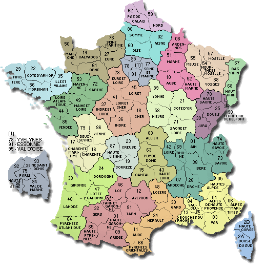
List of french departments


Ain
Aisne
Allier
Alpes de Haute-Provence
Hautes-Alpes
Alpes Maritimes
Ardèche
Ardennes
Ariège
Aube
Aude
Aveyron
Bouches-du-Rhône
Calvados
Cantal
Charente
Charente-Maritime
Cher
Corrèze
Corse-du-Sud
HauteCorse
Côte-d'Or
Côtes d'Armor
Creuse
Dordogne

Doubs
Drôme
Eure
Eure-et-Loir
Finistère
Gard
Haute Garonne
Gers
Gironde
Hérault
Ille-et-Vilaine
Indre
Indre-et-Loire
Isère
Jura
Landes
Loir-et-Cher
Loire
Haute Loire
Loire Atlantique
Loiret
Lot
Lot-et-Garonne
Lozère
Maine-et-Loire

Manche
Marne
HauteMarne
Mayenne
Meurthe-et-Moselle
Meuse
Morbihan
Moselle
Nièvre
Nord
Oise
Orne
Pas-de-Calais
Puy-de-Dôme
Pyrénées Atlantiques
Hautes Pyrénées
Pyrénées Orientales
Bas-Rhin
Haut-Rhin
Rhône
Haute Saône
Saône-et-Loire
Sarthe
Savoie
Haute Savoie

Paris
Seine Maritime
Seine-et-Marne
Yvelines
Deux-Sèvres
Somme
Tarn
Tarn-et-Garonne
Var
Vaucluse
Vendée
Vienne
Haute Vienne
Vosges
Yonne
Territoire de Belfort
Essonne
Hauts-de-Seine
Seine-St-Denis
Val-de-Marne
Val-D'Oise
Guadeloupe
Martinique
Guyane
La-Reunion
Mayotte


Other regions, departments, maps, hotels and towns in france


Find another town, zip code, department, region, ...


Back to the menus Map of France :


Make a link to this pageSalazie with the following code :


Find a town in France by clicking on the following interactives maps :


MAP OF FRANCE REGION


Map of french regions


Map of french regions Alsace Lorraine Franche Comte Champagne Ardenne Nord pas de Calais Picardie Haute Normandie Basse Normandie Bretagne Pays de la Loire Poitou Charentes Limousin Centre Ile de France Bourgogne Rhone Alpes Auvergne Provence Midi Pyrenees Aquitaine Languedoc Rousillon Corse

MAP OF FRANCE DEPARTMENT


Map of french departments
Map of french departments Map France department Nord 59 [15] Map France department Pas de Calais 62 [15] Map France department Somme 80 [19] Map France department Aisne 02 [19] Map France department Oise 60 [19] Map France department Seine Maritime 76 [17] Map France department Eure 27 [17] Map France department Ardennes 08 [07] Map France department Marne 51 [07] Map France department Aube 10 [07] Map France department Haute Marne 52 [07] Map France department Meuse 55 [13] Map France department Meurthe et Moselle 54 [13] Map France department Moselle 57 [13] Map France department Vosges 88 [13] Map France department Bas Rhin 67 [01] Map France department Haut Rhin 68 [01] Map France department Territoire de Belfort 90 [09] Map France department Haute Saône 70 [09] Map France department Doubs 25 [09] Map France department Jura 39 [09] Map France department Haute Savoie 74 [22] Map France department Ain 01 [22] Map France department Rhône 69 [22] Map France department Loire 42 [22] Map France department Savoie 73 [22] Map France department Isère 38 [22] Map France department Drôme 26 [22] Map France department Ardèche 07 [22] Map France department Hautes Alpes 05 [21] Map France department Alpes de Haute Provence 04 [21] Map France department Alpes Maritimes 06 [21] Map France department Var 83 [21] Map France department Vaucluse 84 [21] Map France department Bouches du Rhône 13 [21] Map France department Haute Corse 2B [08] Map France department Corse du Sud 2A [08] Map France department Yonne 89 [04] Map France department Côte d'Or 21 [04] Map France department Saône et Loire 71 [04] Map France department Nièvre 58 [04] Map France department Calvados 14 [16] Map France department Manche 50 [16] Map France department Orne 61 [16] Map France department Eure et Loir [06] Map France department Loiret 45 [06] Map France department Loir et Cher 41 [06] Map France department Cher 18 [06] Map France department Indre et Loire 37 [06] Map France department Indre 36 [06] Map France department Allier 03 [03] Map France department Puy de Dôme 63 [03] Map France department Haute Loire 43 [03] Map France department Cantal 15 [03] Map France department Finistère 29 [05] Map France department Côtes d'Armor 22 [05] Map France department Ille et Vilaine 35 [05] Map France department Morbihan 56 [05] Map France department Mayenne 53 [18] Map France department Sarthe 72 [18] Map France department Maine et Loire 49 [18] Map France department Loire Atlantique 44 [18] Map France department Vendée 85 [18] Map France department Deux sèvres 79 [20] Map France department Vienne 86 [20] Map France department Charente Maritime 17 [20] Map France department Charente 16 [20] Map France department Creuse 23 [12] Map France department Haute Vienne 87 [12] Map France department Corrèze 19 [12] Map France department Dordogne 24 [02] Map France department Gironde 33 [02] Map France department Lot et Garonne 47 [02] Map France department Landes 40 [02] Map France department Pyrénées Athlantiques 64 [02] Map France department Lot 46 [14] Map France department Aveyron 12 [14] Map France department Tarn 81 [14] Map France department Tarn et Garonne 82 [14] Map France department Gers 32 [14] Map France department Haute Garonne 31 [14] Map France department Hautes Pyrénées 65 [14] Map France department Ariège 09 [14] Map France department Lozère 48 [11] Map France department Gard 30 [11] Map France department Hérault 34 [11] Map France department Aude 11 [11] Map France department Pyrénées Orientales 66 [11] Map France department Seine et Marne 77 [10] Map France department Essonne 91 [10] Map France department Yvelines 78 [10] Map France department Val d'Oise 95 [10]


Map of France | Regions | Departments | Cities | Partners | Terms | Contact

French version French version :  La Réunion | Carte de France