|
The city of Huttenheim is a small town located north east of France. The city of Huttenheim is located in the department of Bas-Rhin of the french region Alsace. The city of Huttenheim is located in the township of Benfeld part of the district of Sélestat-Erstein. The area code for Huttenheim is 67216 (also known as code INSEE), and the Huttenheim zip code is 67230.
Geography and map of Huttenheim :
The altitude of the city hall of Huttenheim is approximately 161 meters. The Huttenheim surface is 12.55 km ². The latitude and longitude of Huttenheim are 48.358 degrees North and 7.581 degrees East.
Nearby cities and towns of Huttenheim are :
Benfeld (67230) at 1.61 km, Sermersheim (67230) at 2.42 km, Kertzfeld (67230) at 2.63 km, Rossfeld (67230) at 3.52 km, Sand (67230) at 3.52 km, Kogenheim (67230) at 3.63 km, Herbsheim (67230) at 3.86 km, Westhouse (67230) at 4.27 km.
(The distances to these nearby towns of Huttenheim are calculated as the crow flies)
Population and housing of Huttenheim :
The population of Huttenheim was 2 091 in 1999, 2 460 in 2006 and 2 461 in 2007. The population density of Huttenheim is 196.10 inhabitants per km². The number of housing of Huttenheim was 988 in 2007. These homes of Huttenheim consist of 935 main residences, 3 second or occasional homes and 51 vacant homes. |
|
|
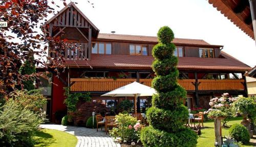
Hotel Huttenheim
|
|
|
Book now ! Best Price Guaranteed, no booking fees, pay at the hotel with our partner Booking.com, leader in online hotel reservation.
Find all hotels of Huttenheim : Hotel Huttenheim
| |
|
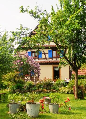
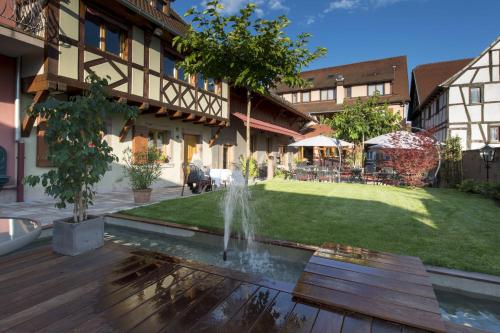
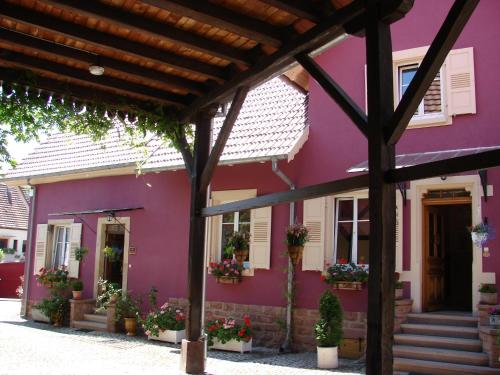
Bed and Breakfast : Le Jardin de l'Ill
Le Jardin de l'Ill is located in Huttenheim and offers free bikes to discover the area as well as free WiFi access throughout. You can relax on the terrace, by the flowered gard...
Rate : from 70.00 €
to 127.00 €
Address : 8 rue de l'Arbre 67230 Huttenheim
Distance Bed and Breakfast - Huttenheim : 0.26 km
|
|
|
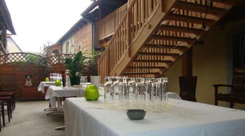
Bed and Breakfast : Auberge des Sauterelles
Located in the city of Sermersheim, Auberge les Sauterelles is set in a typically Alsatian old farm house and offers a traditional restaurant and a terrace. Free Wi-Fi access i...
Price : from 62.00 €
to 140.00 €
Contact : 9 Rue Du 1er Décembre 67230 Sermersheim
Distance Bed and Breakfast - Huttenheim : 2.69 km
|
|
|
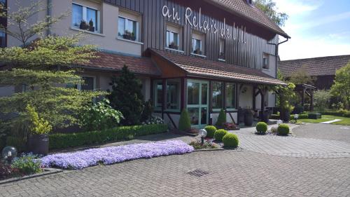
Hotel : Au Relais de l'Ill

Au Relais de l'Ill is a family-run 3-star hotel located in Sermersheim. It offers free WiFi and has a garden with a terrace. All of the rooms are en suite with a bath or shower...
Prices : from 65.00 €
to 120.00 €
Contact : 11, rue des remparts 67230 Sermersheim
Distance Hotel - Huttenheim : 2.77 km
|
|
|
Guest accommodation : Holiday home Sand 36
Located in Sand in the Alsace region, Holiday home Sand 36 is a 3-star property boasting free WiFi. The accommodation is 29 km from Strasbourg. This holiday home is equipped wi...
Contact : 67230 Sand
Distance Guest accommodation - Huttenheim : 3.55 km
|
|
|
Hotel : Hôtel Restaurant La Charrue
Located in the heart of the Alsatian countryside, Logis Hôtel Restaurant La Charrue is 20 km from Europa Park in Sand. It is located 35 km from Colmar, 28 km from Strasbourg, 13...
Price : from 79.00 €
to 89.00 €
Address : 4, Rue Du 1er Décembre 67230 Sand
Distance Hotel - Huttenheim : 3.58 km
|
|
|
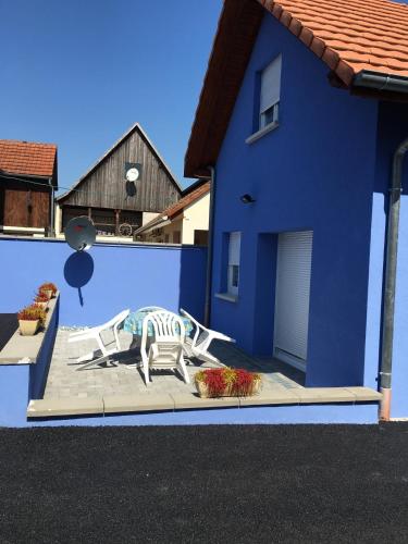
Guest accommodation : Gite Westhouse
Boasting accommodation with a terrace, Gite Westhouse is situated in Westhouse. Complimentary WiFi is provided. The holiday home is fitted with 2 bedrooms and a fully fitted ki...
Prices : from 80.00 €
Contact : 258 Rue des Agriculteurs 67230 Westhouse
Distance Guest accommodation - Huttenheim : 4.66 km
|
|
|
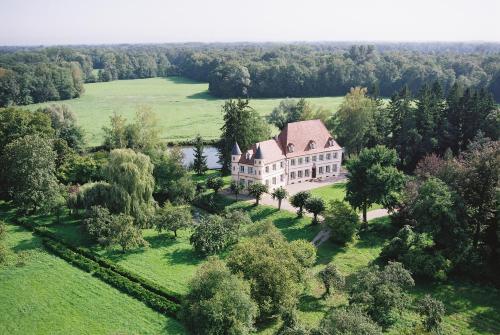
Guest accommodation : Château De Werde
Set in a 17th-century building, the Château de Werde is located in the heart of the Alsace region in a peaceful parkland setting by the river. It offers elegant and comfortable ...
Contact : Hameau de Werde 67150 Matzenheim
Distance Guest accommodation - Huttenheim : 5.30 km
|
|
|
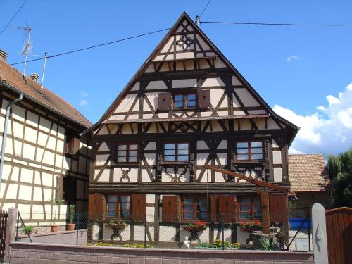
Guest accommodation : Gite d'Audrey et Jean
Set in a half-timbered house, the Gite d'Audrey et Jean offers self-catering accommodation in Uttenheim. This traditional holiday home features a small garden and free parking o...
Contact : 3 rue Principale 67150 Uttenheim
Distance Guest accommodation - Huttenheim : 5.97 km
|
|
|
Hotel : Hôtel à la Ferme
Set in a renovated 18th-century farm overlooking Osthouse Château, this hotel features a landscaped garden. The stylish guest rooms have antique furniture, and Erstein Train Sta...
Prices : from 99.00 €
to 210.00 €
Address : 10 Rue du Château 67150 Osthouse
Distance Hotel - Huttenheim : 6.41 km
|
|
|
Guest accommodation : Les Gavottes
Set in Stotzheim in the Alsace region, Les Gavottes features a terrace. It has free bikes, a seasonal outdoor swimming pool, mountain views and free WiFi. The holiday home has ...
Contact : 30 Rue du Bas Village 67140 Stotzheim
Distance Guest accommodation - Huttenheim : 6.55 km
|
|
Find another hotel near Huttenheim : Huttenheim hotels list
|
Map of Huttenheim
|
|
Map of Huttenheim :
At right you can find the localization of Huttenheim on the map of France. Below, this is the satellite map of Huttenheim. A road map, and maps templates of Huttenheim are available here : "road map of Huttenheim". This map show Huttenheim seen by the satellite of Google Map. To see the streets of Huttenheim or move on another zone, use the buttons "zoom" and "map" on top of this dynamic map.
Search on the map of Huttenheim :
To search hotels, housings, tourist information office, administrations or other services, use the Google search integrated to the map on the following page : "map Huttenheim".
Hotels of Huttenheim are listed on the map with the following icons: 
The map of Huttenheim is centred in the following coordinates :
|

|
|
|
|
Print the map of Huttenheim

Print the map of Huttenheim : map of Huttenheim
|
Photos Huttenheim
|
See all photos of Huttenheim :
Other photos of Huttenheim and nearby towns can be found here: photos Huttenheim
|
|
Huttenheim weather forecast
Find next hours and 7 days weather forecast for Huttenheim here : weather Huttenheim (with english metrics)
This is the last weather forecast for Huttenheim collected by the nearest observation station of Benfeld.
Week Forecast:
The latest weather data for Huttenheim were collected Monday, 14 July 2025 at 19:07 from the nearest observation station of Benfeld.
| Monday, July 14th |
28°C 19°C
70%
66%
|
Rain
Temperature Max: 28°C Temperature Min: 19°C
Precipitation Probability: 70% (Rain)
Percentage of sky occluded by clouds: 66%
Wind speed: 15 km/h North-East
Humidity: 64%° UV Index: 6
Sunrise: 05:43 Sunset: 21:27 |
|
| | Tuesday, July 15th |
27°C 17°C
12%
82%
|
Mostly cloudy
Temperature Max: 27°C Temperature Min: 17°C
Precipitation Probability: 12% (Rain)
Percentage of sky occluded by clouds: 82%
Wind speed: 15 km/h East
Humidity: 53%° UV Index: 5
Sunrise: 05:44 Sunset: 21:26 |
|
| | Wednesday, July 16th |
24°C 16°C
23%
59%
|
Partly cloudy
Temperature Max: 24°C Temperature Min: 16°C
Precipitation Probability: 23% (Rain)
Percentage of sky occluded by clouds: 59%
Wind speed: 18 km/h East
Humidity: 51%° UV Index: 6
Sunrise: 05:45 Sunset: 21:25 |
|
| | Thursday, July 17th |
25°C 13°C
0%
50%
|
Partly cloudy
Temperature Max: 25°C Temperature Min: 13°C
Precipitation Probability: 0%
Percentage of sky occluded by clouds: 50%
Wind speed: 7 km/h South
Humidity: 53%° UV Index: 6
Sunrise: 05:46 Sunset: 21:24 |
|
|
Attribution: 
|
|
Other maps, hotels and towns in france
Find another town, zip code, department, region, ...
Quick links Huttenheim :
Make a link to this page of Huttenheim with the following code :
|
|
|
 French Version : http://www.cartesfrance.fr/carte-france-ville/67216_Huttenheim.html


