|
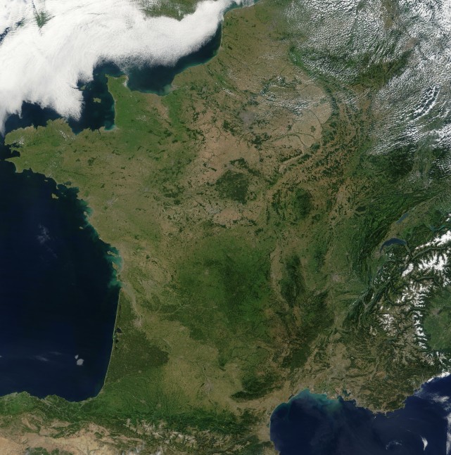
Map of France Satellite French Version : Carte de France satellite French Version : Carte de France satellite
|
Find a town, a zip code,
a department, a region... in France
|
||||
|
|
||||||||||
|
|
||||||||||
Search on the satellite map of France |
||||||||||
|
||||||||||
|
|
||||||||||
Satellite map of France
Here is a satellite picture of France. This image can be saved on your computer to be able to see it with a better resolution. For that, right click with the mouse on this satellite france map and choose the option "Save picture as... ".
We can notice grey "spots" on this map. They correspond to the main cities of France. Paris is particularly visible. We can also notice that the urban zones (these most visible grey spots), are especially situated along the rivers of France. This satellite map also allows to see the detailed relief of France characterized by its "S" which begin from the south of Vosges, comes down the valley of the Rhône and end on the West on the South of Massif Central and the North of Pyrenees. The six mountains of France that are: the Alps, the Pyrénnées, the Massif Central, Jura, Vosges and the Armorican massif 
satellite france map |
||||||||||
|
Map of France | Regions | Departments | Cities | Partners | Terms | Contact  French Version : Carte de France satellite | Carte de France French Version : Carte de France satellite | Carte de France
|
||||||||||