|
The village of Palluel is a small village located north of France. The town of Palluel is located in the department of Pas-de-Calais of the french region Nord-Pas-de-Calais. The town of Palluel is located in the township of Marquion part of the district of Arras. The area code for Palluel is 62646 (also known as code INSEE), and the Palluel zip code is 62860.
Geography and map of Palluel :
The altitude of the city hall of Palluel is approximately 40 meters. The Palluel surface is 2.77 km ². The latitude and longitude of Palluel are 50.267 degrees North and 3.098 degrees East.
Nearby cities and towns of Palluel are :
Arleux (59151) at 1.41 km, Hamel (59151) at 2.23 km, Écourt-Saint-Quentin (62860) at 2.73 km, Oisy-le-Verger (62860) at 2.74 km, Brunémont (59151) at 2.88 km, Sauchy-Cauchy (62860) at 3.45 km, Rumaucourt (62860) at 3.91 km, Estrées (59151) at 4.22 km.
(The distances to these nearby towns of Palluel are calculated as the crow flies)
Population and housing of Palluel :
The population of Palluel was 541 in 1999, 559 in 2006 and 564 in 2007. The population density of Palluel is 203.61 inhabitants per km². The number of housing of Palluel was 286 in 2007. These homes of Palluel consist of 210 main residences, 71 second or occasional homes and 6 vacant homes. |
|
|
Hotel Palluel
|
|
|
Book now ! Best Price Guaranteed, no booking fees, pay at the hotel with our partner Booking.com, leader in online hotel reservation.
Find all hotels of Palluel : Hotel Palluel
| |
|
Bed and Breakfast : Bed&B La Ferme De L'ostrevent
Situated in Estrées, Bed&B La Ferme De L'ostrevent offers accommodation with a seating area and a kitchenette. Free WiFi is provided. All units come with an oven, microwave, a ...
Rate : from 60.00 €
to 75.00 €
Address : 26, Rue Du Mont 59151 Estrées
Distance Bed and Breakfast - Palluel : 4.26 km
|
|
|
Bed and Breakfast : Le patio d'Eric

Set in Aubigny-au-Bac, Le patio d'Eric provides accommodation with free WiFi. The bed and breakfast offers a TV and a private bathroom with free toiletries, a hair dryer and sh...
Price : from 75.00 €
to 165.00 €
Contact : 2 Ter Rue Du Stade 59265 Aubigny-au-Bac
Distance Bed and Breakfast - Palluel : 4.72 km
|
|
|
Bed and Breakfast : La Ferme de la Sensée
Set opposite the church in Gouy-sous-Bellonne, this renovated farmhouse is just 6 km from Douai. You can visit the bed and breakfast’s horses or use the free Wi-Fi connection. ...
Prices : from 85.00 €
to 135.00 €
Contact : 5 rue de l'église 62112 Gouy-sous-Bellonne
Distance Bed and Breakfast - Palluel : 5.89 km
|
|
|
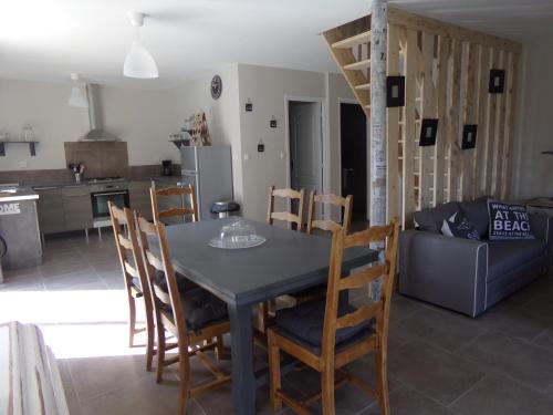
Apartment : Le Gite De La Ferme Du Tertre

Offering barbecue facilities and a garden, as well as a terrace, Le Gite De La Ferme Du Tertre is set in Villers-au-Tertre, 4.4 km from Mining History Centre of Lewarde. Guests ...
Contact : 501 Rue De Fressain 59234 Villers-au-Tertre
Distance Apartment - Palluel : 7.19 km
|
|
|
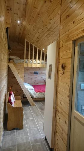
Guest accommodation : le chalet de la ferme du tertre
Le chalet de la ferme du tertre is located in Villers-au-Tertre, 4.4 km from Mining History Centre of Lewarde, and barbecue facilities, a garden and a terrace are accessible in-...
Price : from 70.00 €
to 91.00 €
Address : 501 rue de fressain 59234 Villers-au-Tertre
Distance Guest accommodation - Palluel : 7.24 km
|
|
|
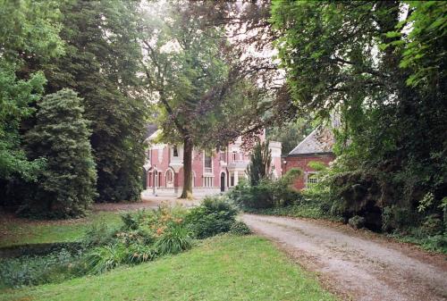
Guest accommodation : Manoir Les Cèdres
Located in Corbehem, Manoir Les Cèdres dates back to the 19th-Century and is set in a 2-acre park with a terrace. Lille city centre is just a 35-minute drive away. All rooms fe...
Prices : from 58.97 €
to 95.00 €
Contact : 14 Rue de Sailly 62112 Corbehem
Distance Guest accommodation - Palluel : 8.35 km
|
|
|
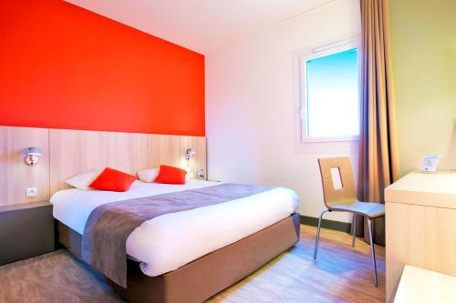
This Kyriad is located just 4 km south of Douai and a 10-minute drive from the A21 motorway. It offers a 24-hour reception, air-conditioned rooms with free Wi-Fi access and mode...
Rate : from 49.00 €
to 78.00 €
Contact : Zac Du Luc 59187 Dechy
Distance Hotel - Palluel : 8.78 km
|
|
|
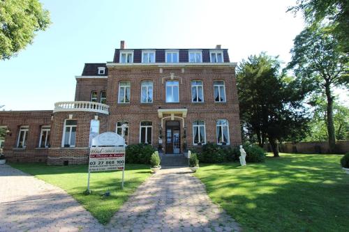
Hotel : Logis Manoir de Fourcy
This 18th century Manor is set in a beautiful park 6km from Douai, in the Nord region. It offers spacious rooms and suites with elegant antique furnishings. The en suite rooms ...
Price : from 60.00 €
to 90.00 €
Contact : 48 rue de la Gare 62112 Corbehem
Distance Hotel - Palluel : 8.89 km
|
|
|
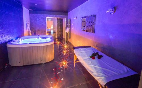
Guest accommodation : L'effet SPA
Set in Corbehem, L'effet SPA provides accommodation with private terraces. All rooms feature a flat-screen TV with satellite channels and a private bathroom. The property featur...
Prices : from 260.00 €
to 350.00 €
Address : 1 Rue des Grosses Bornes 62112 Corbehem
Distance Guest accommodation - Palluel : 9.06 km
|
|
|
Guest accommodation : L'acacias
L'acacias is located in Hem-Lenglet and offers a garden and a terrace. Complimentary WiFi is offered. The holiday home features 3 bedrooms, a kitchen with a dishwasher and an o...
Contact : 29 rue des acacias 59247 Hem-Lenglet
Distance Guest accommodation - Palluel : 9.20 km
|
|
Find another hotel near Palluel : Palluel hotels list
|
Map of Palluel
|
|
Map of Palluel :
At right you can find the localization of Palluel on the map of France. Below, this is the satellite map of Palluel. A road map, and maps templates of Palluel are available here : "road map of Palluel". This map show Palluel seen by the satellite of Google Map. To see the streets of Palluel or move on another zone, use the buttons "zoom" and "map" on top of this dynamic map.
Search on the map of Palluel :
To search hotels, housings, tourist information office, administrations or other services, use the Google search integrated to the map on the following page : "map Palluel".
Hotels of Palluel are listed on the map with the following icons: 
The map of Palluel is centred in the following coordinates :
|

|
|
|
|
Print the map of Palluel

Print the map of Palluel : map of Palluel
|
Photos Palluel
|
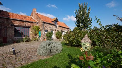
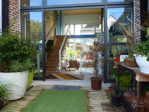
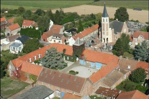
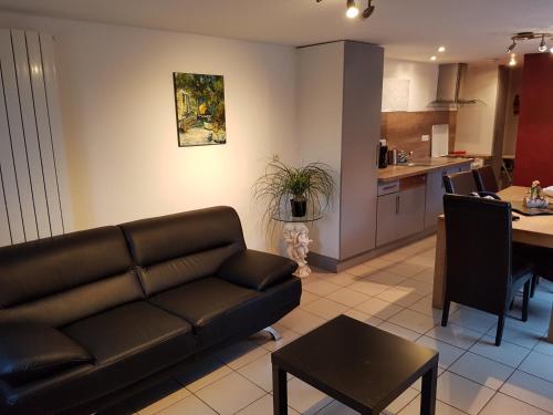
See all photos of Palluel :
Other photos of Palluel and nearby towns can be found here: photos Palluel
|
|
Palluel weather forecast
Find next hours and 7 days weather forecast for Palluel here : weather Palluel (with english metrics)
This is the last weather forecast for Palluel collected by the nearest observation station of Marquion.
Week Forecast:
The latest weather data for Palluel were collected Sunday, 13 July 2025 at 11:05 from the nearest observation station of Marquion.
| Sunday, July 13th |
28°C 13°C
0%
24%
|
Mostly clear
Temperature Max: 28°C Temperature Min: 13°C
Precipitation Probability: 0%
Percentage of sky occluded by clouds: 24%
Wind speed: 7 km/h South-East
Humidity: 59%° UV Index: 7
Sunrise: 05:52 Sunset: 21:54 |
|
| | Monday, July 14th |
25°C 17°C
57%
73%
|
Drizzle
Temperature Max: 25°C Temperature Min: 17°C
Precipitation Probability: 57% (Rain)
Percentage of sky occluded by clouds: 73%
Wind speed: 20 km/h East
Humidity: 65%° UV Index: 5
Sunrise: 05:53 Sunset: 21:53 |
|
| | Tuesday, July 15th |
23°C 14°C
26%
51%
|
Partly cloudy
Temperature Max: 23°C Temperature Min: 14°C
Precipitation Probability: 26% (Rain)
Percentage of sky occluded by clouds: 51%
Wind speed: 21 km/h North-East
Humidity: 57%° UV Index: 5
Sunrise: 05:54 Sunset: 21:52 |
|
| | Wednesday, July 16th |
22°C 15°C
59%
72%
|
Drizzle
Temperature Max: 22°C Temperature Min: 15°C
Precipitation Probability: 59% (Rain)
Percentage of sky occluded by clouds: 72%
Wind speed: 24 km/h East
Humidity: 65%° UV Index: 5
Sunrise: 05:55 Sunset: 21:51 |
|
|
Attribution: 
|
|
Other maps, hotels and towns in france
Find another town, zip code, department, region, ...
Quick links Palluel :
Make a link to this page of Palluel with the following code :
|
|
|
 French Version : http://www.cartesfrance.fr/carte-france-ville/62646_Palluel.html