Crèvecœur-sur-l'Escaut on the relief France map in Lambert 93 coordinates
|
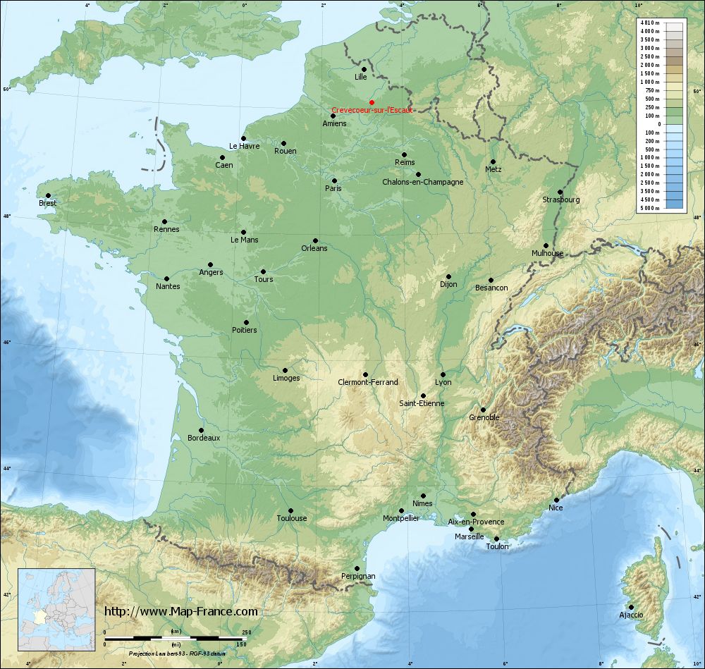
See the map of Crèvecœur-sur-l'Escaut in full screen (1000 x 949)
|
At left, here is the location of Crèvecœur-sur-l'Escaut on the relief France map in Lambert 93 coordinates.
Here are the altitudes of Crèvecœur-sur-l'Escaut :
- Town hall altitude of Crèvecœur-sur-l'Escaut is 75 meters
- Minimum altitude of Crèvecœur-sur-l'Escaut is 60 meters
- Maximum altitude of Crèvecœur-sur-l'Escaut is 147 meters
- Medium altitude of Crèvecœur-sur-l'Escaut is 104 meters
Here are the altitudes of Lille, prefecture of Nord department:
- Town hall altitude of Lille is 20 meters
- Minimum altitude of Lille is 17 meters
- Maximum altitude of Lille is 45 meters
- Medium altitude of Lille is 31 meters
Here are the altitudes of the french biggest cities:
Paris : 33 meters
Marseille : 20 meters
Lyon : 237 meters
Toulouse : 146 meters
Nice : 10 meters
Nantes : 20 meters
Strasbourg : 144 meters
Montpellier : 35 meters
Bordeaux : 16 meters
Lille : 20 meters
Rennes : 35 meters
Reims : 83 meters
Click here for the terrain map of Crèvecœur-sur-l'Escaut in full screen:
Relief map of Crèvecœur-sur-l%27Escaut
|
This relief map of Crèvecœur-sur-l'Escaut is reusable and modifiable by making a link to this page of the Map-France.com website or by using the given code :
|
Terrain base map of Crèvecœur-sur-l'Escaut
|

See the terrain base map of Crèvecœur-sur-l'Escaut in full screen (1000 x 949)
|
Small relief base map of Crèvecœur-sur-l'Escaut

|
This base map of Crèvecœur-sur-l'Escaut is reusable and modifiable by making a link to this page of the Map-France.com website or by using the given code :
|
Map of Crèvecœur-sur-l'Escaut with regions and prefectures
|
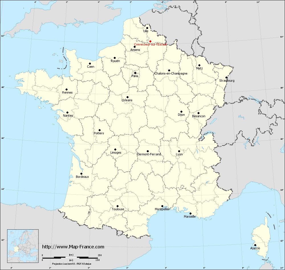
View the map of Crèvecœur-sur-l'Escaut in full screen (1000 x 949)
|
You will find the location of Crèvecœur-sur-l'Escaut on the map of France of regions in Lambert 93 coordinates. The town of Crèvecœur-sur-l'Escaut is located in the department of Nord of the french region Nord-Pas-de-Calais.
Geographical sexagesimal coordinates / GPS (WGS84):
Latitude: 50° 06' 22'' North
Longitude: 03° 15' 03'' East
Geographical decimal coordinates :
Latitude: 50.106 degrees (50.106° North)
Longitude: 3.252 degrees (3.252° East)
Lambert 93 coordinates :
X: 7 180 hectometers
Y: 70 009 hectometers
Lambert 2 coordinates :
X: 6 655 hectometers
Y: 25 682 hectometers
Below, the geographical coordinates of Lille, prefecture of the Nord department:
Geographical sexagesimal coordinates / GPS (WGS84):
Latitude: 50° 37' 55'' North
Longitude: 03° 03' 27'' East
Geographical decimal coordinates :
Latitude: 50.628 degrees (50.628° North)
Longitude: 3.045 degrees (3.045° East)
Lambert 93 coordinates :
X: 7 041 hectometers
Y: 70 594 hectometers
Lambert 2 coordinates :
X: 6 511 hectometers
Y: 26 266 hectometers
|
This map of Crèvecœur-sur-l'Escaut is reusable and modifiable by making a link to this page of the Map-France.com website or by using the given code :
|
Map of Crèvecœur-sur-l'Escaut with departments and prefectures
|
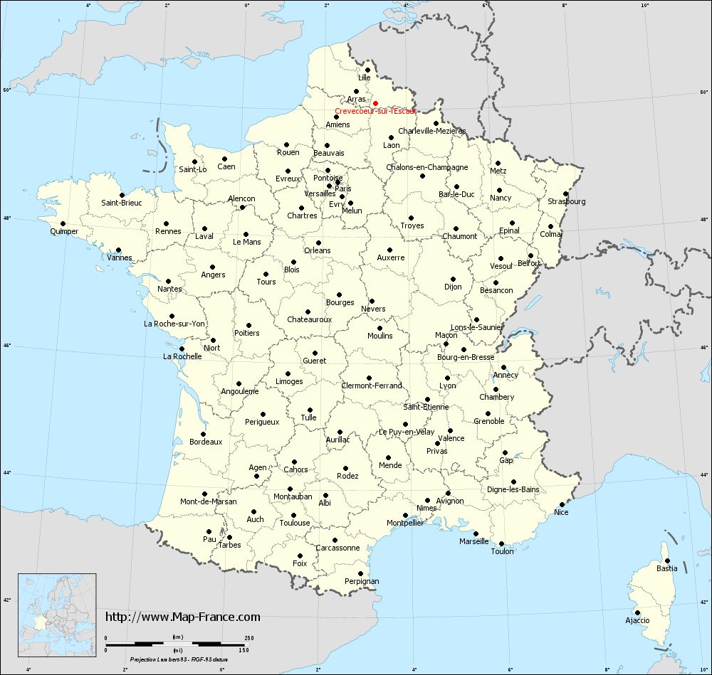
Voir la carte of Crèvecœur-sur-l'Escaut en grand format (1000 x 949)
|
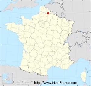
Here is the localization of Crèvecœur-sur-l'Escaut on the France map of departments in Lambert 93 coordinates. The city of Crèvecœur-sur-l'Escaut is shown on the map by a red point.
The town of Crèvecœur-sur-l'Escaut is located in the department of Nord of the french region Nord-Pas-de-Calais.
The latitude of Crèvecœur-sur-l'Escaut is 50.106 degrees North.
The longitude of Crèvecœur-sur-l'Escaut is 3.252 degrees East.
Here the distance between Crèvecœur-sur-l'Escaut and the biggest cities of France:
Distances are calculated as the crow flies (orthodromic distance)
Distance between Crèvecœur-sur-l'Escaut and Paris : 153.06 kilometers
Distance between Crèvecœur-sur-l'Escaut and Marseille : 773.93 kilometers
Distance between Crèvecœur-sur-l'Escaut and Lyon : 497.07 kilometers
Distance between Crèvecœur-sur-l'Escaut and Toulouse : 735.69 kilometers
Distance between Crèvecœur-sur-l'Escaut and Nice : 773.25 kilometers
Distance between Crèvecœur-sur-l'Escaut and Nantes : 476.55 kilometers
Distance between Crèvecœur-sur-l'Escaut and Strasbourg : 367.19 kilometers
Distance between Crèvecœur-sur-l'Escaut and Montpellier : 723.46 kilometers
Distance between Crèvecœur-sur-l'Escaut and Bordeaux : 651.37 kilometers
Distance between Crèvecœur-sur-l'Escaut and Lille : 59.78 kilometers
Distance between Crèvecœur-sur-l'Escaut and Rennes : 421.76 kilometers
Distance between Crèvecœur-sur-l'Escaut and Reims : 109.66 kilometers
Clic here to see the map of Crèvecœur-sur-l'Escaut in full screen:
Crèvecœur-sur-l%27Escaut on the map of french departments
|
This administrative map of Crèvecœur-sur-l'Escaut is reusable and modifiable by making a link to this page of the Map-France.com website or by using the given code :
|
Administrative base maps of Crèvecœur-sur-l'Escaut
|

See the administrative base map of Crèvecœur-sur-l'Escaut in full screen (1000 x 949)
|
Small administrative base map of Crèvecœur-sur-l'Escaut
|
This base map administrative of Crèvecœur-sur-l'Escaut is reusable and modifiable by making a link to this page of the Map-France.com website or by using the given code :
|
 French Version : http://www.cartesfrance.fr