|
The village of Boutavent is a small village located north of France. The town of Boutavent is located in the department of Oise of the french region Picardie. The town of Boutavent is located in the township of Formerie part of the district of Beauvais. The area code for Boutavent is 60096 (also known as code INSEE), and the Boutavent zip code is 60220.
Geography and map of Boutavent :
The altitude of the city hall of Boutavent is approximately 220 meters. The Boutavent surface is 4.37 km ². The latitude and longitude of Boutavent are 49.642 degrees North and 1.759 degrees East.
Nearby cities and towns of Boutavent are :
Bouvresse (60220) at 1.25 km, Mureaumont (60220) at 1.95 km, Formerie (60220) at 2.15 km, Campeaux (60220) at 2.50 km, Monceaux-l'Abbaye (60220) at 2.59 km, Blargies (60220) at 3.45 km, Moliens (60220) at 4.66 km, Saint-Arnoult (60220) at 4.69 km.
(The distances to these nearby towns of Boutavent are calculated as the crow flies)
Population and housing of Boutavent :
The population of Boutavent was 76 in 1999, 67 in 2006 and 67 in 2007. The population density of Boutavent is 15.33 inhabitants per km². The number of housing of Boutavent was 40 in 2007. These homes of Boutavent consist of 33 main residences, 4 second or occasional homes and 3 vacant homes. |
|
|
Hotel Boutavent
|
|
|
Book now ! Best Price Guaranteed, no booking fees, pay at the hotel with our partner Booking.com, leader in online hotel reservation.
Find all hotels of Boutavent : Hotel Boutavent
| |

|
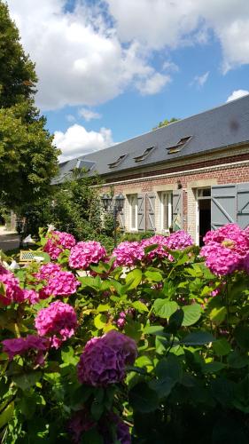
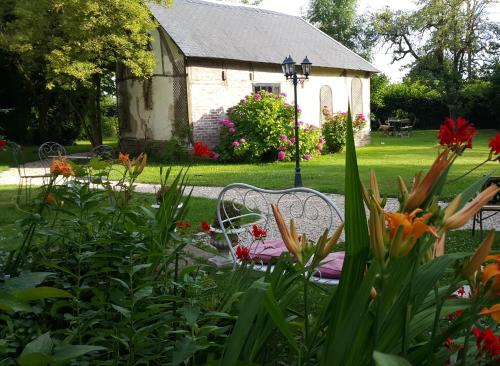
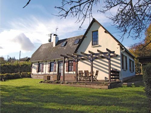
Bed and Breakfast : La Grange
The Grange offers rooms set in an 18th-century farmhouse located in Mureaumont, in the Picardie region, a 35-minute drive from Beauvais Tillé Airport. It features a large garden...
Rate : from 55.00 €
to 60.00 €
Address : 4 Rue Principale 60220 Mureaumont
Distance Bed and Breakfast - Boutavent : 1.37 km
|
|
|
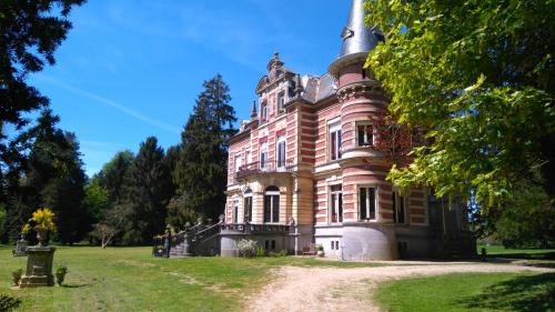
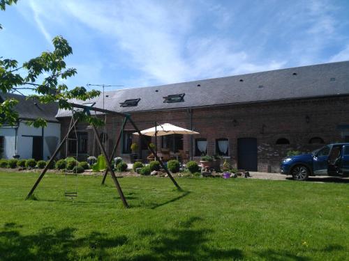
Bed and Breakfast : Château De Colagnie-Des-Bois
Set in a 6-hectare park, Château De Colagnie-Des-Bois offers free WiFi and a sun terrace in Saint-Arnoult, 31 km from Beauvais and its airport. Free private parking is available...
Price : from 68.00 €
to 110.00 €
Contact : 9, Lieu-Dit Colagnie-Des-Bois (Saint-Arnoult) 60220 Saint-Arnoult
Distance Bed and Breakfast - Boutavent : 1.98 km
|
|
|
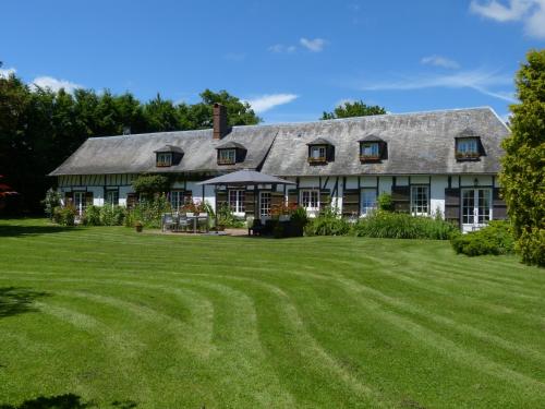
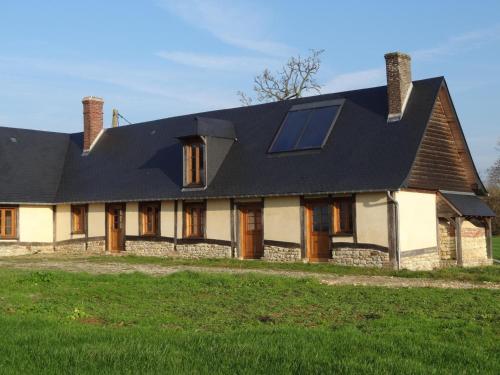
Guest accommodation : Les Clés d'Auriane
Located in the Pays de Bray region, Les Clés d'Auriane is a guesthouse which boats a 4000m² garden. Free parking is offered and free WiFi is available. The rooms at Les Clés d'...
Prices : from 59.00 €
to 90.00 €
Contact : Hameau de Rousseville 15, rue des Puits 76440 Grumesnil
Distance Guest accommodation - Boutavent : 4.95 km
|
|
|
Guest accommodation : Les Clés d'Auriane - Gîte "Le 440"
Situated in Grumesnil in the Upper Normandy region, Les Clés d'Auriane - Gîte "Le 440" has a terrace. The property features garden views. The 1-bedroom holiday home comes with ...
Contact : 15, rue des Puits 76440 Grumesnil
Distance Guest accommodation - Boutavent : 4.95 km
|
|
|
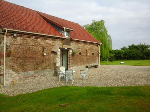
Guest accommodation : Gîte du Grand Cerf
Gîte du Grand Cerf is set in Criquiers and offers free bikes, a garden and a terrace. This holiday home provides a shared lounge. This 3-bedroom holiday home comes with a kitch...
Address : 5 rue principale 76390 Criquiers
Distance Guest accommodation - Boutavent : 4.99 km
|
|
|
Bed and Breakfast : Le Petit Verger
Le Petit Verger is a family-run, traditional-style guest house set in Grumesnil, 60 km from Rouen. Featuring exposed beams and a large garden with orchards, the accommodation ha...
Prices : from 59.00 €
to 69.00 €
Contact : 12 Rue du Chateau d'Eau 76440 Grumesnil
Distance Bed and Breakfast - Boutavent : 6.02 km
|
|
|
Guest accommodation : Le Ferme du Gaillon Gite
Situated in Haussez, Le Ferme du Gaillon Gite offers accommodation with a patio and free WiFi. Guests staying at this holiday home have access to a fully equipped kitchen. The ...
Contact : Impasse du Gaillon 76440 Haussez
Distance Guest accommodation - Boutavent : 7.11 km
|
|
|
Guest accommodation : Holiday home Route d'Haudricourt L-868

Holiday home Route d'Haudricourt L-868 is located in Haudricourt Au bois. This property offers access to free WiFi. The holiday home includes 4 bedrooms and a living room with ...
Contact : 76390 Haudricourt Au bois
Distance Guest accommodation - Boutavent : 9.78 km
|
|
|
Guest accommodation : Le Gite dans la prairie
Le Gite dans la prairie is situated in Ménerval. Guests staying at this holiday home have access to a fully equipped kitchen. The holiday home offers a terrace. Guests can go h...
Address : 1 chemin de La Butte 76220 Ménerval
Distance Guest accommodation - Boutavent : 12.16 km
|
|
|
Bed and Breakfast : Les Babylones

Providing a garden, Les Babylones features accommodation in Saumont-la-Poterie. Free WiFi is featured. A continental breakfast can be enjoyed at the property. Guests can grab a...
Rate : from 63.75 €
to 75.00 €
Contact : 40 Impasse de la Corbiere, Saumont la Poterie 76440 Saumont-la-Poterie
Distance Bed and Breakfast - Boutavent : 12.91 km
|
|
Find another hotel near Boutavent : Boutavent hotels list
|
Map of Boutavent
|
|
Map of Boutavent :
At right you can find the localization of Boutavent on the map of France. Below, this is the satellite map of Boutavent. A road map, and maps templates of Boutavent are available here : "road map of Boutavent". This map show Boutavent seen by the satellite of Google Map. To see the streets of Boutavent or move on another zone, use the buttons "zoom" and "map" on top of this dynamic map.
Search on the map of Boutavent :
To search hotels, housings, tourist information office, administrations or other services, use the Google search integrated to the map on the following page : "map Boutavent".
Hotels of Boutavent are listed on the map with the following icons: 
The map of Boutavent is centred in the following coordinates :
|

|
|
|
|
Print the map of Boutavent

Print the map of Boutavent : map of Boutavent
|
Photos Boutavent
|
See all photos of Boutavent :
Other photos of Boutavent and nearby towns can be found here: photos Boutavent
|
|
Boutavent weather forecast
Find next hours and 7 days weather forecast for Boutavent here : weather Boutavent (with english metrics)
This is the last weather forecast for Boutavent collected by the nearest observation station of Formerie.
Week Forecast:
The latest weather data for Boutavent were collected Wednesday, 17 June 2026 at 19:05 from the nearest observation station of Formerie.
| Wednesday, June 17th |
27°C 13°C
0%
48%
|
Partly cloudy
Temperature Max: 27°C Temperature Min: 13°C
Precipitation Probability: 0%
Percentage of sky occluded by clouds: 48%
Wind speed: 12 km/h North-East
Humidity: 64%° UV Index: 7
Sunrise: 05:45 Sunset: 22:03 |
|
| | Thursday, June 18th |
29°C 14°C
52%
60%
|
Thunderstorms
Temperature Max: 29°C Temperature Min: 14°C
Precipitation Probability: 52% (Rain)
Percentage of sky occluded by clouds: 60%
Wind speed: 9 km/h North-West
Humidity: 62%° UV Index: 6
Sunrise: 05:45 Sunset: 22:03 |
|
| | Friday, June 19th |
32°C 19°C
30%
57%
|
Drizzle
Temperature Max: 32°C Temperature Min: 19°C
Precipitation Probability: 30% (Rain)
Percentage of sky occluded by clouds: 57%
Wind speed: 13 km/h North
Humidity: 59%° UV Index: 6
Sunrise: 05:45 Sunset: 22:03 |
|
| | Saturday, June 20th |
27°C 16°C
30%
50%
|
Drizzle
Temperature Max: 27°C Temperature Min: 16°C
Precipitation Probability: 30% (Rain)
Percentage of sky occluded by clouds: 50%
Wind speed: 9 km/h South
Humidity: 68%° UV Index: 7
Sunrise: 05:45 Sunset: 22:04 |
|
|
Attribution: 
|
|
Other maps, hotels and towns in france
Find another town, zip code, department, region, ...
Quick links Boutavent :
Make a link to this page of Boutavent with the following code :
|
|
|
 French Version : http://www.cartesfrance.fr/carte-france-ville/60096_Boutavent.html