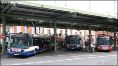
Here are the photos of the city of Castanet-Tolosan and nearby towns. Castanet-Tolosan is located in the department of Haute-Garonne in the region of Midi-Pyrénées. You will find the satellite map of Castanet-Tolosan under these photos.
To see photos of nearby towns of Castanet-Tolosan, you can try the following links :
- Pictures of Péchabou (31320) : town located at 1.84 km - Pictures of Auzeville-Tolosane (31320) : town located at 2.25 km - Pictures of Mervilla (31320) : town located at 2.35 km - Pictures of Labège (31670) : town located at 2.83 km - Pictures of Pompertuzat (31450) : town located at 3.14 km - Pictures of Rebigue (31320) : town located at 3.30 km - Pictures of Vigoulet-Auzil (31320) : town located at 3.52 km - Pictures of Pechbusque (31320) : town located at 3.64 km - Pictures of Ramonville-Saint-Agne (31520) : town located at 3.93 km - Pictures of Vieille-Toulouse (31320) : town located at 4.54 km - Pictures of Deyme (31450) : town located at 4.74 km - Pictures of Corronsac (31450) : town located at 4.78 km
- photos of the department prefecture of Haute-Garonne : photos of Toulouse - pictures of others cities of Haute-Garonne : Haute-Garonne
To see Castanet-Tolosan from the sky, here is the satellite map of the city of Castanet-Tolosan : Castanet-Tolosan map.
|
I like Castanet-Tolosan !
|
|
|
|
|