|
The village of Chambord is a small village located north of France. The town of Chambord is located in the department of Eure of the french region Haute-Normandie. The town of Chambord is located in the township of Rugles part of the district of Évreux. The area code for Chambord is 27139 (also known as code INSEE), and the Chambord zip code is 27250.
Geography and map of Chambord :
The altitude of the city hall of Chambord is approximately 211 meters. The Chambord surface is 14.62 km ². The latitude and longitude of Chambord are 48.889 degrees North and 0.611 degrees East.
Nearby cities and towns of Chambord are :
La Haye-Saint-Sylvestre (27330) at 2.16 km, Glos-la-Ferrière (61550) at 3.65 km, Mesnil-Rousset (27390) at 4.22 km, Les Bottereaux (27250) at 4.76 km, Couvains (61550) at 4.79 km, Saint-Pierre-du-Mesnil (27330) at 5.72 km, Juignettes (27250) at 6.11 km, Bois-Normand-près-Lyre (27330) at 6.56 km.
(The distances to these nearby towns of Chambord are calculated as the crow flies)
Population and housing of Chambord :
The population of Chambord was 194 in 1999, 176 in 2006 and 174 in 2007. The population density of Chambord is 11.90 inhabitants per km². The number of housing of Chambord was 120 in 2007. These homes of Chambord consist of 78 main residences, 30 second or occasional homes and 12 vacant homes. |
|
|
Hotel Chambord
|
|
|
Book now ! Best Price Guaranteed, no booking fees, pay at the hotel with our partner Booking.com, leader in online hotel reservation.
Find all hotels of Chambord : Hotel Chambord
| |
|
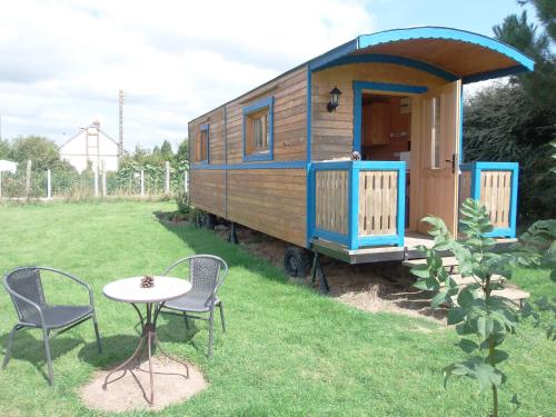
Guest accommodation : Roulotte du Preamont
Located in the countryside of Couvains, Roulotte du Preamont provides a wooden caravan set in a working farm with animals. It has a garden, free private parking and is 10 km fro...
Rate : from 55.00 €
to 75.00 €
Address : Le Préamont 61550 Couvains
Distance Guest accommodation - Chambord : 3.24 km
|
|
|
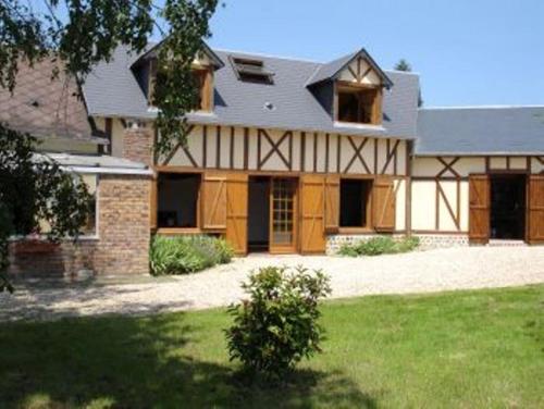
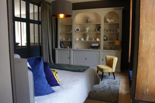
Bed and Breakfast : Château de la Duquerie
Located in Bois-Normand-près-Lyre in the Upper Normandy region, Château de la Duquerie provides accommodation with free WiFi. A continental breakfast is served every morning at...
Price : from 125.00 €
Contact : Route de la Ducquerie 3 27330 Bois-Normand-près-Lyre
Distance Bed and Breakfast - Chambord : 4.06 km
|
|
|
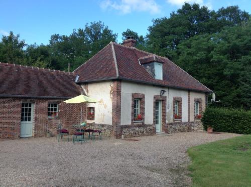
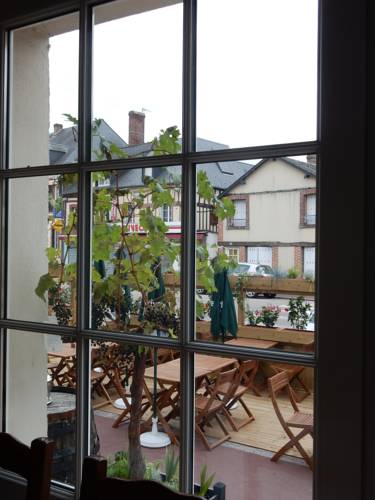
Bed and Breakfast : La Grenouillère
Set in a former sheep barn, La Grenouillère is located in Gisay-la-Coudre and offers a garden, horse riding activities and a pond. Château De Beaumesnil is a 15-minute drive awa...
Prices : from 60.00 €
to 70.00 €
Contact : La Villette 27330 Gisay
Distance Bed and Breakfast - Chambord : 7.14 km
|
|
|
Guest accommodation : Le Rucher
Le Rucher is situated in Bois-Normand-près-Lyre and offers a garden. The property has garden views. The holiday home consists of 3 bedrooms, a kitchen and 1 bathroom. The holi...
Contact : 5 route de Rouge Maison 27330 Bois-Normand-près-Lyre
Distance Guest accommodation - Chambord : 8.67 km
|
|
|
Guest accommodation : Rouge Maison
Providing free WiFi, Rouge Maison is situated in Bois-Normand-près-Lyre. All rooms boast a kitchen and a private bathroom. The guest house has a garden and offers a sun terrace....
Address : 5 route de Rouge Maison 5 D45 27330 Bois-Normand-près-Lyre
Distance Guest accommodation - Chambord : 8.98 km
|
|
|
Hotel : Hôtel Restaurant Le Paradis
Featuring free WiFi and a terrace, Hôtel Restaurant Le Paradis offers pet-friendly accommodation in La Ferté-Frênel, 13 km form L'Aigle. Guests can enjoy the on-site restaurant....
Prices : from 60.00 €
Contact : 10 Grande Rue 61550 La Ferté-Frênel
Distance Hotel - Chambord : 9.02 km
|
|

|
Bed and Breakfast : Au bord de l'eau

Situated in Ambenay, Au bord de l'eau features accommodation with access to a garden. There is a fully equipped private bathroom with bath and free toiletries. A continental b...
Rate : from 65.00 €
to 120.00 €
Contact : route de Transière 27250 Ambenay
Distance Bed and Breakfast - Chambord : 9.30 km
|
|
|
Guest accommodation : Maison De Vacances - La Trinite-De-Reville
Maison De Vacances - La Trinite-De-Reville is set in Saint-Agnan-de-Cernières and offers barbecue facilities. Guests staying at this holiday home have access to a fully equipped...
Contact : 27270 Saint-Agnan-de-Cernières
Distance Guest accommodation - Chambord : 11.08 km
|
|
|
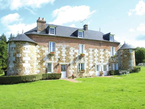
Bed and Breakfast : Le Manoir de Villers
Le Manoir de Villers offers rooms set in a restored farmhouse typical of the Basse Normandie region. It features free Wi-Fi access, a restaurant and a riding school on site. Fre...
Prices : from 63.00 €
to 115.00 €
Address : 11 route d'Anceins 61550 Villers-en-Ouche
Distance Bed and Breakfast - Chambord : 11.37 km
|
|
|
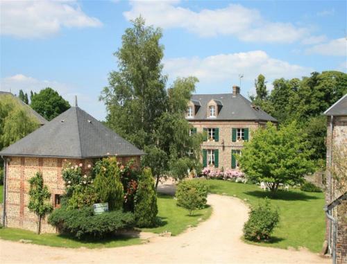
Guest accommodation : Logis campagnard du XVIeme
Situated in Bosc-Renoult-en-Ouche in the Upper Normandy Region, this holiday home with a garden is 43 km from Lisieux, while Conches en Ouche and Bernay are 21 km away. Free pri...
Contact : Rubremont 6 rue Saint-Ouen 27330 Bosc-Renoult-en-Ouche
Distance Guest accommodation - Chambord : 11.50 km
|
|
Find another hotel near Chambord : Chambord hotels list
|
Map of Chambord
|
|
Map of Chambord :
At right you can find the localization of Chambord on the map of France. Below, this is the satellite map of Chambord. A road map, and maps templates of Chambord are available here : "road map of Chambord". This map show Chambord seen by the satellite of Google Map. To see the streets of Chambord or move on another zone, use the buttons "zoom" and "map" on top of this dynamic map.
Search on the map of Chambord :
To search hotels, housings, tourist information office, administrations or other services, use the Google search integrated to the map on the following page : "map Chambord".
Hotels of Chambord are listed on the map with the following icons: 
The map of Chambord is centred in the following coordinates :
|

|
|
|
|
Print the map of Chambord

Print the map of Chambord : map of Chambord
|
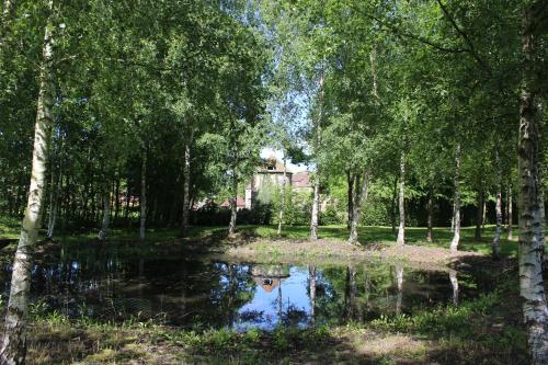
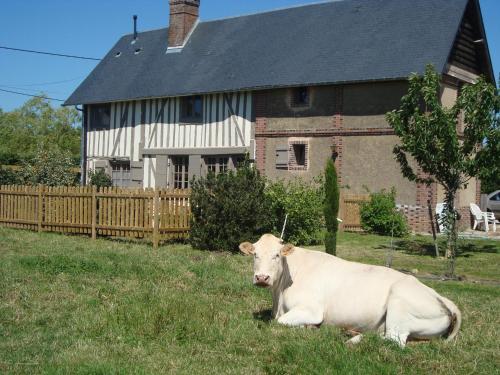
Photos Chambord
|
See all photos of Chambord :
Other photos of Chambord and nearby towns can be found here: photos Chambord
|
These photos taken near the town of Chambord can be shown in full screen clicking on the thumbnails. Photos are copyrighted by their owners.
| | |

France périphérique
|
|
Chambord weather forecast
Find next hours and 7 days weather forecast for Chambord here : weather Chambord (with english metrics)
This is the last weather forecast for Chambord collected by the nearest observation station of Rugles.
Week Forecast:
The latest weather data for Chambord were collected Saturday, 01 August 2026 at 11:02 from the nearest observation station of Rugles.
| Saturday, August 1st |
25°C 11°C
0%
45%
|
Partly cloudy
Temperature Max: 25°C Temperature Min: 11°C
Precipitation Probability: 0%
Percentage of sky occluded by clouds: 45%
Wind speed: 12 km/h South-East
Humidity: 53%° UV Index: 6
Sunrise: 06:30 Sunset: 21:35 |
|
| | Sunday, August 2nd |
29°C 12°C
0%
50%
|
Partly cloudy
Temperature Max: 29°C Temperature Min: 12°C
Precipitation Probability: 0%
Percentage of sky occluded by clouds: 50%
Wind speed: 10 km/h West
Humidity: 46%° UV Index: 6
Sunrise: 06:32 Sunset: 21:34 |
|
| | Monday, August 3rd |
32°C 16°C
29%
62%
|
Partly cloudy
Temperature Max: 32°C Temperature Min: 16°C
Precipitation Probability: 29% (Rain)
Percentage of sky occluded by clouds: 62%
Wind speed: 11 km/h North
Humidity: 46%° UV Index: 5
Sunrise: 06:33 Sunset: 21:32 |
|
| | Tuesday, August 4th |
28°C 18°C
41%
42%
|
Drizzle
Temperature Max: 28°C Temperature Min: 18°C
Precipitation Probability: 41% (Rain)
Percentage of sky occluded by clouds: 42%
Wind speed: 16 km/h North-East
Humidity: 55%° UV Index: 6
Sunrise: 06:34 Sunset: 21:31 |
|
|
Attribution: 
|
|
Other maps, hotels and towns in france
Find another town, zip code, department, region, ...
Quick links Chambord :
Make a link to this page of Chambord with the following code :
|
|
|
 French Version : http://www.cartesfrance.fr/carte-france-ville/27139_Chambord.html