|
The village of Chantelouve is a small village located south east of France. The town of Chantelouve is located in the department of Isère of the french region Rhône-Alpes. The town of Chantelouve is located in the township of Valbonnais part of the district of Grenoble. The area code for Chantelouve is 38073 (also known as code INSEE), and the Chantelouve zip code is 38740.
Geography and map of Chantelouve :
The altitude of the city hall of Chantelouve is approximately 1 110 meters. The Chantelouve surface is 33.41 km ². The latitude and longitude of Chantelouve are 44.983 degrees North and 5.968 degrees East.
Nearby cities and towns of Chantelouve are :
Le Périer (38740) at 5.24 km, Lavaldens (38350) at 6.40 km, Villard-Reymond (38520) at 6.84 km, Villard-Notre-Dame (38520) at 7.11 km, Ornon (38520) at 7.27 km, La Morte (38350) at 9.13 km, Entraigues (38740) at 9.19 km, Le Bourg-d'Oisans (38520) at 9.20 km.
(The distances to these nearby towns of Chantelouve are calculated as the crow flies)
Population and housing of Chantelouve :
The population of Chantelouve was 73 in 1999, 73 in 2006 and 75 in 2007. The population density of Chantelouve is 2.24 inhabitants per km². The number of housing of Chantelouve was 120 in 2007. These homes of Chantelouve consist of 40 main residences, 72 second or occasional homes and 8 vacant homes. |
|
|
Hotel Chantelouve
|
|
|
Book now ! Best Price Guaranteed, no booking fees, pay at the hotel with our partner Booking.com, leader in online hotel reservation.
Find all hotels of Chantelouve : Hotel Chantelouve
| |
|
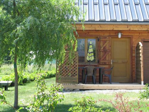
Guest accommodation : Gîte de la Lignarre
Gîte de la Lignarre is situated in Ornon, 2.4 km from Col d'Ornon. The accommodation features free WiFi. All units at the guest house are equipped with a seating area and a fla...
Address : Hameau Le Rivier 38520 Ornon
Distance Guest accommodation - Chantelouve : 5.18 km
|
|
|
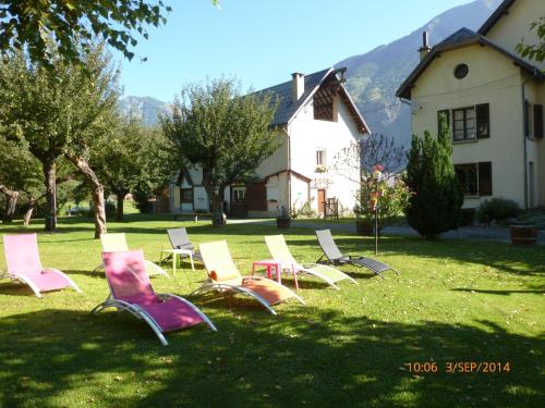
Guest accommodation : le perce neige

Located in Le Vert in the Rhône-Alps region, le perce neige features a garden. The accommodation has free WiFi. Offering direct access to a terrace, this chalet comes with 3 se...
Contact : le mas d'oisans rue du paradis 38520 Le Vert
Distance Guest accommodation - Chantelouve : 8.35 km
|
|
|
Guest accommodation : Bourg d'Oisans Studio
Bourg d'Oisans Studio offers accommodation in Les Gauchoirs, 18 km from Les Deux Alpes and 28 km from L'Alpe-d'Huez. It features views of the mountains. This non-smoking proper...
Contact : Les Gauchoirs, Le Bourg d'Oisans 38520 Le Bourg-dʼOisans
Distance Guest accommodation - Chantelouve : 8.36 km
|
|
|
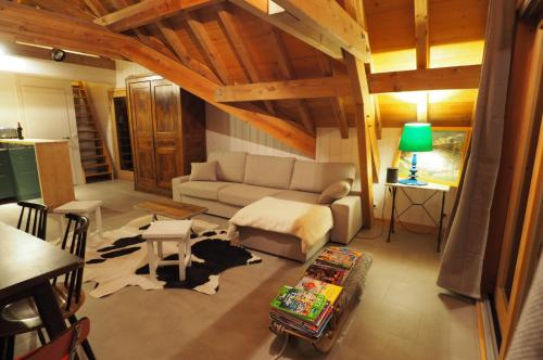
Guest accommodation : L'Etoile des Glaciers
Featuring accommodation with a terrace, L'Etoile des Glaciers is set in Le Bourg-dʼOisans. The property, housed in a building dating from 2012, features free WiFi. Offering 5 b...
Contact : Hameau le Vert 38520 Le Bourg-dʼOisans
Distance Guest accommodation - Chantelouve : 8.39 km
|
|
|
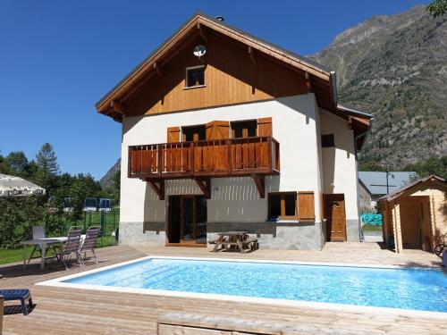
Apartment : Apartment Chalet Bourg d'Oisans
Located 1.5 km from Le Bourg-d’Oisans, Apartment Chalet Bourg d'Oisans offers self-catering accommodation with a terrace, BBQ facilities and a garden. Guests have access to free...
Address : Hameau du Vert 38520 Le Bourg-dʼOisans
Distance Apartment - Chantelouve : 8.39 km
|
|
|
Guest accommodation : La Marmotte De La Meije
Offering a restaurant upon reservation, La Marmotte De La Meije is a guest house located in Le Bourg-d’Oisans. Guests can relax in the private garden on site. The property is 14...
Prices : from 38.00 €
to 275.00 €
Contact : 408 route du vert 38520 Le Bourg-dʼOisans
Distance Guest accommodation - Chantelouve : 8.78 km
|
|
|
Apartment : L'Orée du Vert
L'Orée du Vert is situated in Le Bourg-dʼOisans and offers barbecue facilities and a garden. The property features mountain views. The apartment has 2 bedrooms, a living room, ...
Contact : Rue du paradis 38520 Le Bourg-dʼOisans
Distance Apartment - Chantelouve : 8.79 km
|
|
|
Guest accommodation : Marianne
Set 5 km from Venosc Ski Lift and 8 km from La Toura Ski Lift in Vénosc, Marianne offers accommodation with a kitchen. Guests may go for a swim in the private pool and enjoy the...
Contact : 38520 Vénosc
Distance Guest accommodation - Chantelouve : 8.81 km
|
|
|
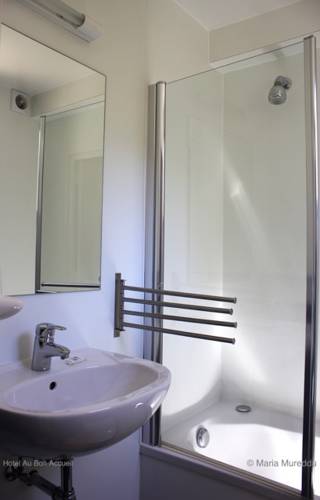
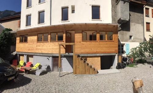
Hotel : Hotel Au Bon Accueil
Hotel Au Bon Accueil is a family run hotel located at the foot of Les Deux Alps Ski Resort. It features a terrace, lounge and library. The hotel offers an array of activities, ...
Prices : from 130.00 €
Address : Les Ougiers 38520 Vénosc
Distance Hotel - Chantelouve : 8.84 km
|
|
|
Apartment : Riders
Situated in Le Bourg-dʼOisans, Riders provides accommodation with a kitchen. Free WiFi is available. All units come with a seating area, a flat-screen TV and a private bathroom...
Contact : 15 Rue Ernest Graziotti 38520 Le Bourg-dʼOisans
Distance Apartment - Chantelouve : 9.26 km
|
|
Find another hotel near Chantelouve : Chantelouve hotels list
|
Map of Chantelouve
|
|
Map of Chantelouve :
At right you can find the localization of Chantelouve on the map of France. Below, this is the satellite map of Chantelouve. A road map, and maps templates of Chantelouve are available here : "road map of Chantelouve". This map show Chantelouve seen by the satellite of Google Map. To see the streets of Chantelouve or move on another zone, use the buttons "zoom" and "map" on top of this dynamic map.
Search on the map of Chantelouve :
To search hotels, housings, tourist information office, administrations or other services, use the Google search integrated to the map on the following page : "map Chantelouve".
Hotels of Chantelouve are listed on the map with the following icons: 
The map of Chantelouve is centred in the following coordinates :
|

|
|
|
|
Print the map of Chantelouve

Print the map of Chantelouve : map of Chantelouve
|
Photos Chantelouve
|
See all photos of Chantelouve :
Other photos of Chantelouve and nearby towns can be found here: photos Chantelouve
|
|
Chantelouve weather forecast
Find next hours and 7 days weather forecast for Chantelouve here : weather Chantelouve (with english metrics)
This is the last weather forecast for Chantelouve collected by the nearest observation station of Valbonnais.
Week Forecast:
The latest weather data for Chantelouve were collected Friday, 31 July 2026 at 11:03 from the nearest observation station of Valbonnais.
| Friday, July 31st |
30°C 19°C
53%
54%
|
Drizzle
Temperature Max: 30°C Temperature Min: 19°C
Precipitation Probability: 53% (Rain)
Percentage of sky occluded by clouds: 54%
Wind speed: 7 km/h North
Humidity: 43%° UV Index: 8
Sunrise: 06:20 Sunset: 21:04 |
|
| | Saturday, August 1st |
27°C 17°C
38%
11%
|
Rain
Temperature Max: 27°C Temperature Min: 17°C
Precipitation Probability: 38% (Rain)
Percentage of sky occluded by clouds: 11%
Wind speed: 7 km/h South-East
Humidity: 52%° UV Index: 9
Sunrise: 06:22 Sunset: 21:02 |
|
| | Sunday, August 2nd |
29°C 16°C
29%
20%
|
Mostly clear
Temperature Max: 29°C Temperature Min: 16°C
Precipitation Probability: 29%
Percentage of sky occluded by clouds: 20%
Wind speed: 6 km/h East
Humidity: 36%° UV Index: 8
Sunrise: 06:23 Sunset: 21:01 |
|
| | Monday, August 3rd |
29°C 18°C
24%
44%
|
Partly cloudy
Temperature Max: 29°C Temperature Min: 18°C
Precipitation Probability: 24% (Rain)
Percentage of sky occluded by clouds: 44%
Wind speed: 7 km/h North
Humidity: 42%° UV Index: 7
Sunrise: 06:24 Sunset: 21:00 |
|
|
Attribution: 
|
|
Other maps, hotels and towns in france
Find another town, zip code, department, region, ...
Quick links Chantelouve :
Make a link to this page of Chantelouve with the following code :
|
|
|
 French Version : http://www.cartesfrance.fr/carte-france-ville/38073_Chantelouve.html


