|
The village of Lhôpital is a small village located south east of France. The town of Lhôpital is located in the department of Ain of the french region Rhône-Alpes. The town of Lhôpital is located in the township of Bellegarde-sur-Valserine part of the district of Nantua. The area code for Lhôpital is 01215 (also known as code INSEE), and the Lhôpital zip code is 01420.
Geography and map of Lhôpital :
The altitude of the city hall of Lhôpital is approximately 490 meters. The Lhôpital surface is 3.68 km ². The latitude and longitude of Lhôpital are 46.023 degrees North and 5.777 degrees East.
Nearby cities and towns of Lhôpital are :
Chanay (01420) at 1.88 km, Surjoux (01420) at 1.89 km, Challonges (74910) at 4.04 km, Injoux-Génissiat (01200) at 4.08 km, Franclens (74910) at 4.51 km, Usinens (74910) at 5.11 km, Saint-Germain-sur-Rhône (01200) at 5.17 km, Bassy (74910) at 6.03 km.
(The distances to these nearby towns of Lhôpital are calculated as the crow flies)
Population and housing of Lhôpital :
The population of Lhôpital was 49 in 1999, 56 in 2006 and 57 in 2007. The population density of Lhôpital is 15.49 inhabitants per km². The number of housing of Lhôpital was 33 in 2007. These homes of Lhôpital consist of 24 main residences, 7 second or occasional homes and 2 vacant homes. |
|
|
Hotel Lhôpital
|
|
|
Book now ! Best Price Guaranteed, no booking fees, pay at the hotel with our partner Booking.com, leader in online hotel reservation.
Find all hotels of Lhôpital : Hotel Lhôpital
| |
|
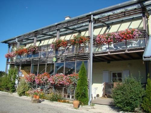
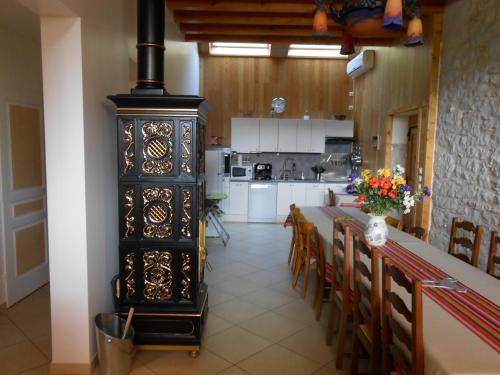
Guest accommodation : Gîte eco refuge
Gîte eco refuge is a detached mountain refuge holiday home set in Puthier in the Rhône-Alps Region and is 56 km from Geneva. The property offers views of the mountains and Rhône...
Rate : from 45.00 €
to 180.00 €
Address : Montailloux de Bise Chemin des pierrailles 01420 Corbonod
Distance Guest accommodation - Lhôpital : 4.68 km
|
|
|
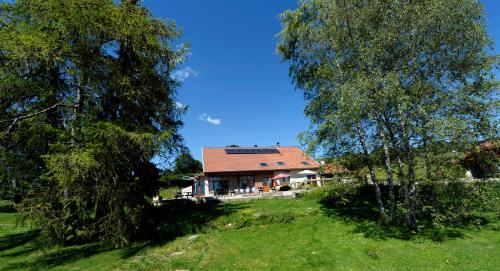
Guest accommodation : Activ'Plein Air
Activ'Plein Air is an accommodation situated in Hotonnes, 100 metres from Les Plans d'Hotonnes Ski School and 500 metres from Les Plans d'Hotonnes. Complimentary WiFi is availab...
Contact : Les Plans d'Hotonnes 01260 Hotonnes
Distance Guest accommodation - Lhôpital : 6.10 km
|
|
|
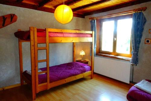
Guest accommodation : Chambres & Gites les Pelaz
Located in Hotonnes in a renovated farm house, Gites les Pelaz offers bed and breakfast accommodation just 1 km from the ski slopes. A two-bedroom apartment and a studio are ava...
Contact : "Les Pelaz" 01260 Hotonnes
Distance Guest accommodation - Lhôpital : 6.24 km
|
|
|
Guest accommodation : La Grange Des Plans
Set 600 metres from Les Plans d'Hotonnes Ski School in Hotonnes, La Grange Des Plans offers accommodation with a kitchen. The Les Plans d'Hotonnes is within 1 km of the holiday ...
Contact : LE LA GRANGE DES PLANS 01260 Hotonnes
Distance Guest accommodation - Lhôpital : 6.37 km
|
|
|
Guest accommodation : Gite du Cret

Featuring free WiFi, Gite du Cret is a holiday home, situated in Hotonnes in the Valromey region. You can relax by the seasonal outdoor pool in the garden in fair weather. The P...
Address : HOTONNES 36 Rue du Cet 01260 Hotonnes
Distance Guest accommodation - Lhôpital : 6.96 km
|
|
|
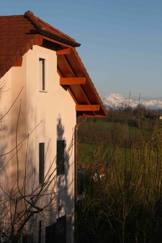
Guest accommodation : Villa Haute Savoie
Offering free WiFi and free-use bicycles, Villa Haute Savoie is located in Chessenaz. This self-catering accommodation is 40 km from Geneva and 35 km from Annecy. This holiday ...
Contact : 138 route de la Contamine 74270 Chessenaz
Distance Guest accommodation - Lhôpital : 9.37 km
|
|
|
Bed and Breakfast : Les Clés des Songes
Les Clés des Songes is located in Seyssel at an altitude of 500 metres. Free WiFi access is available. Each room here will provide you with air conditioning, a terrace and a se...
Rate : from 99.00 €
to 124.00 €
Contact : 93 hameau de prairod 74910 Seyssel
Distance Bed and Breakfast - Lhôpital : 10.17 km
|
|

|
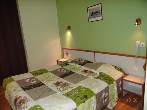
Hotel : Hotel Marinet
Hotel Marinet features a garden and a bar in Châtillon-en-Michaille. Rooms are equipped with a flat-screen TV with satellite channels. At the hotel, all rooms are fitted with a...
Price : from 67.00 €
Contact : 369 Rue du Bugey-Vouvray 01200 Châtillon-en-Michaille
Distance Hotel - Lhôpital : 10.23 km
|
|
|
Hotel : Hôtel Hermance
Offering free Wi-Fi access in the guest rooms, this 2-star hotel is located opposite Bellegarde Train Station. You can enjoy a drink in the bar and a buffet breakfast is prepare...
Prices : from 66.00 €
to 115.00 €
Address : 19, rue Joseph Bertola 01200 Bellegarde-sur-Valserine
Distance Hotel - Lhôpital : 10.28 km
|
|
|
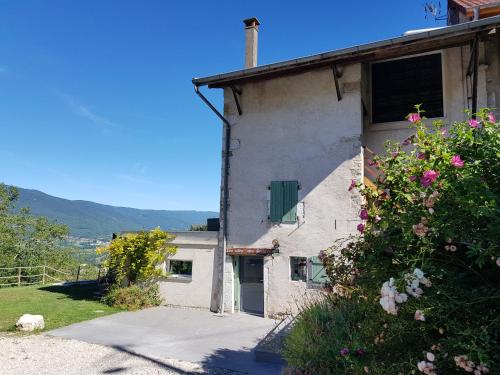
Guest accommodation : Gîte du Coq à l'Ane
Gîte du Coq à l'Ane is located in Lompnieu and offers barbecue facilities, a garden and a terrace. This holiday home provides accommodation with free WiFi. This holiday home wi...
Contact : 180 route de la Doue 01260 Lompnieu
Distance Guest accommodation - Lhôpital : 10.38 km
|
|
Find another hotel near Lhôpital : Lhôpital hotels list
|
Map of Lhôpital
|
|
Map of Lhôpital :
At right you can find the localization of Lhôpital on the map of France. Below, this is the satellite map of Lhôpital. A road map, and maps templates of Lhôpital are available here : "road map of Lhôpital". This map show Lhôpital seen by the satellite of Google Map. To see the streets of Lhôpital or move on another zone, use the buttons "zoom" and "map" on top of this dynamic map.
Search on the map of Lhôpital :
To search hotels, housings, tourist information office, administrations or other services, use the Google search integrated to the map on the following page : "map Lhôpital".
Hotels of Lhôpital are listed on the map with the following icons: 
The map of Lhôpital is centred in the following coordinates :
|

|
|
|
|
Print the map of Lhôpital

Print the map of Lhôpital : map of Lhôpital
|
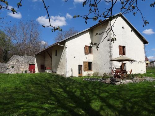
Photos Lhôpital
|
See all photos of Lhôpital :
Other photos of Lhôpital and nearby towns can be found here: photos Lhôpital
|
|
Lhôpital weather forecast
Find next hours and 7 days weather forecast for Lhôpital here : weather Lhôpital (with english metrics)
This is the last weather forecast for Lhôpital collected by the nearest observation station of Bellegarde-sur-Valserine.
Week Forecast:
The latest weather data for Lhôpital were collected Saturday, 01 August 2026 at 11:01 from the nearest observation station of Bellegarde-sur-Valserine.
| Saturday, August 1st |
27°C 17°C
46%
31%
|
Drizzle
Temperature Max: 27°C Temperature Min: 17°C
Precipitation Probability: 46% (Rain)
Percentage of sky occluded by clouds: 31%
Wind speed: 7 km/h South-East
Humidity: 66%° UV Index: 7
Sunrise: 06:18 Sunset: 21:06 |
|
| | Sunday, August 2nd |
30°C 17°C
0%
19%
|
Mostly clear
Temperature Max: 30°C Temperature Min: 17°C
Precipitation Probability: 0%
Percentage of sky occluded by clouds: 19%
Wind speed: 4 km/h North-West
Humidity: 55%° UV Index: 7
Sunrise: 06:20 Sunset: 21:05 |
|
| | Monday, August 3rd |
31°C 19°C
30%
29%
|
Drizzle
Temperature Max: 31°C Temperature Min: 19°C
Precipitation Probability: 30% (Rain)
Percentage of sky occluded by clouds: 29%
Wind speed: 7 km/h North
Humidity: 45%° UV Index: 8
Sunrise: 06:21 Sunset: 21:04 |
|
| | Tuesday, August 4th |
29°C 18°C
45%
46%
|
Drizzle
Temperature Max: 29°C Temperature Min: 18°C
Precipitation Probability: 45% (Rain)
Percentage of sky occluded by clouds: 46%
Wind speed: 5 km/h North-East
Humidity: 59%° UV Index: 7
Sunrise: 06:22 Sunset: 21:02 |
|
|
Attribution: 
|
|
Other maps, hotels and towns in france
Find another town, zip code, department, region, ...
Quick links Lhôpital :
Make a link to this page of Lhôpital with the following code :
|
|
|
 French Version : http://www.cartesfrance.fr/carte-france-ville/01215_Lhopital.html


