|
The village of Pact is a small village located south east of France. The town of Pact is located in the department of Isère of the french region Rhône-Alpes. The town of Pact is located in the township of Beaurepaire part of the district of Vienne. The area code for Pact is 38290 (also known as code INSEE), and the Pact zip code is 38270.
Geography and map of Pact :
The altitude of the city hall of Pact is approximately 260 meters. The Pact surface is 9.74 km ². The latitude and longitude of Pact are 45.353 degrees North and 4.99 degrees East.
Nearby cities and towns of Pact are :
Lapeyrouse-Mornay (26210) at 3.23 km, Jarcieu (38270) at 3.92 km, Bellegarde-Poussieu (38270) at 3.94 km, Moissieu-sur-Dolon (38270) at 3.98 km, Beaurepaire (38270) at 5.14 km, Revel-Tourdan (38270) at 5.18 km, Manthes (26210) at 5.71 km, Primarette (38270) at 6.39 km.
(The distances to these nearby towns of Pact are calculated as the crow flies)
Population and housing of Pact :
The population of Pact was 642 in 1999, 763 in 2006 and 776 in 2007. The population density of Pact is 79.67 inhabitants per km². The number of housing of Pact was 349 in 2007. These homes of Pact consist of 300 main residences, 34 second or occasional homes and 15 vacant homes. |
|
|
Hotel Pact
|
|
|
Book now ! Best Price Guaranteed, no booking fees, pay at the hotel with our partner Booking.com, leader in online hotel reservation.
Find all hotels of Pact : Hotel Pact
| |
|
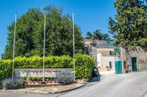
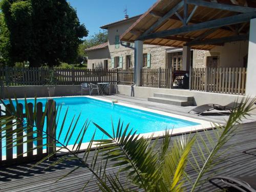
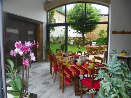
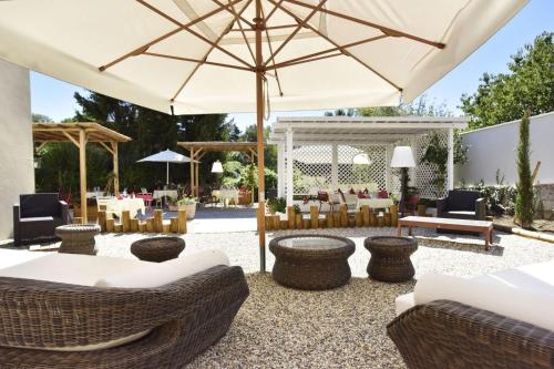
Hotel : Le Domaine de la Colombière


Set in a 4-hectare park with century trees, this property has a seasonal outdoor pool. It is located in the Rhône-Alpes region, between Lyon, Valence and Grenoble Le Domaine de...
Rate : from 80.00 €
to 199.00 €
Address : 45 Montée des Remparts 38270 Moissieu-sur-Dolon
Distance Hotel - Pact : 3.51 km
|
|
|
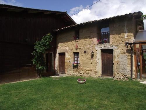
Bed and Breakfast : A La Mare du Vieux Chêne
A La Mare du Vieux Chêne sits in a well-kept garden, 57 km from Lyon Saint Exupéry Airport. It offers a heated swimming pool and Wi-Fi is free of charge in the entire property. ...
Price : from 74.00 €
to 140.00 €
Contact : 94 Chemin des Bruyères 38270 Bellegarde-Poussieu
Distance Bed and Breakfast - Pact : 5.06 km
|
|
|
Hotel : Le Ponceau La Joceane
Located in the centre of Beaurepaire, Le Ponceau hotel has a restaurant and bar on site. It offers free Wi-Fi access and a meeting room for 20 people. Rooms at Le Ponceau are f...
Prices : from 60.00 €
Contact : 18 av des terreaux 38270 Beaurepaire
Distance Hotel - Pact : 5.37 km
|
|
|
Hotel : Le Pic Boeuf
Located in Manthes, Le Pic Boeuf provides free WiFi. All rooms are fitted with a terrace with city views. At the hotel, the rooms are equipped with a wardrobe and a flat-screen...
Rate : from 50.00 €
to 56.00 €
Contact : le pic boeuf 235 rue des sources 26210 Manthes
Distance Hotel - Pact : 5.70 km
|
|
|
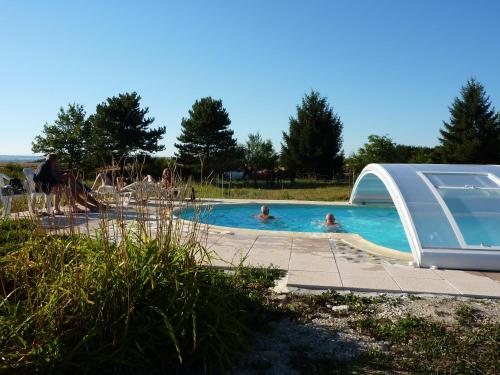
Bed and Breakfast : Chateau de la Saone
Featuring an outdoor swimming pool and a garden, Chateau de la Saone offers B&B accommodation in Hauterives. This property also offers table tennis, a volleyball court and table...
Price : from 77.00 €
to 175.00 €
Address : La Saone 26210 Lens-Lestang
Distance Bed and Breakfast - Pact : 7.14 km
|
|
|
Guest accommodation : Une pause sur la colline
Providing mountain views, Une pause sur la colline in Saint-Romain-de-Surieu provides accommodation, free bikes and barbecue facilities. Complimentary WiFi is offered. All unit...
Prices : from 75.00 €
to 120.00 €
Contact : 2 rue du Molymard 38150 Saint-Romain-de-Surieu
Distance Guest accommodation - Pact : 8.72 km
|
|
|
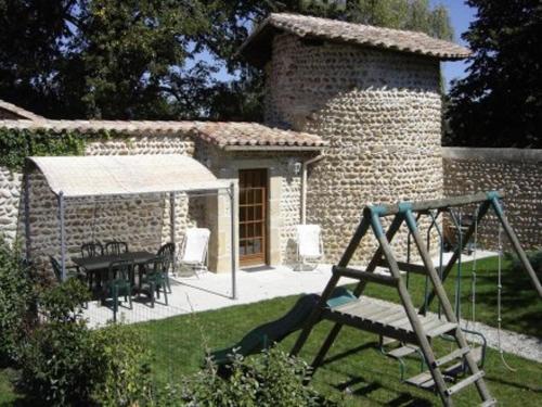
Bed and Breakfast : Le Clos des Collières
Le Clos des Collières offers B&B accommodation and a self-catering apartment, located in the countryside of the Isère region. A covered swimming pool features in the large garde...
Contact : 717 route de Viriville 38270 Marcollin
Distance Bed and Breakfast - Pact : 9.73 km
|
|
|
Guest accommodation : Holiday home chateaux du cros
Holiday home chateaux du cros is situated in Anneyron and offers barbecue facilities. Guests may enjoy free WiFi. The holiday home comes with 2 bedrooms, a TV with satellite ch...
Price : from 188.64 €
Contact : chateaux du cros 26140 Anneyron
Distance Guest accommodation - Pact : 10.77 km
|
|
|
Guest accommodation : La Petite Ferme des Vitoz
La Petite Ferme des Vitoz is located in Assieu. Free WiFi access is available in this farm stay. The property is a 5-minute drive from N7 road. Local produce tasting is availab...
Prices : from 72.50 €
to 167.20 €
Address : 14 rue de taramas 38150 Assieu
Distance Guest accommodation - Pact : 11.26 km
|
|
|
Hotel : Hôtel Le Relais
Situated in a traditional stone building of the region, Hôtel Le Relais features a terrace and garden. It offers an on-site restaurant serving a traditional menu, free Wi-Fi acc...
Rate : from 63.60 €
to 126.00 €
Contact : 1 Place du Général de Miribel 26390 Hauterives
Distance Hotel - Pact : 11.26 km
|
|
Find another hotel near Pact : Pact hotels list
|
Map of Pact
|
|
Map of Pact :
At right you can find the localization of Pact on the map of France. Below, this is the satellite map of Pact. A road map, and maps templates of Pact are available here : "road map of Pact". This map show Pact seen by the satellite of Google Map. To see the streets of Pact or move on another zone, use the buttons "zoom" and "map" on top of this dynamic map.
Search on the map of Pact :
To search hotels, housings, tourist information office, administrations or other services, use the Google search integrated to the map on the following page : "map Pact".
Hotels of Pact are listed on the map with the following icons: 
The map of Pact is centred in the following coordinates :
|

|
|
|
|
Print the map of Pact

Print the map of Pact : map of Pact
|
Photos Pact
|
See all photos of Pact :
Other photos of Pact and nearby towns can be found here: photos Pact
|
These photos taken near the town of Pact can be shown in full screen clicking on the thumbnails. Photos are copyrighted by their owners.
| | |

IMG_8902
|

IMG_8904
|
| |

Les halles rafters
|
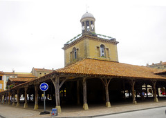
Revel - les halles
|
| |

France, April 2019. Palais Idéal
|

France, April 2019. Palais Idéal
|
| |

France, April 2019. Palais Idéal
|
France, April 2019. Palais Idéal
|
| |
France, April 2019. Palais Idéal
|
France, April 2019. Palais Idéal
|
| |

France, April 2019. Palais Idéal
|
France, April 2019. Palais Idéal
|
| |

France, April 2019. Palais Idéal
|

France, April 2019. Palais Idéal
|
|
Pact weather forecast
Find next hours and 7 days weather forecast for Pact here : weather Pact (with english metrics)
This is the last weather forecast for Pact collected by the nearest observation station of Beaurepaire.
Week Forecast:
The latest weather data for Pact were collected Wednesday, 01 July 2026 at 19:03 from the nearest observation station of Beaurepaire.
| Wednesday, July 1st |
28°C 20°C
43%
37%
|
Thunderstorms
Temperature Max: 28°C Temperature Min: 20°C
Precipitation Probability: 43% (Rain)
Percentage of sky occluded by clouds: 37%
Wind speed: 23 km/h South
Humidity: 47%° UV Index: 7
Sunrise: 05:55 Sunset: 21:31 |
|
| | Thursday, July 2nd |
30°C 17°C
0%
3%
|
Windy
Temperature Max: 30°C Temperature Min: 17°C
Precipitation Probability: 0%
Percentage of sky occluded by clouds: 3%
Wind speed: 26 km/h South
Humidity: 40%° UV Index: 9
Sunrise: 05:56 Sunset: 21:31 |
|
| | Friday, July 3rd |
30°C 19°C
0%
28%
|
Windy
Temperature Max: 30°C Temperature Min: 19°C
Precipitation Probability: 0%
Percentage of sky occluded by clouds: 28%
Wind speed: 25 km/h South
Humidity: 50%° UV Index: 7
Sunrise: 05:56 Sunset: 21:31 |
|
| | Saturday, July 4th |
31°C 16°C
0%
0%
|
Clear
Temperature Max: 31°C Temperature Min: 16°C
Precipitation Probability: 0%
Percentage of sky occluded by clouds: 0%
Wind speed: 21 km/h South
Humidity: 36%° UV Index: 9
Sunrise: 05:57 Sunset: 21:31 |
|
|
Attribution: 
|
|
Other maps, hotels and towns in france
Find another town, zip code, department, region, ...
Quick links Pact :
Make a link to this page of Pact with the following code :
|
|
|
 French Version : http://www.cartesfrance.fr/carte-france-ville/38290_Pact.html