|
The village of Rémeling is a small village located north east of France. The town of Rémeling is located in the department of Moselle of the french region Lorraine. The town of Rémeling is located in the township of Sierck-les-Bains part of the district of Thionville-Est. The area code for Rémeling is 57569 (also known as code INSEE), and the Rémeling zip code is 57480.
Geography and map of Rémeling :
The altitude of the city hall of Rémeling is approximately 280 meters. The Rémeling surface is 6.47 km ². The latitude and longitude of Rémeling are 49.407 degrees North and 6.487 degrees East.
Nearby cities and towns of Rémeling are :
Halstroff (57480) at 2.19 km, Waldwisse (57480) at 3.16 km, Launstroff (57480) at 3.49 km, Grindorff-Bizing (57480) at 3.57 km, Ritzing (57480) at 3.79 km, Kirschnaumen (57480) at 3.95 km, Laumesfeld (57480) at 5.20 km, Waldweistroff (57320) at 5.43 km.
(The distances to these nearby towns of Rémeling are calculated as the crow flies)
Population and housing of Rémeling :
The population of Rémeling was 260 in 1999, 307 in 2006 and 309 in 2007. The population density of Rémeling is 47.76 inhabitants per km². The number of housing of Rémeling was 127 in 2007. These homes of Rémeling consist of 116 main residences, 6 second or occasional homes and 5 vacant homes. |
|
|
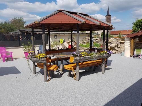
Hotel Rémeling
|
|
|
Book now ! Best Price Guaranteed, no booking fees, pay at the hotel with our partner Booking.com, leader in online hotel reservation.
Find all hotels of Rémeling : Hotel Rémeling
| |
|
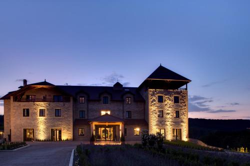
Hotel : Domaine de la Klauss

Located in Montenach in the Lorraine Region, 28 km from Luxembourg, Domaine de la Klauss boasts a spa centre and hot tub. The hotel has a sauna and fitness centre, and guests ca...
Rate : from 154.00 €
to 396.00 €
Address : 2 Impasse du Klaussberg 57480 Montenach
Distance Hotel - Rémeling : 7.99 km
|
|
|
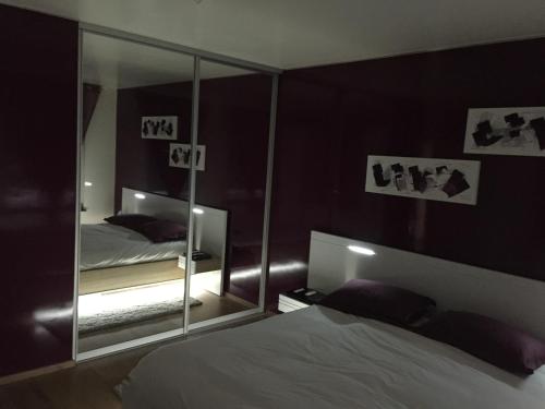
Apartment : Appartement Grand Luxe
Set in Apach in the Lorraine region, Appartement Grand Luxe features a terrace. This apartment also has free WiFi. The apartment comes with 2 bedrooms, a kitchen with a dining ...
Price : from 10.00 €
to 61.00 €
Contact : 5 Rue Des Bouleaux Apach 57480 Apach
Distance Apartment - Rémeling : 9.59 km
|
|
|
Bed and Breakfast : Chambres d'hôtes au Moulin d'Apach
Offering a sun terrace and views of the garden, Chambres d'hôtes au Moulin d'Apach is a former mill located in Apach in the Lorraine Region, 24 km from Luxembourg. Free WiFi and...
Contact : 24, Rue De L'école 57480 Apach
Distance Bed and Breakfast - Rémeling : 9.98 km
|
|
|
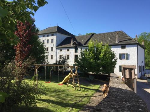
Guest accommodation : Gite "Vue Sur La Frontiere"
Set in Heining-lès-Bouzonville, a 5-minute walk from Leiding, this holiday home features a terrace and a garden with a barbecue. Guests benefit from free WiFi and private parkin...
Contact : 8 Rue de la Frontière 57320 Heining-lès-Bouzonville
Distance Guest accommodation - Rémeling : 14.41 km
|
|
|
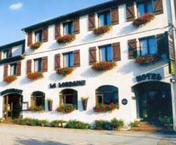
Hotel : La Lorraine
La Lorraine is located in the small village of Koenigsmacker, half-way between Metz, Luxembourg and Treves. It offers en suite accommodation with a restaurant. Each guest room...
Price : from 52.00 €
to 79.00 €
Address : 1 Rue De L'Eglise 57970 Koenigsmacker
Distance Hotel - Rémeling : 15.04 km
|
|
|
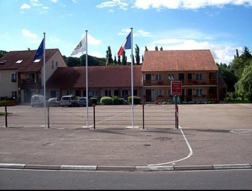
Hotel : Hotel Restaurant De La Canner

The Hotel Restaurant De La Canner is situated in a peaceful and leafy setting, in the heart of the Country of the Three Borders. It provides a shaded terrace, a children's playg...
Prices : from 57.00 €
to 115.00 €
Contact : 4 rue de l'Église 57920 Kédange-sur-Canner
Distance Hotel - Rémeling : 15.38 km
|
|
|
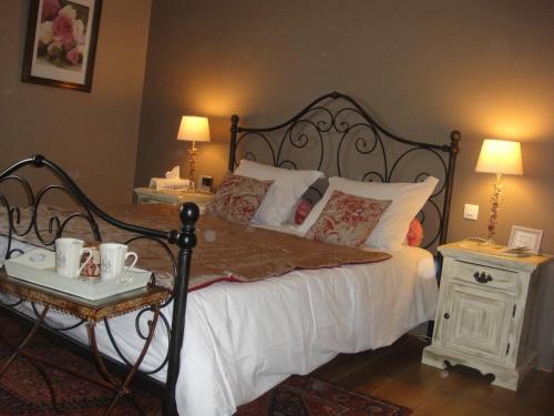
Bed and Breakfast : Chambres d'Hôtes Le Clos Du Verger
Set in a renovated farmhouse, dating back to the 19th century, Le Clos Du Verger offers B&B accommodation and is just 7 km from Moselle Vineyard. It features a garden and terrac...
Rate : from 70.00 €
to 85.00 €
Contact : 8 bis Boucle d'Alsace-lorraine 57570 Cattenom
Distance Bed and Breakfast - Rémeling : 16.66 km
|
|
|
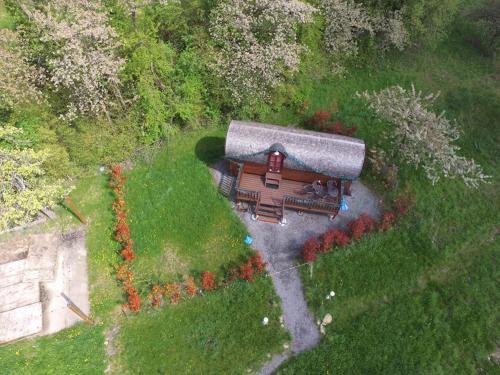
Guest accommodation : Le Chalet du Chemin et sa Roulotte
Le Chalet du Chemin et sa Roulotte is located in Berviller-en-Moselle within a natural setting. It offers a garden and free Wi-Fi access in public areas. The wooden caravan off...
Price : from 125.00 €
to 225.00 €
Contact : Chemin de la Carrière 57550 Berviller-en-Moselle
Distance Guest accommodation - Rémeling : 19.27 km
|
|
|
Bed and Breakfast : Chambres d'hôtes Chez Mariebel
Located in the centre of Ottonville, Chez Mariebel’ is 13 km from the A4 motorway and offers rooms with free Wi-Fi. Free activities for children are organized in the property’s ...
Prices : from 63.00 €
to 105.00 €
Address : 15 rue Saint Paul 57220 Ottonville et Ricrange
Distance Bed and Breakfast - Rémeling : 21.17 km
|
|
|
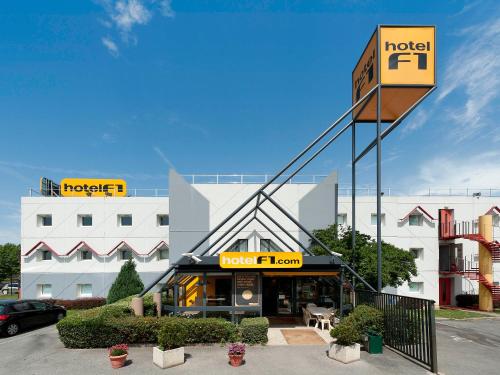
Hotel : hotelF1 Thionville Yutz
Hotelf1 Thionville Yutz is set in Illange, 30 km from Luxembourg and 25 km from Metz. Free WiFi and free private parking are offered on site. Each room is fitted with a flat-sc...
Rate : from 26.75 €
to 51.90 €
Contact : 1 rue des Carolingiens 57970 Illange
Distance Hotel - Rémeling : 23.25 km
|
|
Find another hotel near Rémeling : Rémeling hotels list
|
Map of Rémeling
|
|
Map of Rémeling :
At right you can find the localization of Rémeling on the map of France. Below, this is the satellite map of Rémeling. A road map, and maps templates of Rémeling are available here : "road map of Rémeling". This map show Rémeling seen by the satellite of Google Map. To see the streets of Rémeling or move on another zone, use the buttons "zoom" and "map" on top of this dynamic map.
Search on the map of Rémeling :
To search hotels, housings, tourist information office, administrations or other services, use the Google search integrated to the map on the following page : "map Rémeling".
Hotels of Rémeling are listed on the map with the following icons: 
The map of Rémeling is centred in the following coordinates :
|

|
|
|
|
Print the map of Rémeling

Print the map of Rémeling : map of Rémeling
|
Photos Rémeling
|
See all photos of Rémeling :
Other photos of Rémeling and nearby towns can be found here: photos Rémeling
|
|
Rémeling weather forecast
Find next hours and 7 days weather forecast for Rémeling here : weather Rémeling (with english metrics)
This is the last weather forecast for Rémeling collected by the nearest observation station of Sierck-les-Bains.
Week Forecast:
The latest weather data for Rémeling were collected Friday, 31 July 2026 at 15:04 from the nearest observation station of Sierck-les-Bains.
| Friday, July 31st |
30°C 18°C
30%
72%
|
Drizzle
Temperature Max: 30°C Temperature Min: 18°C
Precipitation Probability: 30% (Rain)
Percentage of sky occluded by clouds: 72%
Wind speed: 10 km/h East
Humidity: 54%° UV Index: 4
Sunrise: 06:04 Sunset: 21:16 |
|
| | Saturday, August 1st |
28°C 17°C
40%
54%
|
Drizzle
Temperature Max: 28°C Temperature Min: 17°C
Precipitation Probability: 40% (Rain)
Percentage of sky occluded by clouds: 54%
Wind speed: 7 km/h South-East
Humidity: 55%° UV Index: 6
Sunrise: 06:05 Sunset: 21:15 |
|
| | Sunday, August 2nd |
31°C 16°C
0%
28%
|
Mostly clear
Temperature Max: 31°C Temperature Min: 16°C
Precipitation Probability: 0%
Percentage of sky occluded by clouds: 28%
Wind speed: 8 km/h West
Humidity: 46%° UV Index: 6
Sunrise: 06:07 Sunset: 21:13 |
|
| | Monday, August 3rd |
33°C 18°C
32%
62%
|
Drizzle
Temperature Max: 33°C Temperature Min: 18°C
Precipitation Probability: 32% (Rain)
Percentage of sky occluded by clouds: 62%
Wind speed: 8 km/h North
Humidity: 45%° UV Index: 6
Sunrise: 06:08 Sunset: 21:11 |
|
|
Attribution: 
|
|
Other maps, hotels and towns in france
Find another town, zip code, department, region, ...
Quick links Rémeling :
Make a link to this page of Rémeling with the following code :
|
|
|
 French Version : http://www.cartesfrance.fr/carte-france-ville/57569_Remeling.html


