Map of France

Saint-Bon-Tarentaise photos


Find a town, a zip code,
a department, a region... in France
I like Map-France.com !


Saint-Bon-Tarentaise pictures


Here are the photos of the town of Saint-Bon-Tarentaise and nearby towns. Saint-Bon-Tarentaise is located in the department of Savoie in the region of Rhône-Alpes. You will find the satellite map of Saint-Bon-Tarentaise under these photos.

To see photos of nearby towns of Saint-Bon-Tarentaise, you can try the following links :
   - Photo of Bozel (73350) : town located at 1.25 km
   - Photo of La Perrière (73600) : town located at 3.63 km
   - Photo of Montagny (73350) : town located at 4.34 km
   - Photo of Champagny-en-Vanoise (73350) : town located at 4.71 km
   - Photo of Planay (73350) : town located at 4.73 km
   - Photo of Brides-les-Bains (73570) : town located at 6.04 km
   - Photo of Les Allues (73550) : town located at 6.42 km
   - Photo of Feissons-sur-Salins (73350) : town located at 7.25 km
   - Photo of Pralognan-la-Vanoise (73710) : town located at 8.75 km
   - Photo of Villarlurin (73600) : town located at 9.07 km
   - Photo of Notre-Dame-du-Pré (73600) : town located at 9.19 km
   - Photo of Salins-les-Thermes (73600) : town located at 9.41 km

 - photos of the department prefecture of Savoie : photos of Chambéry
 - pictures of others cities of Savoie : Savoie


To see Saint-Bon-Tarentaise from the sky, here is the satellite map of the town of Saint-Bon-Tarentaise : Saint-Bon-Tarentaise map.

I like Saint-Bon-Tarentaise !


Photos of the town of Saint-Bon-Tarentaise

These photos taken near the town of Saint-Bon-Tarentaise can be shown in full screen clicking on the thumbnails. Photos are copyrighted by their owners.

Col de la Rossa (2 091 m) - Photo of Saint-Bon-Tarentaise
Col de la Rossa (2 091 m)

Champagny-le-Bas vu d-en-haut - Photo of Saint-Bon-Tarentaise
Champagny-le-Bas vu d-en-haut

Tu veux ma ruine ? - Photo of Saint-Bon-Tarentaise
Tu veux ma ruine ?

L-alpage de La Montagne (environ 2 000 m) - Photo of Saint-Bon-Tarentaise
L-alpage de La Montagne (environ 2 000 m)

Vers le rocher de Plassa (2 836 m) - Photo of Saint-Bon-Tarentaise
Vers le rocher de Plassa (2 836 m)

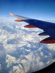
Sky clouds mountains - Photo of Saint-Bon-Tarentaise
Sky clouds mountains

Pralognan - Photo of Saint-Bon-Tarentaise
Pralognan

La vallée de Pralognan - Photo of Saint-Bon-Tarentaise
La vallée de Pralognan

Panorama sur la Vanoise - Photo of Saint-Bon-Tarentaise
Panorama sur la Vanoise

La Plagne - Photo of Saint-Bon-Tarentaise
La Plagne

Camouflage végétal - Photo of Saint-Bon-Tarentaise
Camouflage végétal

Chalet tranquille - Photo of Saint-Bon-Tarentaise
Chalet tranquille

La Dent du Villard - Photo of Saint-Bon-Tarentaise
La Dent du Villard

Pralognan - Photo of Saint-Bon-Tarentaise
Pralognan


Saint-Bon-Tarentaise from the sky


Old photos of the town of Saint-Bon-Tarentaise

These photos taken near the town of Saint-Bon-Tarentaise can be shown in full screen clicking on the thumbnails. Photos are copyrighted by their owners.


Other maps, hotels and towns in france


Find another town, zip code, department, region, ...


Quick links Saint-Bon-Tarentaise :


Back to the menus Map of France :


Make a link to this page of Saint-Bon-Tarentaise with the following code :


Map of France | Regions | Departments | Cities | Partners | Terms | Contact