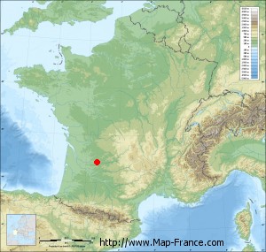
Saint-Capraise-de-Lalinde on the relief France map in Lambert 93 coordinates
|

See the map of Saint-Capraise-de-Lalinde in full screen (1000 x 949)
|
At left, here is the location of Saint-Capraise-de-Lalinde on the relief France map in Lambert 93 coordinates.
Here are the altitudes of Saint-Capraise-de-Lalinde :
- Town hall altitude of Saint-Capraise-de-Lalinde is 50 meters
- Minimum altitude of Saint-Capraise-de-Lalinde is 18 meters
- Maximum altitude of Saint-Capraise-de-Lalinde is 132 meters
- Medium altitude of Saint-Capraise-de-Lalinde is 75 meters
Here are the altitudes of Périgueux, prefecture of Dordogne department:
- Town hall altitude of Périgueux is 90 meters
- Minimum altitude of Périgueux is 75 meters
- Maximum altitude of Périgueux is 189 meters
- Medium altitude of Périgueux is 132 meters
Here are the altitudes of the french biggest cities:
Paris : 33 meters
Marseille : 20 meters
Lyon : 237 meters
Toulouse : 146 meters
Nice : 10 meters
Nantes : 20 meters
Strasbourg : 144 meters
Montpellier : 35 meters
Bordeaux : 16 meters
Lille : 20 meters
Rennes : 35 meters
Reims : 83 meters
Click here for the terrain map of Saint-Capraise-de-Lalinde in full screen:
Relief map of Saint-Capraise-de-Lalinde
|
This relief map of Saint-Capraise-de-Lalinde is reusable and modifiable by making a link to this page of the Map-France.com website or by using the given code :
|
Terrain base map of Saint-Capraise-de-Lalinde
|

See the terrain base map of Saint-Capraise-de-Lalinde in full screen (1000 x 949)
|
Small relief base map of Saint-Capraise-de-Lalinde
|
This base map of Saint-Capraise-de-Lalinde is reusable and modifiable by making a link to this page of the Map-France.com website or by using the given code :
|
Map of Saint-Capraise-de-Lalinde with regions and prefectures
|
View the map of Saint-Capraise-de-Lalinde in full screen (1000 x 949)
|
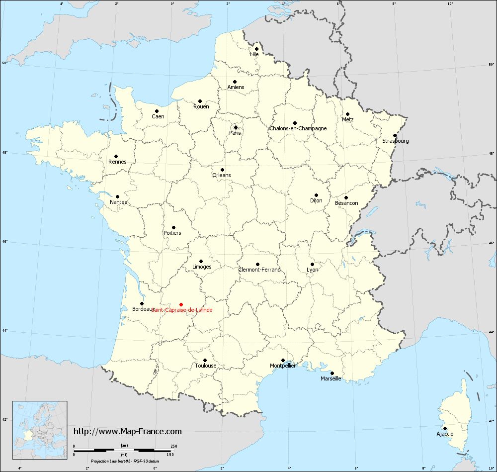
You will find the location of Saint-Capraise-de-Lalinde on the map of France of regions in Lambert 93 coordinates. The town of Saint-Capraise-de-Lalinde is located in the department of Dordogne of the french region Aquitaine.
Geographical sexagesimal coordinates / GPS (WGS84):
Latitude: 44° 50' 31'' North
Longitude: 00° 39' 13'' East
Geographical decimal coordinates :
Latitude: 44.842 degrees (44.842° North)
Longitude: 0.655 degrees (0.655° East)
Lambert 93 coordinates :
X: 5 146 hectometers
Y: 64 186 hectometers
Lambert 2 coordinates :
X: 4 669 hectometers
Y: 19 838 hectometers
Below, the geographical coordinates of Périgueux, prefecture of the Dordogne department:
Geographical sexagesimal coordinates / GPS (WGS84):
Latitude: 45° 11' 03'' North
Longitude: 00° 43' 05'' East
Geographical decimal coordinates :
Latitude: 45.185 degrees (45.185° North)
Longitude: 0.721 degrees (0.721° East)
Lambert 93 coordinates :
X: 5 208 hectometers
Y: 64 565 hectometers
Lambert 2 coordinates :
X: 4 728 hectometers
Y: 20 217 hectometers
|
This map of Saint-Capraise-de-Lalinde is reusable and modifiable by making a link to this page of the Map-France.com website or by using the given code :
|
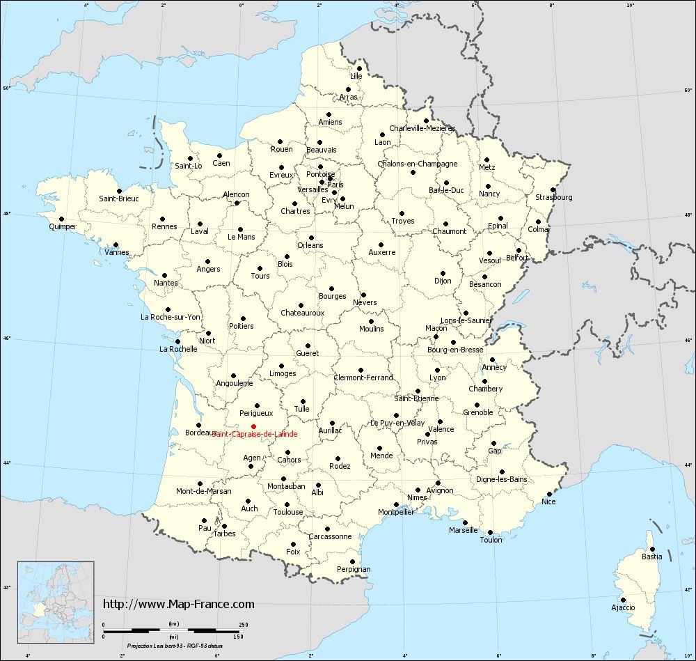
Map of Saint-Capraise-de-Lalinde with departments and prefectures
|
Voir la carte of Saint-Capraise-de-Lalinde en grand format (1000 x 949)
|
Here is the localization of Saint-Capraise-de-Lalinde on the France map of departments in Lambert 93 coordinates. The city of Saint-Capraise-de-Lalinde is shown on the map by a red point.
The town of Saint-Capraise-de-Lalinde is located in the department of Dordogne of the french region Aquitaine.
The latitude of Saint-Capraise-de-Lalinde is 44.842 degrees North.
The longitude of Saint-Capraise-de-Lalinde is 0.655 degrees East.
Here the distance between Saint-Capraise-de-Lalinde and the biggest cities of France:
Distances are calculated as the crow flies (orthodromic distance)
Distance between Saint-Capraise-de-Lalinde and Paris : 464.57 kilometers
Distance between Saint-Capraise-de-Lalinde and Marseille : 415.73 kilometers
Distance between Saint-Capraise-de-Lalinde and Lyon : 342.14 kilometers
Distance between Saint-Capraise-de-Lalinde and Toulouse : 151.85 kilometers
Distance between Saint-Capraise-de-Lalinde and Nice : 540.4 kilometers
Distance between Saint-Capraise-de-Lalinde and Nantes : 314.26 kilometers
Distance between Saint-Capraise-de-Lalinde and Strasbourg : 681.79 kilometers
Distance between Saint-Capraise-de-Lalinde and Montpellier : 290.6 kilometers
Distance between Saint-Capraise-de-Lalinde and Bordeaux : 96.89 kilometers
Distance between Saint-Capraise-de-Lalinde and Lille : 667.09 kilometers
Distance between Saint-Capraise-de-Lalinde and Rennes : 404.39 kilometers
Distance between Saint-Capraise-de-Lalinde and Reims : 553.08 kilometers
Clic here to see the map of Saint-Capraise-de-Lalinde in full screen:
Saint-Capraise-de-Lalinde on the map of french departments
|
This administrative map of Saint-Capraise-de-Lalinde is reusable and modifiable by making a link to this page of the Map-France.com website or by using the given code :
|
Administrative base maps of Saint-Capraise-de-Lalinde
|

See the administrative base map of Saint-Capraise-de-Lalinde in full screen (1000 x 949)
|
Small administrative base map of Saint-Capraise-de-Lalinde
|
This base map administrative of Saint-Capraise-de-Lalinde is reusable and modifiable by making a link to this page of the Map-France.com website or by using the given code :
|
 French Version : http://www.cartesfrance.fr