Map of France

Saint-Donat

French version French Version : http://www.cartesfrance.fr/carte-france-ville/63336_Saint-Donat.html

Find a town, a zip code,
a department, a region... in France
I like Map-France.com !


Town of Saint-Donat


The village of Saint-Donat is a small village located center of France. The town of Saint-Donat is located in the department of Puy-de-Dôme of the french region Auvergne. The town of Saint-Donat is located in the township of La Tour-d'Auvergne part of the district of Issoire. The area code for Saint-Donat is 63336 (also known as code INSEE), and the Saint-Donat zip code is 63680.

Geography and map of Saint-Donat :

The altitude of the city hall of Saint-Donat is approximately 1 040 meters. The Saint-Donat surface is 33.27 km ². The latitude and longitude of Saint-Donat are 45.469 degrees North and 2.719 degrees East. Nearby cities and towns of Saint-Donat are : Picherande (63113) at 3.90 km, Chastreix (63680) at 4.79 km, Saint-Genès-Champespe (63850) at 5.65 km, La Tour-d'Auvergne (63680) at 7.34 km, Bagnols (63810) at 7.68 km, Cros (63810) at 9.26 km, Égliseneuve-d'Entraigues (63850) at 10.75 km, Montboudif (15190) at 10.88 km.
(The distances to these nearby towns of Saint-Donat are calculated as the crow flies)

Population and housing of Saint-Donat :

The population of Saint-Donat was 283 in 1999, 245 in 2006 and 241 in 2007. The population density of Saint-Donat is 7.24 inhabitants per km². The number of housing of Saint-Donat was 279 in 2007. These homes of Saint-Donat consist of 122 main residences, 106 second or occasional homes and 51 vacant homes.
I like Saint-Donat !
   

Administrative Information of Saint-Donat
Region :Auvergne (83) Map of France regions
Departement :Puy-de-Dôme (63) Map of France departments
 
District :Issoire 
 
Township :La Tour-d'Auvergne 
 
Area code :63336 
 
Zip code :63680 
Nearby towns of Saint-Donat
Here are maps and information of the close municipalities near Saint-Donat.
See all the towns of Puy-de-Dôme (Distances are calculated as the crow flies)
Picherande (63)  at 3.90 kmChastreix (63)  at 4.79 km
Saint-Genès-Champespe (63)  at 5.65 kmLa Tour-d'Auvergne (63)  at 7.34 km
Bagnols (63)  at 7.68 kmCros (63)  at 9.26 km
Égliseneuve-d'Entraigues (63)  at 10.75 kmMontboudif (15)  at 10.88 km
Trémouille (15)  at 11.22 kmChanterelle (15)  at 12.38 km
Trémouille-Saint-Loup (63)  at 12.72 kmTauves (63)  at 12.74 km
La Bourboule (63)  at 13.17 kmMont-Dore (63)  at 13.78 km
Saint-Amandin (15)  at 14.14 kmLabessette (63)  at 14.18 km
Murat-le-Quaire (63)  at 14.24 kmCondat (15)  at 14.51 km
Larodde (63)  at 14.64 kmChamps-sur-Tarentaine-Marchal (15)  at 14.73 km

Geography of Saint-Donat
Area :33.27 km² (3 327 hectares) 
Minimum altitude : 795 m  
Maximum altitude : 1 184 m  
Average altitude : 990 m  
Altitude of the city hall : 1 040 m Map France physical
Sexagesimal geographical coordinates (WGS84): Latitude: 45° 28' 09'' North
Longitude: 02° 43' 07'' East
Decimal geographical coordinates : Latitude: 45.469 degrees (45.469° North)
Longitude: 2.719 degrees (2.719° East)
Lambert 93 geographical coordinates : X: 6 780 hectometers
Y: 64 856 hectometers

Population and housings of Saint-Donat
Inhabitants in 1999 :283 inhabitants 
Inhabitants in 2006 :245 inhabitants 
Inhabitants in 2007 :241 inhabitants 
Population data :Population Saint-Donat
Population density : 7.24 hab/km² Map of France population density
Variation of population density : -1.99 %/year variation of population density of France
Housings in 1999 :255 logements 
Housings in 2007 :279 logements 
Housings data :Housing Saint-Donat


Hotel Saint-Donat

Search hotels near Saint-Donat : Book your hotel now !

Where ? 

Check-in date 
calendar
Check-out date 
calendar

Book now ! Best Price Guaranteed, no booking fees, pay at the hotel with our partner Booking.com, leader in online hotel reservation.

Find all hotels of Saint-Donat :

Hotel Saint-Donat

 
Auberge De La Providence : Hotel near Saint-Donat
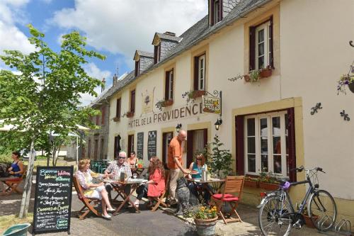
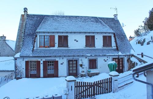
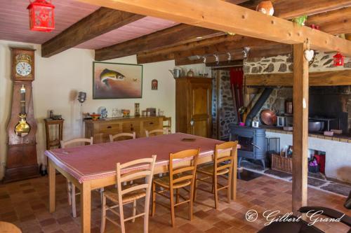
Hotel : Auberge De La Providence
This guesthouse sits in the Auvergne region and offers a terrace with views of the Puy de Sancy, the highest mountain in the Massif Central. It offers spacious, mountain-themed ...
Rate : from 51.00 € to 85.00 €
Address : Le Bourg 63680 Saint-Donat
Distance Hotel - Saint-Donat : 0.13 km

Aux Balcons du Sancy : Guest accommodation near Saint-Donat
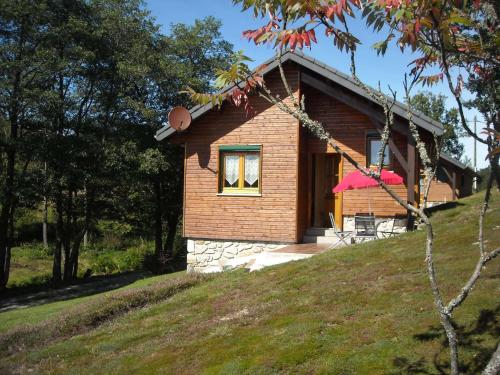
Guest accommodation : Aux Balcons du Sancy
Situated in the Auvergne National Volcano Park, Aux Balcons du Sancy offers self-catering accommodation located in Picherande, on the southern slopes of the Massif du Sancy. Sup...
Price : from 70.00 € to 130.00 €
Contact : Le Bourg - RD 203 63113 Picherande
Distance Guest accommodation - Saint-Donat : 3.71 km

Appartement Cap Sancy : Apartment near Saint-Donat
Apartment : Appartement Cap Sancy
Appartement Cap Sancy is a duplex apartment located in Picherande, in the Auvergne Volcanic Regional Nature Park. This apartment features free WiFi. The apartment offers mounta...
Prices : from 60.00 €
Contact : Le bourg 63113 Picherande
Distance Apartment - Saint-Donat : 3.86 km

La maison Chasse Temps : Guest accommodation near Saint-Donat
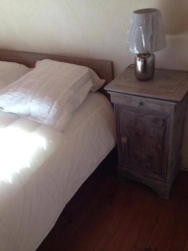
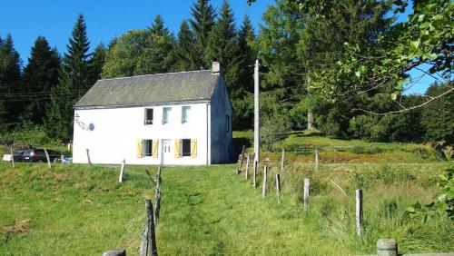
Guest accommodation : La maison Chasse Temps
Chasse Temps is a renovated stone house dating back from 1885. The property is located at 1200 metres in Saint-Donat near the Fontaine Salée Nature Reserve. The accommodation w...
Contact : Chastang 63680 Saint-Donat
Distance Guest accommodation - Saint-Donat : 4.11 km

Chalet Sancy : Guest accommodation near Saint-Donat
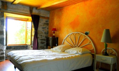
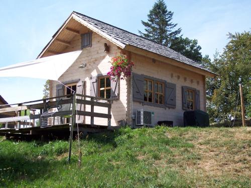
Guest accommodation : Chalet Sancy
Chalet Sancy offers accommodation in Saint-Genès-Champespe, 48 km from Clermont-Ferrand and 33 km from Le Mont-Dore. Guests benefit from terrace and a barbecue. There is a seat...
Address : lotissement "Les Pics" le bourg 63850 Saint-Genès-Champespe
Distance Guest accommodation - Saint-Donat : 5.28 km

La Cascade Fleurie : Apartment near Saint-Donat
Apartment : La Cascade Fleurie
Situated in Saint-Genès-Champespe, La Cascade Fleurie is an apartment boasting a barbecue. The property is 20 km from Super-Besse while La Bourboule is 29 km away. Free WiFi is ...
Contact : 1, rue du bourg 63850 Saint-Genès-Champespe
Distance Apartment - Saint-Donat : 5.63 km

Les Feuillantines : Guest accommodation near Saint-Donat
Guest accommodation : Les Feuillantines
Offering river views, Les Feuillantines in Saint-Genès-Champespe features accommodation, a garden and a terrace. All units are equipped with a flat-screen TV and a fully equipp...
Contact : Les Feuillantines 63850 Saint-Genès-Champespe
Distance Guest accommodation - Saint-Donat : 6.03 km

Holiday home Lac de Laspialade : Guest accommodation near Saint-Donat
Guest accommodation : Holiday home Lac de Laspialade
Holiday home Lac de Laspialade is set in Saint-Genès-Champespe and offers barbecue facilities. The holiday home features lake views and is 36 km from Le Mont-Dore. This 4-bedro...
Contact : Lac de Laspialade 63850 Saint-Genès-Champespe
Distance Guest accommodation - Saint-Donat : 6.22 km

Chalet de l'Artense : Guest accommodation near Saint-Donat
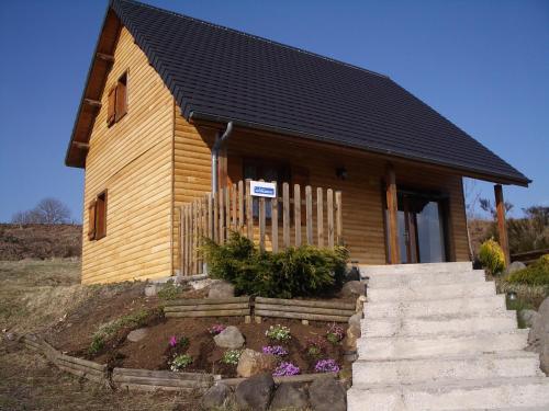
Guest accommodation : Chalet de l'Artense
Chalet de l'Artense offers accommodation in Fouillat, 18 km from Chastreix. You can fire up the barbecue for a tasty meal and enjoy the garden in fair weather. There is a dinin...
Address : Champ du Moulin lieu dit Fouillat 63810 Fouillat
Distance Guest accommodation - Saint-Donat : 6.23 km

Le Champ du Moulin : Bed and Breakfast near Saint-Donat
Bed and Breakfast : Le Champ du Moulin
Featuring a garden and a terrace, Le Champ du Moulin offers B&B accommodation in Cros. Free WiFi access is available. Each room offers a private bathroom with a shower and a ha...
Rate : from 59.00 € to 90.00 €
Contact : Lieu dit Fouillat 63810 Cros
Distance Bed and Breakfast - Saint-Donat : 6.24 km


Find another hotel near Saint-Donat :

Saint-Donat hotels list


Map of Saint-Donat


Map of Saint-Donat :

At right you can find the localization of Saint-Donat on the map of France. Below, this is the satellite map of Saint-Donat. A road map, and maps templates of Saint-Donat are available here : "road map of Saint-Donat". This map show Saint-Donat seen by the satellite of Google Map. To see the streets of Saint-Donat or move on another zone, use the buttons "zoom" and "map" on top of this dynamic map.

Search on the map of Saint-Donat :

To search hotels, housings, tourist information office, administrations or other services, use the Google search integrated to the map on the following page : "map Saint-Donat".
Hotels of Saint-Donat are listed on the map with the following icons: hotel Saint-Donat

The map of Saint-Donat is centred in the following coordinates :

Latitude :   Longitude :   

Saint-Donat on the map of France


Print the map of Saint-Donat


Print the map of Saint-Donat : map of Saint-Donat


Photos Saint-Donat

See all photos of Saint-Donat :

Other photos of Saint-Donat and nearby towns can be found here: photos Saint-Donat
These photos taken near the town of Saint-Donat can be shown in full screen clicking on the thumbnails. Photos are copyrighted by their owners.

A dyke above Le Mont Dore - a side view - Photo of Saint-Donat
A dyke above Le Mont Dore - a side view

A dyke above Le Mont Dore - Photo of Saint-Donat
A dyke above Le Mont Dore

Alasdair and Chris walking above Le Mont Dore 2 - Photo of Saint-Donat
Alasdair and Chris walking above Le Mont Dore 2

Alasdair and Chris walking above Le Mont Dore 3 - Photo of Saint-Donat
Alasdair and Chris walking above Le Mont Dore 3

Alasdair and Chris walking above Le Mont Dore - Photo of Saint-Donat
Alasdair and Chris walking above Le Mont Dore

Vassivière, Puy-de-Dôme, France - Photo of Saint-Donat
Vassivière, Puy-de-Dôme, France

Matin d-été à Vassivière - Photo of Saint-Donat
Matin d-été à Vassivière

Le Puy de Sancy - Photo of Saint-Donat
Le Puy de Sancy

En pleine méditation - Photo of Saint-Donat
En pleine méditation

Notre Dame de Vassivière... Détails... - Photo of Saint-Donat
Notre Dame de Vassivière... Détails...

Lac de Lastioulles, Cantal - Photo of Saint-Donat
Lac de Lastioulles, Cantal

Vassivière, Massif du Sancy - Photo of Saint-Donat
Vassivière, Massif du Sancy

Montagnes - Photo of Saint-Donat
Montagnes

Randonneurs - Photo of Saint-Donat
Randonneurs

Moutons - Photo of Saint-Donat
Moutons

Regarder... - Photo of Saint-Donat
Regarder...

Barres Rocheuses - Photo of Saint-Donat
Barres Rocheuses

Version couleur de la Chaîne des Puys - Photo of Saint-Donat
Version couleur de la Chaîne des Puys

L-Auvergne volcanique - Photo of Saint-Donat
L-Auvergne volcanique

La Chaîne des Puys - Photo of Saint-Donat
La Chaîne des Puys

... faut y aller ! - Photo of Saint-Donat
... faut y aller !

Quand faut descendre... - Photo of Saint-Donat
Quand faut descendre...

Préparatifs... - Photo of Saint-Donat
Préparatifs...

S-asseoir et prendre le temps d-admirer - Photo of Saint-Donat
S-asseoir et prendre le temps d-admirer

201108_0342 - 201108_0344 - Photo of Saint-Donat
201108_0342 - 201108_0344

201108_0345 - 201108_0352 - Photo of Saint-Donat
201108_0345 - 201108_0352

201108_0359 - 201108_0360 - Photo of Saint-Donat
201108_0359 - 201108_0360

201108_0251 - 201108_0252 - Photo of Saint-Donat
201108_0251 - 201108_0252

201108_0353 - 201108_0356 - Photo of Saint-Donat
201108_0353 - 201108_0356

201108_0361 - 201108_0365 - Photo of Saint-Donat
201108_0361 - 201108_0365


Saint-Donat weather forecast

Find next hours and 7 days weather forecast for Saint-Donat here : weather Saint-Donat (with english metrics)
This is the last weather forecast for Saint-Donat collected by the nearest observation station of La Tour-d'Auvergne.

Week Forecast:


The latest weather data for Saint-Donat were collected Thursday, 28 March 2024 at 17:00 from the nearest observation station of La Tour-d'Auvergne.

Thursday, March 28th

9°C     -0°C

66%
 73%


Snow

Temperature Max: 9°C    Temperature Min: -0°C
Precipitation Probability: 66% (Snow)
Percentage of sky occluded by clouds: 73%
Wind speed: 24 km/h North-East
Humidity: 77%°        UV Index: 3
Sunrise: 06:36     Sunset: 19:12

Friday, March 29th

10°C     6°C

59%
 97%


Rain

Temperature Max: 10°C    Temperature Min: 6°C
Precipitation Probability: 59% (Rain)
Percentage of sky occluded by clouds: 97%
Wind speed: 14 km/h North
Humidity: 87%°        UV Index: 3
Sunrise: 06:34     Sunset: 19:14

Saturday, March 30th

9°C     1°C

51%
 72%


Rain

Temperature Max: 9°C    Temperature Min: 1°C
Precipitation Probability: 51% (Rain)
Percentage of sky occluded by clouds: 72%
Wind speed: 11 km/h North-East
Humidity: 79%°        UV Index: 3
Sunrise: 06:32     Sunset: 19:15

Sunday, March 31st

10°C     3°C

35%
 84%


Rain

Temperature Max: 10°C    Temperature Min: 3°C
Precipitation Probability: 35% (Rain)
Percentage of sky occluded by clouds: 84%
Wind speed: 25 km/h North
Humidity: 73%°        UV Index: 2
Sunrise: 07:30     Sunset: 20:16

Attribution:             


Other maps, hotels and towns in france


Find another town, zip code, department, region, ...


Quick links Saint-Donat :


Make a link to this page of Saint-Donat with the following code :


Map of France | Regions | Departments | Cities | Partners | Terms | Contact