|
The village of Saint-Léger is a small village located west of France. The town of Saint-Léger is located in the department of Charente-Maritime of the french region Poitou-Charentes. The town of Saint-Léger is located in the township of Pons part of the district of Saintes. The area code for Saint-Léger is 17354 (also known as code INSEE), and the Saint-Léger zip code is 17800.
Geography and map of Saint-Léger :
The altitude of the city hall of Saint-Léger is approximately 50 meters. The Saint-Léger surface is 15.88 km ². The latitude and longitude of Saint-Léger are 45.623 degrees North and 0.585 degrees West.
Nearby cities and towns of Saint-Léger are :
Berneuil (17460) at 2.69 km, Villars-en-Pons (17260) at 3.46 km, Colombiers (17460) at 3.49 km, La Jard (17460) at 3.67 km, Jazennes (17260) at 5.13 km, Tesson (17460) at 5.46 km, Saint-Seurin-de-Palenne (17800) at 5.58 km, Préguillac (17460) at 5.94 km.
(The distances to these nearby towns of Saint-Léger are calculated as the crow flies)
Population and housing of Saint-Léger :
The population of Saint-Léger was 464 in 1999, 551 in 2006 and 562 in 2007. The population density of Saint-Léger is 35.39 inhabitants per km². The number of housing of Saint-Léger was 256 in 2007. These homes of Saint-Léger consist of 222 main residences, 18 second or occasional homes and 17 vacant homes. |
|
|
Hotel Saint-Léger
|
|
|
Book now ! Best Price Guaranteed, no booking fees, pay at the hotel with our partner Booking.com, leader in online hotel reservation.
Find all hotels of Saint-Léger : Hotel Saint-Léger
| |
|
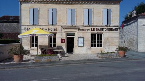
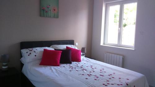
Hotel : Le Saintongeais
Set in Berneuil, Le Saintongeais features free WiFi. At the hotel, each room includes a wardrobe. Every room comes with a private bathroom. Royan is 42 km from Le Saintongeais...
Rate : from 50.00 €
to 70.00 €
Address : 5 rue des Tilleuls 17460 Berneuil
Distance Hotel - Saint-Léger : 2.63 km
|
|
|
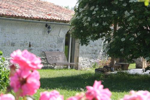
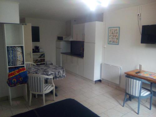
Guest accommodation : Gîte les Chaillots

Boasting accommodation with a terrace, Gîte les Chaillots is situated in La Jard. Guests have access to free WiFi. This holiday home is fitted with 4 bedrooms and 4 bathrooms e...
Contact : 11 rue des Chaillots 17460 La Jard
Distance Guest accommodation - Saint-Léger : 4.16 km
|
|
|
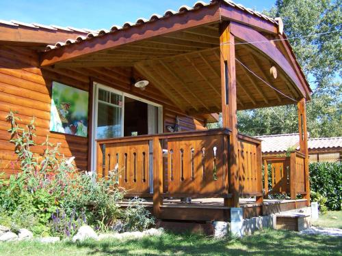
Guest accommodation : Le Papillon
A wooden chalet located a 5-minute drive from the medieval village of Pons, Le Papillon is set in an estate with an outdoor swimming pool and features a private covered terrace....
Contact : Route de Colombiers 64 17800 Pons
Distance Guest accommodation - Saint-Léger : 4.40 km
|
|
|
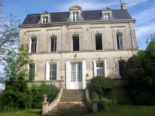
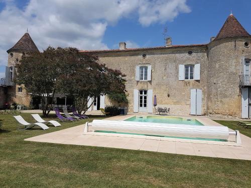
Guest accommodation : Château Fontclaire
Featuring barbecue facilities, Château Fontclaire provides accommodation in Pons with free WiFi and garden views. Guests staying at this holiday home have access to a fully equi...
Rate : from 250.00 €
to 290.00 €
Contact : 2 Rue des Pierrères 17800 Pons
Distance Guest accommodation - Saint-Léger : 4.55 km
|
|
|
Guest accommodation : Holiday Home Le Manoir Des Touches
Set in Villars-en-Pons, Holiday Home Le Manoir Des Touches provides a private pool and free WiFi. This property offers access to a terrace. This holiday home comes with 6 bedro...
Address : 17800 Villars-en-Pons
Distance Guest accommodation - Saint-Léger : 4.65 km
|
|
|
Apartment : Moulins de la Vergne
Moulins de la Vergne is situated in Pons in the Poitou-Charentes Region, 38 km from the coastal city of Royan. Saintes is 18 km from the property. Free WiFi is provided on the t...
Contact : 9 Impasse du Moulin de la Vergne 17800 Pons
Distance Apartment - Saint-Léger : 4.82 km
|
|
|
Bed and Breakfast : Jolysable
Featuring free WiFi throughout the property, Jolysable offers pet-friendly accommodation in Pons, 37 km from Royan. Free private parking is available on site. Every room at thi...
Rate : from 60.00 €
to 100.00 €
Contact : 14 Rue des Fontaines 17800 Pons
Distance Bed and Breakfast - Saint-Léger : 4.96 km
|
|
|
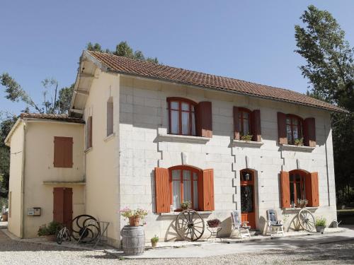
Guest accommodation : Maison Schuler

Set in a 17th-century farmhouse, Maison Schuler features a large furnished patio, a gazeebo and BBQ facilities in the garden. Located in Berneuil, in the Charente-Maritime regio...
Price : from 70.00 €
to 105.00 €
Contact : 6A rue de la Borderie Berneuil 17460 Berneuil
Distance Guest accommodation - Saint-Léger : 5.07 km
|
|
|
Bed and Breakfast : Les Gîtes du Vigneron et Cd'h
Situated in Saint-Seurin-de-Palenne, in the countryside, in the Charente Maritime region, 8 km from Pons, 47 km from Royan and the nearest beaches, Les Gîtes du Vigneron et Cd’h...
Prices : from 75.00 €
Address : 22 Avenue de Pons 17800 Saint-Seurin-de-Palenne
Distance Bed and Breakfast - Saint-Léger : 5.32 km
|
|
|
Apartment : Appartement Auberge Pontoise
Located in Pons in the Poitou-Charentes region, Appartement Auberge Pontoise features a terrace and garden views. Guests staying at this apartment have access to a fully equippe...
Contact : 23 avenue gambetta 17800 Pons
Distance Apartment - Saint-Léger : 5.50 km
|
|
Find another hotel near Saint-Léger : Saint-Léger hotels list
|
Map of Saint-Léger
|
|
Map of Saint-Léger :
At right you can find the localization of Saint-Léger on the map of France. Below, this is the satellite map of Saint-Léger. A road map, and maps templates of Saint-Léger are available here : "road map of Saint-Léger". This map show Saint-Léger seen by the satellite of Google Map. To see the streets of Saint-Léger or move on another zone, use the buttons "zoom" and "map" on top of this dynamic map.
Search on the map of Saint-Léger :
To search hotels, housings, tourist information office, administrations or other services, use the Google search integrated to the map on the following page : "map Saint-Léger".
Hotels of Saint-Léger are listed on the map with the following icons: 
The map of Saint-Léger is centred in the following coordinates :
|

|
|
|
|
Print the map of Saint-Léger

Print the map of Saint-Léger : map of Saint-Léger
|
Photos Saint-Léger
|
See all photos of Saint-Léger :
Other photos of Saint-Léger and nearby towns can be found here: photos Saint-Léger
|
|
Saint-Léger weather forecast
Find next hours and 7 days weather forecast for Saint-Léger here : weather Saint-Léger (with english metrics)
This is the last weather forecast for Saint-Léger collected by the nearest observation station of Pons.
Week Forecast:
The latest weather data for Saint-Léger were collected Monday, 20 July 2026 at 15:01 from the nearest observation station of Pons.
| Monday, July 20th |
30°C 17°C
0%
17%
|
Mostly clear
Temperature Max: 30°C Temperature Min: 17°C
Precipitation Probability: 0%
Percentage of sky occluded by clouds: 17%
Wind speed: 21 km/h Sout-East
Humidity: 42%° UV Index: 8
Sunrise: 06:32 Sunset: 21:44 |
|
| | Tuesday, July 21st |
30°C 16°C
0%
3%
|
Clear
Temperature Max: 30°C Temperature Min: 16°C
Precipitation Probability: 0%
Percentage of sky occluded by clouds: 3%
Wind speed: 24 km/h Sout-East
Humidity: 38%° UV Index: 8
Sunrise: 06:33 Sunset: 21:43 |
|
| | Wednesday, July 22nd |
31°C 16°C
0%
1%
|
Clear
Temperature Max: 31°C Temperature Min: 16°C
Precipitation Probability: 0%
Percentage of sky occluded by clouds: 1%
Wind speed: 20 km/h Sout-East
Humidity: 37%° UV Index: 8
Sunrise: 06:34 Sunset: 21:42 |
|
| | Thursday, July 23rd |
32°C 17°C
0%
16%
|
Mostly clear
Temperature Max: 32°C Temperature Min: 17°C
Precipitation Probability: 0%
Percentage of sky occluded by clouds: 16%
Wind speed: 19 km/h Sout-East
Humidity: 38%° UV Index: 8
Sunrise: 06:35 Sunset: 21:41 |
|
|
Attribution: 
|
|
Other maps, hotels and towns in france
Find another town, zip code, department, region, ...
Quick links Saint-Léger :
Make a link to this page of Saint-Léger with the following code :
|
|
|
 French Version : http://www.cartesfrance.fr/carte-france-ville/17354_Saint-Leger.html


