|
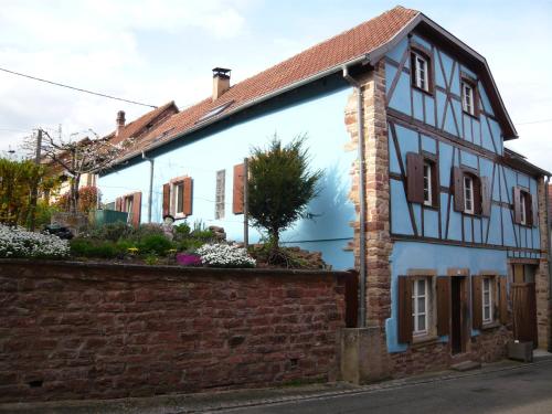
The village of Saint-Nabor is a small village located north east of France. The town of Saint-Nabor is located in the department of Bas-Rhin of the french region Alsace. The town of Saint-Nabor is located in the township of Rosheim part of the district of Molsheim. The area code for Saint-Nabor is 67428 (also known as code INSEE), and the Saint-Nabor zip code is 67530.
Geography and map of Saint-Nabor :
The altitude of the city hall of Saint-Nabor is approximately 330 meters. The Saint-Nabor surface is 1.89 km ². The latitude and longitude of Saint-Nabor are 48.445 degrees North and 7.425 degrees East.
Nearby cities and towns of Saint-Nabor are :
Ottrott (67530) at 1.23 km, Bernardswiller (67210) at 2.89 km, Heiligenstein (67140) at 3.09 km, Bœrsch (67530) at 3.79 km, Barr (67140) at 4.44 km, Obernai (67210) at 4.60 km, Goxwiller (67210) at 4.63 km, Gertwiller (67140) at 4.95 km.
(The distances to these nearby towns of Saint-Nabor are calculated as the crow flies)
Population and housing of Saint-Nabor :
The population of Saint-Nabor was 479 in 1999, 460 in 2006 and 460 in 2007. The population density of Saint-Nabor is 243.39 inhabitants per km². The number of housing of Saint-Nabor was 215 in 2007. These homes of Saint-Nabor consist of 190 main residences, 13 second or occasional homes and 11 vacant homes. |
|
|
Hotel Saint-Nabor
|
|
|
Book now ! Best Price Guaranteed, no booking fees, pay at the hotel with our partner Booking.com, leader in online hotel reservation.
Find all hotels of Saint-Nabor : Hotel Saint-Nabor
| |
|
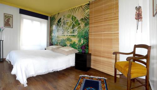
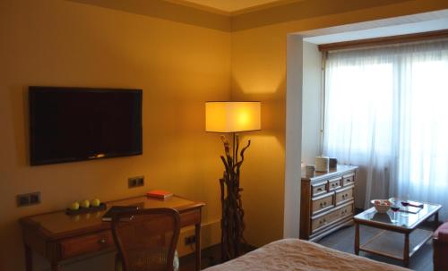
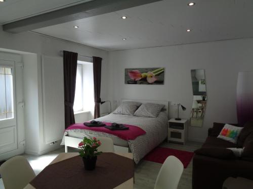
Guest accommodation : Lina et Anaë
Lina et Anaë is set in Saint-Nabor. This property offers access to free WiFi. This holiday home has 2 bedrooms, a kitchenette with an oven and a microwave, a flat-screen TV, a ...
Address : 61 route d'Obernai 67530 Saint-Nabor
Distance Guest accommodation - Saint-Nabor : 0.06 km
|
|
|
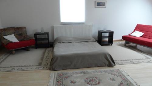
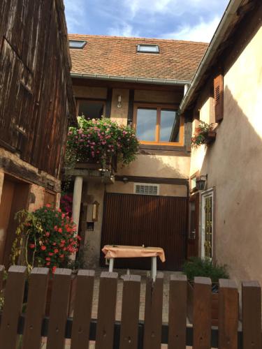
Guest accommodation : Grange Des Arts
Offering free WiFi and garden views, Grange Des Arts is an accommodation located in Saint-Nabor. This holiday home features accommodation with a terrace. This holiday home incl...
Contact : 61 Route D'obernai 67530 Saint-Nabor
Distance Guest accommodation - Saint-Nabor : 0.06 km
|
|
|
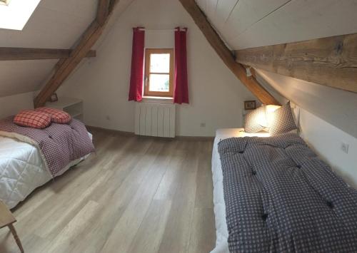
Guest accommodation : Gîte sainte Famille
Located in Ottrott in the Alsace region, Gîte sainte Famille features a terrace and mountain views. Guests have access to free WiFi. The villa has 3 bedrooms, a flat-screen TV ...
Prices : from 130.00 €
Contact : 18 Route de Saint-Nabor 67530 Ottrott
Distance Guest accommodation - Saint-Nabor : 1.12 km
|
|
|
Hotel : Aux Chants Des Oiseaux

This smart country house, situated in the quiet countryside village of Ottrott, offers beautiful views of the Mont Sainte Odile. All rooms in the Aux Chants Des Oiseaux have fr...
Rate : from 92.00 €
to 170.00 €
Contact : 6 Rue Du Vignoble 67530 Ottrott
Distance Hotel - Saint-Nabor : 1.16 km
|
|
|
Hotel : Résidence des Châteaux
Résidence des Châteaux is located in Ottrott, 5 minutes from Obernai. Annex of Hostellerie Des Châteaux, it has air-conditioned guestrooms with flat-screen TVs and free Wi-Fi i...
Price : from 147.00 €
to 197.00 €
Address : 11 rue des châteaux 67530 Ottrott
Distance Hotel - Saint-Nabor : 1.33 km
|
|
|
Apartment : Appartments Rue Des Châteaux
Situated in Ottrott, Appartments Rue Des Châteaux provides accommodation with a flat-screen TV. Complimentary WiFi is available. All units include a fully equipped kitchen, all...
Contact : 4, Rue Des Chateaux 67530 Ottrott
Distance Apartment - Saint-Nabor : 1.33 km
|
|
|
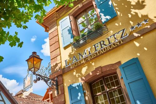
Hotel : Hotel Restaurant L'Ami Fritz
Hotel L’Ami Fritz is located at the foot of Mount St Odile in Alsace and housed in an 18th century stone building. The hotel offers free WiFi access and a free parking. Guest ...
Rate : from 115.00 €
to 330.00 €
Contact : 8, rue des Chateaux 67530 Ottrott
Distance Hotel - Saint-Nabor : 1.35 km
|
|
|
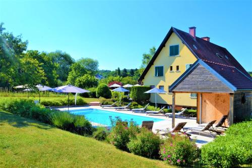
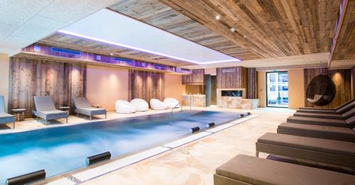
Hotel : Hostellerie Des Châteaux & Spa
Located in the village of Ottrott, the Hostellerie Des Châteaux & Spa is between Strasbourg and Colmar, on the Alsatian Wine Road. It features a 1000 m2 spa centre and a counter...
Price : from 159.00 €
to 749.00 €
Contact : 11, Rue Des Châteaux 67530 Ottrott
Distance Hotel - Saint-Nabor : 1.37 km
|
|
|
Apartment : Studio Gite Fischer Ottrott

Offering free WiFi and city views, Studio Gite Fischer Ottrott is an accommodation located in Ottrott. The apartment is 11 km from Mont Sainte Odile. The apartment consists of ...
Address : 28 Rue principale 67530 Ottrott
Distance Apartment - Saint-Nabor : 1.63 km
|
|
|
Guest accommodation : Gîte Fischer
Located in Ottrott, Gîte Fischer is 450 metres from the Tourism Office. This half-timbered house includes 5 individually decorated bedrooms and a living room with a flat-screen ...
Contact : 28 rue Principale 67530 Ottrott
Distance Guest accommodation - Saint-Nabor : 1.64 km
|
|
Find another hotel near Saint-Nabor : Saint-Nabor hotels list
|
Map of Saint-Nabor
|
|
Map of Saint-Nabor :
At right you can find the localization of Saint-Nabor on the map of France. Below, this is the satellite map of Saint-Nabor. A road map, and maps templates of Saint-Nabor are available here : "road map of Saint-Nabor". This map show Saint-Nabor seen by the satellite of Google Map. To see the streets of Saint-Nabor or move on another zone, use the buttons "zoom" and "map" on top of this dynamic map.
Search on the map of Saint-Nabor :
To search hotels, housings, tourist information office, administrations or other services, use the Google search integrated to the map on the following page : "map Saint-Nabor".
Hotels of Saint-Nabor are listed on the map with the following icons: 
The map of Saint-Nabor is centred in the following coordinates :
|

|
|
|
|
Print the map of Saint-Nabor

Print the map of Saint-Nabor : map of Saint-Nabor
|
Photos Saint-Nabor
|
See all photos of Saint-Nabor :
Other photos of Saint-Nabor and nearby towns can be found here: photos Saint-Nabor
|
|
Saint-Nabor weather forecast
Find next hours and 7 days weather forecast for Saint-Nabor here : weather Saint-Nabor (with english metrics)
This is the last weather forecast for Saint-Nabor collected by the nearest observation station of Rosheim.
Week Forecast:
The latest weather data for Saint-Nabor were collected Saturday, 04 July 2026 at 19:04 from the nearest observation station of Rosheim.
| Saturday, July 4th |
30°C 14°C
0%
0%
|
Clear
Temperature Max: 30°C Temperature Min: 14°C
Precipitation Probability: 0%
Percentage of sky occluded by clouds: 0%
Wind speed: 7 km/h South-East
Humidity: 38%° UV Index: 8
Sunrise: 05:34 Sunset: 21:34 |
|
| | Sunday, July 5th |
29°C 16°C
31%
58%
|
Partly cloudy
Temperature Max: 29°C Temperature Min: 16°C
Precipitation Probability: 31% (Rain)
Percentage of sky occluded by clouds: 58%
Wind speed: 12 km/h South-East
Humidity: 49%° UV Index: 5
Sunrise: 05:35 Sunset: 21:34 |
|
| | Monday, July 6th |
30°C 15°C
0%
67%
|
Mostly cloudy
Temperature Max: 30°C Temperature Min: 15°C
Precipitation Probability: 0%
Percentage of sky occluded by clouds: 67%
Wind speed: 9 km/h East
Humidity: 46%° UV Index: 7
Sunrise: 05:36 Sunset: 21:33 |
|
| | Tuesday, July 7th |
31°C 16°C
0%
73%
|
Mostly cloudy
Temperature Max: 31°C Temperature Min: 16°C
Precipitation Probability: 0%
Percentage of sky occluded by clouds: 73%
Wind speed: 12 km/h East
Humidity: 36%° UV Index: 5
Sunrise: 05:36 Sunset: 21:33 |
|
|
Attribution: 
|
|
Other maps, hotels and towns in france
Find another town, zip code, department, region, ...
Quick links Saint-Nabor :
Make a link to this page of Saint-Nabor with the following code :
|
|
|
 French Version : http://www.cartesfrance.fr/carte-france-ville/67428_Saint-Nabor.html


