|
The village of Saint-Pois is a small village located north west of France. The town of Saint-Pois is located in the department of Manche of the french region Basse-Normandie. The town of Saint-Pois is located in the township of Saint-Pois part of the district of Avranches. The area code for Saint-Pois is 50542 (also known as code INSEE), and the Saint-Pois zip code is 50670.
Geography and map of Saint-Pois :
The altitude of the city hall of Saint-Pois is approximately 170 meters. The Saint-Pois surface is 7.78 km ². The latitude and longitude of Saint-Pois are 48.751 degrees North and 1.065 degrees West.
Nearby cities and towns of Saint-Pois are :
Saint-Michel-de-Montjoie (50670) at 3.16 km, Lingeard (50670) at 3.21 km, Le Mesnil-Gilbert (50670) at 3.92 km, Saint-Laurent-de-Cuves (50670) at 4.17 km, Cuves (50670) at 4.69 km, Le Gast (14380) at 4.98 km, Perriers-en-Beauficel (50150) at 5.27 km, Coulouvray-Boisbenâtre (50670) at 5.31 km.
(The distances to these nearby towns of Saint-Pois are calculated as the crow flies)
Population and housing of Saint-Pois :
The population of Saint-Pois was 529 in 1999, 531 in 2006 and 538 in 2007. The population density of Saint-Pois is 69.15 inhabitants per km². The number of housing of Saint-Pois was 323 in 2007. These homes of Saint-Pois consist of 256 main residences, 39 second or occasional homes and 28 vacant homes. |
|
|
Hotel Saint-Pois
|
|
|
Book now ! Best Price Guaranteed, no booking fees, pay at the hotel with our partner Booking.com, leader in online hotel reservation.
Find all hotels of Saint-Pois : Hotel Saint-Pois
| |
|
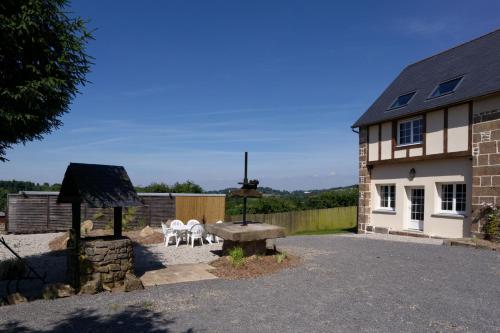
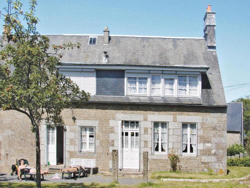
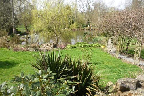
Guest accommodation : Ardeevin
Offering free WiFi and lake views, Ardeevin is an accommodation set in Saint-Michel-de-Montjoie. Guests staying at this holiday home have access to a fully equipped kitchen. Th...
Address : La Tentonniere 50670 Saint-Michel-de-Montjoie
Distance Guest accommodation - Saint-Pois : 1.30 km
|
|
|
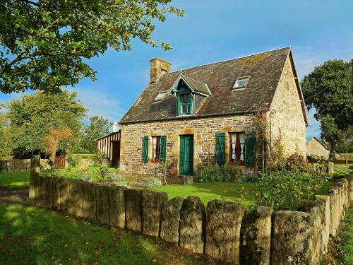
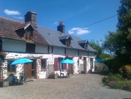
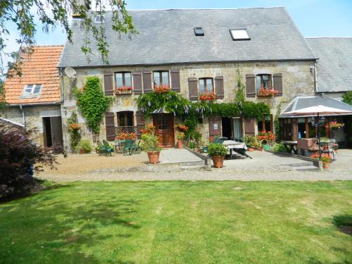
Guest accommodation : Holiday Home Les Eves

Situated in Saint-Pois in the Lower Normandy region, Holiday Home Les Eves features a terrace. This holiday home features a garden. This holiday home comes with 3 bedrooms, a T...
Contact : 50670 Saint-Pois
Distance Guest accommodation - Saint-Pois : 2.23 km
|
|
|
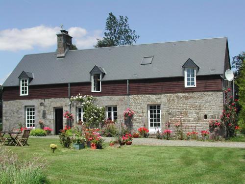
Guest accommodation : 15 rue principale
15 rue principale is a guest house located in Saint-Laurent-de-Cuves, 200 metres from the entrance of Papillons de Nuit Festival. Guests can enjoy garden views. All guest rooms...
Contact : 15 rue principale 50670 Saint-Laurent-de-Cuves
Distance Guest accommodation - Saint-Pois : 4.17 km
|
|
|
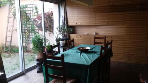
Guest accommodation : Holiday home Les Bois Normand
Holiday home Les Bois Normand is located in Champ-du-Boult. The accommodation is 34 km from Avranches. The holiday home includes a kitchen with a microwave and a fridge, as wel...
Contact : 14380 Champ-du-Boult
Distance Guest accommodation - Saint-Pois : 4.18 km
|
|
|
Guest accommodation : Les Hirondelles
Situated in Les Cresnays in the Lower Normandy Region, 31 km from Le Mont Saint Michel, Les Hirondelles boasts a seasonal outdoor pool and views of the garden. Granville is 38 k...
Address : Les Hirondelles La Rue Marot 50370 Les Cresnays
Distance Guest accommodation - Saint-Pois : 4.87 km
|
|
|
Apartment : Gite Le Clos de Sée

Only 9 km from the Mortain Waterfalls, Le clos de Sée offers self-catering accommodation with free Wi-Fi access. With Mont St-Michel 48 km away, it is set on a 2-hectare parklan...
Prices : from 37.80 €
to 42.00 €
Contact : Le Clos de Séé 50520 Chérencé-le-Roussel
Distance Apartment - Saint-Pois : 5.75 km
|
|
|
Guest accommodation : Mobile Home Le Clos de See
Located in Chérencé-le-Roussel, Mobile Hone Le Clos de See is set within a 2-hectare park with a river and fishing pond. Dathée Lake is only a 25-minute drive away. All mobile ...
Contact : Le Clos de See 50520 Chérencé-le-Roussel
Distance Guest accommodation - Saint-Pois : 5.76 km
|
|
|
Bed and Breakfast : Chambre d'Hôtes Le Clos de Sées
Only 9 km from the Mortain Waterfalls, Le Clos de Sée offers a guest room with free Wi-Fi access. With Mont St-Michel 48 km away, it is set on a 2-hectare parkland with a river ...
Price : from 49.00 €
to 55.00 €
Contact : Le Clos de Sées 50520 Chérencé-le-Roussel
Distance Bed and Breakfast - Saint-Pois : 5.77 km
|
|
|
Bed and Breakfast : B&B La Seliniere
Featuring free WiFi, a restaurant and a barbecue, B&B La Seliniere offers accommodation in Champ-du-Boult. Free private parking is available on site. Certain units include a se...
Address : 16/18 La Seliniere 14380 Champ-du-Boult
Distance Bed and Breakfast - Saint-Pois : 5.85 km
|
|
|
Bed and Breakfast : L'Auvraire B&B
Boasting a garden and a terrace, L'Auvraire B&B offers accommodation in Coulouvray-Boisbenâtre with free WiFi and garden views. This property offers access to ping-pong. A cont...
Rate : from 85.50 €
to 95.00 €
Contact : L'Auvraire 12 rue des Sabotiers 50670 Coulouvray-Boisbenâtre
Distance Bed and Breakfast - Saint-Pois : 6.07 km
|
|
Find another hotel near Saint-Pois : Saint-Pois hotels list
|
Map of Saint-Pois
|
|
Map of Saint-Pois :
At right you can find the localization of Saint-Pois on the map of France. Below, this is the satellite map of Saint-Pois. A road map, and maps templates of Saint-Pois are available here : "road map of Saint-Pois". This map show Saint-Pois seen by the satellite of Google Map. To see the streets of Saint-Pois or move on another zone, use the buttons "zoom" and "map" on top of this dynamic map.
Search on the map of Saint-Pois :
To search hotels, housings, tourist information office, administrations or other services, use the Google search integrated to the map on the following page : "map Saint-Pois".
Hotels of Saint-Pois are listed on the map with the following icons: 
The map of Saint-Pois is centred in the following coordinates :
|

|
|
|
|
Print the map of Saint-Pois

Print the map of Saint-Pois : map of Saint-Pois
|
Photos Saint-Pois
|
See all photos of Saint-Pois :
Other photos of Saint-Pois and nearby towns can be found here: photos Saint-Pois
|
|
Saint-Pois weather forecast
Find next hours and 7 days weather forecast for Saint-Pois here : weather Saint-Pois (with english metrics)
This is the last weather forecast for Saint-Pois collected by the nearest observation station of Saint-Pois.
Week Forecast:
The latest weather data for Saint-Pois were collected Monday, 29 June 2026 at 11:03 from the nearest observation station of Saint-Pois.
| Monday, June 29th |
23°C 11°C
0%
42%
|
Partly cloudy
Temperature Max: 23°C Temperature Min: 11°C
Precipitation Probability: 0%
Percentage of sky occluded by clouds: 42%
Wind speed: 10 km/h South-East
Humidity: 62%° UV Index: 7
Sunrise: 06:04 Sunset: 22:11 |
|
| | Tuesday, June 30th |
24°C 12°C
0%
69%
|
Mostly cloudy
Temperature Max: 24°C Temperature Min: 12°C
Precipitation Probability: 0%
Percentage of sky occluded by clouds: 69%
Wind speed: 9 km/h South-East
Humidity: 60%° UV Index: 5
Sunrise: 06:04 Sunset: 22:11 |
|
| | Wednesday, July 1st |
22°C 13°C
0%
62%
|
Partly cloudy
Temperature Max: 22°C Temperature Min: 13°C
Precipitation Probability: 0%
Percentage of sky occluded by clouds: 62%
Wind speed: 16 km/h South-East
Humidity: 67%° UV Index: 5
Sunrise: 06:05 Sunset: 22:10 |
|
| | Thursday, July 2nd |
20°C 15°C
18%
85%
|
Mostly cloudy
Temperature Max: 20°C Temperature Min: 15°C
Precipitation Probability: 18% (Rain)
Percentage of sky occluded by clouds: 85%
Wind speed: 19 km/h East
Humidity: 77%° UV Index: 5
Sunrise: 06:06 Sunset: 22:10 |
|
|
Attribution: 
|
|
Other maps, hotels and towns in france
Find another town, zip code, department, region, ...
Quick links Saint-Pois :
Make a link to this page of Saint-Pois with the following code :
|
|
|
 French Version : http://www.cartesfrance.fr/carte-france-ville/50542_Saint-Pois.html