|
The village of Saint-Salvadou is a small village located south of France. The town of Saint-Salvadou is located in the department of Aveyron of the french region Midi-Pyrénées. The town of Saint-Salvadou is located in the township of Rieupeyroux part of the district of Villefranche-de-Rouergue. The area code for Saint-Salvadou is 12245 (also known as code INSEE), and the Saint-Salvadou zip code is 12200.
Geography and map of Saint-Salvadou :
The altitude of the city hall of Saint-Salvadou is approximately 460 meters. The Saint-Salvadou surface is 15.50 km ². The latitude and longitude of Saint-Salvadou are 44.281 degrees North and 2.101 degrees East.
Nearby cities and towns of Saint-Salvadou are :
Vabre-Tizac (12240) at 3.97 km, Sanvensa (12200) at 4.31 km, Lunac (12270) at 5.29 km, Morlhon-le-Haut (12200) at 6.50 km, Lescure-Jaoul (12440) at 6.55 km, La Capelle-Bleys (12240) at 6.74 km, La Bastide-l'Évêque (12200) at 7.05 km, La Fouillade (12270) at 7.42 km.
(The distances to these nearby towns of Saint-Salvadou are calculated as the crow flies)
Population and housing of Saint-Salvadou :
The population of Saint-Salvadou was 432 in 1999, 410 in 2006 and 407 in 2007. The population density of Saint-Salvadou is 26.26 inhabitants per km². The number of housing of Saint-Salvadou was 232 in 2007. These homes of Saint-Salvadou consist of 181 main residences, 42 second or occasional homes and 9 vacant homes. |
|
|
Hotel Saint-Salvadou
|
|
|
Book now ! Best Price Guaranteed, no booking fees, pay at the hotel with our partner Booking.com, leader in online hotel reservation.
Find all hotels of Saint-Salvadou : Hotel Saint-Salvadou
| |
|
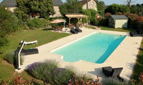
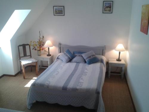
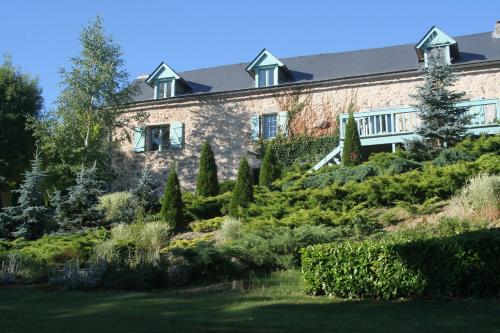
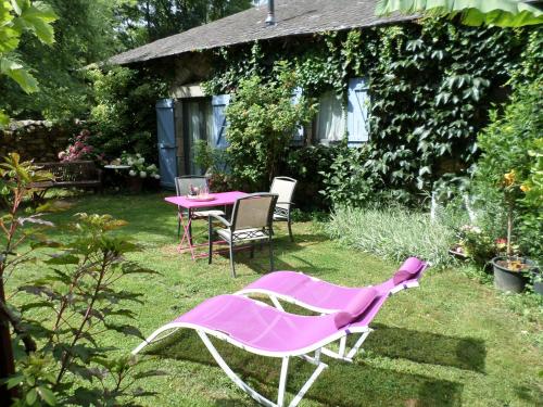
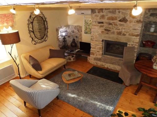
Bed and Breakfast : Domaine le Muret
Set in Saint-Salvadou, Domaine le Muret offers accommodation with a seasonal outdoor pool, barbecue facilities and a garden. Free WiFi is featured. There is a fully equipped pr...
Address : LD Le Muret 12200 Saint-Salvadou
Distance Bed and Breakfast - Saint-Salvadou : 1.71 km
|
|
|
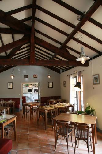
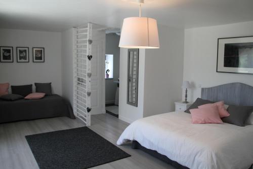
Guest accommodation : Camping Le Muret

Situated in Saint-Salvadou, Camping Le Muret offers accommodation with seating area. Free WiFi is provided. A fridge and stovetop are also available, as well as a coffee machin...
Contact : lieu dit Le Muret 12200 Saint-Salvadou
Distance Guest accommodation - Saint-Salvadou : 1.92 km
|
|
|
Apartment : Relais Des Fargues
Located in Vabre-Tizac, Relais Des Fargues provides a private pool and free WiFi. Guests staying at this apartment have access to a fully equipped kitchenette. This apartment w...
Prices : from 70.00 €
Contact : lieu-dit Les Fargues 12240 Vabre-Tizac
Distance Apartment - Saint-Salvadou : 2.94 km
|
|
|
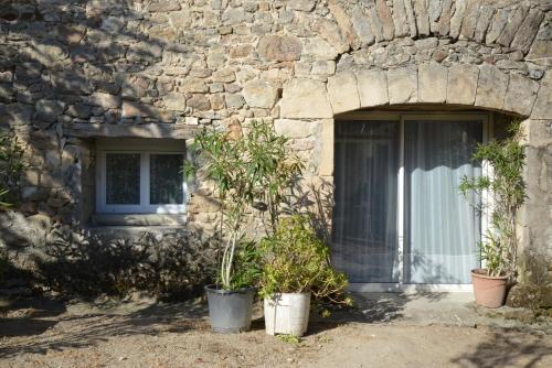
Guest accommodation : La Ferme de Lacalm
La Ferme de Lacalm is offering accommodation in Sanvensa. Guests can enjoy garden views. At the guest house, rooms have a wardrobe. The private bathroom is equipped with a show...
Contact : Ferme de Lacalm 12200 Sanvensa
Distance Guest accommodation - Saint-Salvadou : 3.71 km
|
|
|
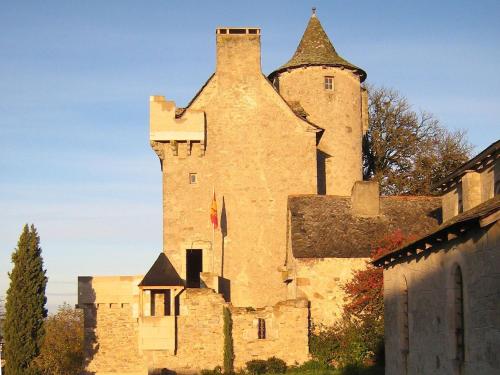
Bed and Breakfast : Chambres d'Hôtes Au Château

Chambres d'Hôtes Au Château offers bed and breakfast accommodation in an 18th-century castle located in Lunac, overlooking the Aveyron countryside. Free Wi-Fi access is availabl...
Price : from 110.00 €
to 140.00 €
Address : Le Château 12270 Lunac
Distance Bed and Breakfast - Saint-Salvadou : 5.12 km
|
|

|
Guest accommodation : Batut
Contact : Sanvensa, Aveyron Le Batut 12200 Sanvensa
Distance Guest accommodation - Saint-Salvadou : 5.42 km
|
|
|
Guest accommodation : Pont Jalbert
Located in La Fouillade, Pont Jalbert offers a seasonal outdoor swimming pool, a garden and a barbecue. The holiday home, set in a building dating from 19th century, provides fr...
Contact : Pont Jalbert 12270 La Fouillade
Distance Guest accommodation - Saint-Salvadou : 5.51 km
|
|
|
Bed and Breakfast : La Maison d'Emile - Chambres d'Hôtes
A renovated 18th-century farm located in La Fouillade, La Maison d'Emile offers a seasonal outdoor swimming pool. Free WiFi access is available. The bedrooms have a terrace wit...
Contact : Louradou 12270 La Fouillade
Distance Bed and Breakfast - Saint-Salvadou : 6.46 km
|
|
|
Guest accommodation : La Belle Poule - SEBRIGHT
La Belle Poule - SEBRIGHT is located in Villefranche-de-Rouergue. Featuring garden views, this holiday home also has free WiFi. With direct access to a terrace, the air-conditi...
Prices : from 65.00 €
Address : PEYREMORTE 12200 Villefranche-de-Rouergue
Distance Guest accommodation - Saint-Salvadou : 6.57 km
|
|
|
Guest accommodation : La Belle Poule - FAVEROLLE
Situated in Villefranche-de-Rouergue, La Belle Poule - FAVEROLLE provides accommodation with a terrace and free WiFi. The air-conditioned accommodation is 43 km from Figeac. Th...
Rate : from 62.00 €
Contact : Peyremorte 12200 Villefranche-de-Rouergue
Distance Guest accommodation - Saint-Salvadou : 6.58 km
|
|
Find another hotel near Saint-Salvadou : Saint-Salvadou hotels list
|
Map of Saint-Salvadou
|
|
Map of Saint-Salvadou :
At right you can find the localization of Saint-Salvadou on the map of France. Below, this is the satellite map of Saint-Salvadou. A road map, and maps templates of Saint-Salvadou are available here : "road map of Saint-Salvadou". This map show Saint-Salvadou seen by the satellite of Google Map. To see the streets of Saint-Salvadou or move on another zone, use the buttons "zoom" and "map" on top of this dynamic map.
Search on the map of Saint-Salvadou :
To search hotels, housings, tourist information office, administrations or other services, use the Google search integrated to the map on the following page : "map Saint-Salvadou".
Hotels of Saint-Salvadou are listed on the map with the following icons: 
The map of Saint-Salvadou is centred in the following coordinates :
|

|
|
|
|
Print the map of Saint-Salvadou

Print the map of Saint-Salvadou : map of Saint-Salvadou
|
Photos Saint-Salvadou
|
See all photos of Saint-Salvadou :
Other photos of Saint-Salvadou and nearby towns can be found here: photos Saint-Salvadou
|
|
Saint-Salvadou weather forecast
Find next hours and 7 days weather forecast for Saint-Salvadou here : weather Saint-Salvadou (with english metrics)
This is the last weather forecast for Saint-Salvadou collected by the nearest observation station of Rieupeyroux.
Week Forecast:
The latest weather data for Saint-Salvadou were collected Friday, 10 July 2026 at 19:01 from the nearest observation station of Rieupeyroux.
| Friday, July 10th |
34°C 20°C
36%
42%
|
Partly cloudy
Temperature Max: 34°C Temperature Min: 20°C
Precipitation Probability: 36% (Rain)
Percentage of sky occluded by clouds: 42%
Wind speed: 10 km/h North
Humidity: 35%° UV Index: 7
Sunrise: 06:17 Sunset: 21:35 |
|
| | Saturday, July 11th |
32°C 19°C
41%
50%
|
Partly cloudy
Temperature Max: 32°C Temperature Min: 19°C
Precipitation Probability: 41% (Rain)
Percentage of sky occluded by clouds: 50%
Wind speed: 10 km/h North-West
Humidity: 38%° UV Index: 6
Sunrise: 06:17 Sunset: 21:35 |
|
| | Sunday, July 12th |
35°C 20°C
51%
33%
|
Mostly clear
Temperature Max: 35°C Temperature Min: 20°C
Precipitation Probability: 51%
Percentage of sky occluded by clouds: 33%
Wind speed: 16 km/h North-West
Humidity: 39%° UV Index: 8
Sunrise: 06:18 Sunset: 21:34 |
|
| | Monday, July 13th |
34°C 21°C
53%
61%
|
Partly cloudy
Temperature Max: 34°C Temperature Min: 21°C
Precipitation Probability: 53%
Percentage of sky occluded by clouds: 61%
Wind speed: 15 km/h North-West
Humidity: 40%° UV Index: 7
Sunrise: 06:19 Sunset: 21:34 |
|
|
Attribution: 
|
|
Other maps, hotels and towns in france
Find another town, zip code, department, region, ...
Quick links Saint-Salvadou :
Make a link to this page of Saint-Salvadou with the following code :
|
|
|
 French Version : http://www.cartesfrance.fr/carte-france-ville/12245_Saint-Salvadou.html