|
The village of Saints is a small village located east center of France. The town of Saints is located in the department of Yonne of the french region Bourgogne. The town of Saints is located in the township of Saint-Sauveur-en-Puisaye part of the district of Auxerre. The area code for Saints is 89367 (also known as code INSEE), and the Saints zip code is 89520.
Geography and map of Saints :
The altitude of the city hall of Saints is approximately 250 meters. The Saints surface is 27.71 km ². The latitude and longitude of Saints are 47.621 degrees North and 3.263 degrees East.
Nearby cities and towns of Saints are :
Thury (89520) at 4.52 km, Fontenoy (89520) at 4.61 km, Saint-Sauveur-en-Puisaye (89520) at 4.85 km, Levis (89520) at 5.91 km, Sainte-Colombe-sur-Loing (89520) at 6.10 km, Lain (89560) at 6.25 km, Moutiers-en-Puisaye (89520) at 6.58 km, Lainsecq (89520) at 7.41 km.
(The distances to these nearby towns of Saints are calculated as the crow flies)
Population and housing of Saints :
The population of Saints was 571 in 1999, 589 in 2006 and 592 in 2007. The population density of Saints is 21.36 inhabitants per km². The number of housing of Saints was 354 in 2007. These homes of Saints consist of 253 main residences, 86 second or occasional homes and 15 vacant homes. |
|
|
Hotel Saints
|
|
|
Book now ! Best Price Guaranteed, no booking fees, pay at the hotel with our partner Booking.com, leader in online hotel reservation.
Find all hotels of Saints : Hotel Saints
| |
|
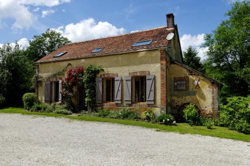
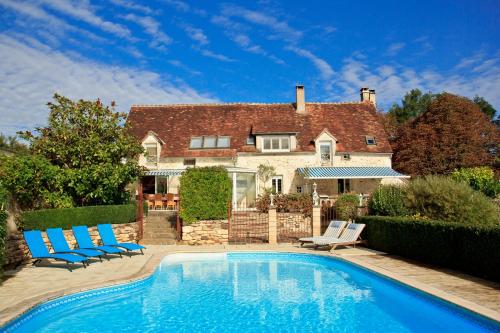
Guest accommodation : Les Roudons
Les Roudons is located in Saint-Sauveur-en-Puisaye and offers barbecue facilities. This holiday home features a garden as well as free WiFi. This holiday home has a living room...
Address : Les Roudons 89520 Saint-Sauveur-en-Puisaye
Distance Guest accommodation - Saints : 3.22 km
|
|
|
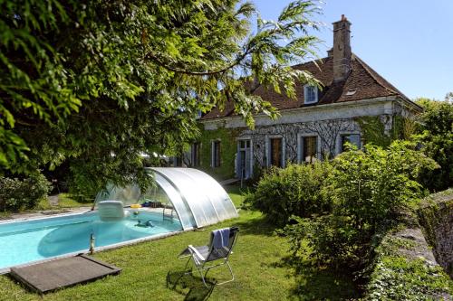
Guest accommodation : La chambonnette

Set in Saint-Sauveur-en-Puisaye, 7 km from Guedelon Medieval Site, La chambonnette features a living room with a flat-screen TV, and free WiFi. With pool views, this accommodati...
Contact : 1 Rue de Bel air 89520 Saint-Sauveur-en-Puisaye
Distance Guest accommodation - Saints : 4.75 km
|
|
|
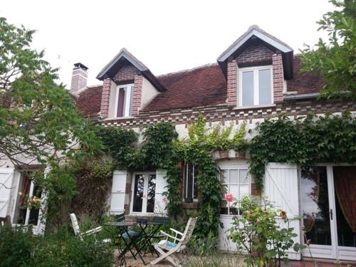
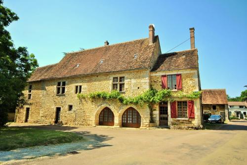
Guest accommodation : Longère De Charme Bourgogne

The Longère De Charme Bourgogne is set in Fontaines. Free WiFi is provided throughout the property and free private parking is available on site. The rooms feature a flat-scree...
Contact : 3 les Bezards 89130 Fontaines
Distance Guest accommodation - Saints : 6.14 km
|
|
|
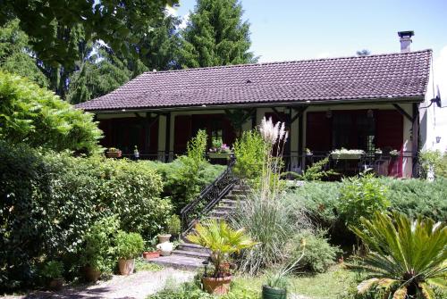
Guest accommodation : vakantiewoning Thury
Located in Thury, this holiday home features an outdoor heated pool and several terraces. The property is 40-minute drive to Auxerre and free private parking is offered. Free Wi...
Contact : 37 Avenue de la Forterre 89520 Thury
Distance Guest accommodation - Saints : 6.32 km
|
|

|
Guest accommodation : La Biche de Forterre
Boasting accommodation with a private pool, La Biche de Forterre is located in Lainsecq. The accommodation is 43 km from Auxerre. The holiday home has a TV with satellite chann...
Address : Le Jarloy 89520 Lainsecq
Distance Guest accommodation - Saints : 6.71 km
|
|
|
Guest accommodation : La Guirtelle
La Guirtelle is set in Lainsecq. This holiday home features accommodation with a terrace. The holiday home has a flat-screen TV with satellite channels, a well-equipped kitchen...
Contact : 177-178 La Guirtelle d'en Haut 89520 Lainsecq
Distance Guest accommodation - Saints : 7.32 km
|
|
|
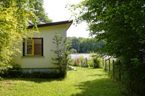
Guest accommodation : Chalet de Moutiers
Featuring accommodation with a balcony, Chalet de Moutiers is set in Les Boulmiers. With lake views, this accommodation features a patio. The chalet includes 1 bedroom and a li...
Contact : etang de moutiers 89520 Les Boulmiers
Distance Guest accommodation - Saints : 8.10 km
|
|

|
Bed and Breakfast : La Treille
Situated in Treigny, 35 km from Cosne-Cours-sur-Loire, La Treille features a garden and free WiFi. There is a private bathroom with shower in all units, along with free toiletr...
Contact : 29 rue du chanoine grossier le chaineau 89520 Treigny
Distance Bed and Breakfast - Saints : 8.91 km
|
|
|
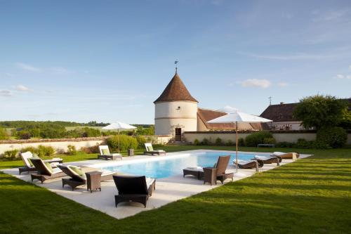
Guest accommodation : Le Tribunal
Set in Perreuse, Le Tribunal features a private pool. Guests staying at this holiday home have access to a fully equipped kitchen. Boasting pool views, the holiday home is fitt...
Address : 15-17 Rue de la Pommeraie 89520 Perreuse
Distance Guest accommodation - Saints : 9.48 km
|
|
|
Hotel : La Borde
Located in the region of Burgundy, La Borde is 2 km from the centre of Leugny. It offers an outdoor swimming pool, a fitness room and a French formal garden. Free Wi-Fi and a he...
Rate : from 358.00 €
to 935.00 €
Contact : La Borde 89130 Leugny
Distance Hotel - Saints : 10.05 km
|
|
Find another hotel near Saints : Saints hotels list
|
Map of Saints
|
|
Map of Saints :
At right you can find the localization of Saints on the map of France. Below, this is the satellite map of Saints. A road map, and maps templates of Saints are available here : "road map of Saints". This map show Saints seen by the satellite of Google Map. To see the streets of Saints or move on another zone, use the buttons "zoom" and "map" on top of this dynamic map.
Search on the map of Saints :
To search hotels, housings, tourist information office, administrations or other services, use the Google search integrated to the map on the following page : "map Saints".
Hotels of Saints are listed on the map with the following icons: 
The map of Saints is centred in the following coordinates :
|

|
|
|
|
Print the map of Saints

Print the map of Saints : map of Saints
|
Photos Saints
|
See all photos of Saints :
Other photos of Saints and nearby towns can be found here: photos Saints
|
|
Saints weather forecast
Find next hours and 7 days weather forecast for Saints here : weather Saints (with english metrics)
This is the last weather forecast for Saints collected by the nearest observation station of Saint-Sauveur-en-Puisaye.
Week Forecast:
The latest weather data for Saints were collected Sunday, 12 July 2026 at 11:05 from the nearest observation station of Saint-Sauveur-en-Puisaye.
| Sunday, July 12th |
36°C 21°C
0%
32%
|
Mostly clear
Temperature Max: 36°C Temperature Min: 21°C
Precipitation Probability: 0%
Percentage of sky occluded by clouds: 32%
Wind speed: 13 km/h Sout-East
Humidity: 33%° UV Index: 7
Sunrise: 06:02 Sunset: 21:43 |
|
| | Monday, July 13th |
36°C 22°C
22%
41%
|
Partly cloudy
Temperature Max: 36°C Temperature Min: 22°C
Precipitation Probability: 22% (Rain)
Percentage of sky occluded by clouds: 41%
Wind speed: 10 km/h West
Humidity: 31%° UV Index: 8
Sunrise: 06:03 Sunset: 21:42 |
|
| | Tuesday, July 14th |
34°C 21°C
15%
70%
|
Mostly cloudy
Temperature Max: 34°C Temperature Min: 21°C
Precipitation Probability: 15% (Rain)
Percentage of sky occluded by clouds: 70%
Wind speed: 10 km/h East
Humidity: 46%° UV Index: 6
Sunrise: 06:03 Sunset: 21:41 |
|
| | Wednesday, July 15th |
34°C 21°C
42%
73%
|
Rain
Temperature Max: 34°C Temperature Min: 21°C
Precipitation Probability: 42% (Rain)
Percentage of sky occluded by clouds: 73%
Wind speed: 7 km/h North-West
Humidity: 46%° UV Index: 6
Sunrise: 06:04 Sunset: 21:41 |
|
|
Attribution: 
|
|
Other maps, hotels and towns in france
Find another town, zip code, department, region, ...
Quick links Saints :
Make a link to this page of Saints with the following code :
|
|
|
 French Version : http://www.cartesfrance.fr/carte-france-ville/89367_Saints.html


