Map of France

Spay

French version French Version : http://www.cartesfrance.fr/carte-france-ville/72344_Spay.html

Find a town, a zip code,
a department, a region... in France
I like Map-France.com !


City of Spay


The city of Spay is a small town located north west of France. The city of Spay is located in the department of Sarthe of the french region Pays de la Loire. The city of Spay is located in the township of La Suze-sur-Sarthe part of the district of La Flèche. The area code for Spay is 72344 (also known as code INSEE), and the Spay zip code is 72700.

Geography and map of Spay :

The altitude of the city hall of Spay is approximately 42 meters. The Spay surface is 14.22 km ². The latitude and longitude of Spay are 47.924 degrees North and 0.152 degrees East. Nearby cities and towns of Spay are : Arnage (72230) at 2.42 km, Fillé (72210) at 3.43 km, Moncé-en-Belin (72230) at 5.11 km, Allonnes (72700) at 5.15 km, Guécélard (72230) at 5.71 km, Voivres-lès-le-Mans (72210) at 6.00 km, Étival-lès-le-Mans (72700) at 6.07 km, Saint-Georges-du-Bois (72700) at 6.82 km.
(The distances to these nearby towns of Spay are calculated as the crow flies)

Population and housing of Spay :

The population of Spay was 2 300 in 1999, 2 497 in 2006 and 2 602 in 2007. The population density of Spay is 182.98 inhabitants per km². The number of housing of Spay was 1 010 in 2007. These homes of Spay consist of 973 main residences, 11 second or occasional homes and 26 vacant homes.
I like Spay !
   

Administrative Information of Spay
Region :Pays de la Loire (52) Map of France regions
Departement :Sarthe (72) Map of France departments
 
District :La Flèche 
 
Township :La Suze-sur-Sarthe 
 
Area code :72344 
 
Zip code :72700 
Nearby towns of Spay
Here are maps and information of the close municipalities near Spay.
See all the towns of Sarthe (Distances are calculated as the crow flies)
Arnage (72)  at 2.42 kmFillé (72)  at 3.43 km
Moncé-en-Belin (72)  at 5.11 kmAllonnes (72)  at 5.15 km
Guécélard (72)  at 5.71 kmVoivres-lès-le-Mans (72)  at 6.00 km
Étival-lès-le-Mans (72)  at 6.07 kmSaint-Georges-du-Bois (72)  at 6.82 km
Saint-Gervais-en-Belin (72)  at 7.04 kmRoézé-sur-Sarthe (72)  at 7.07 km
Mulsanne (72)  at 7.37 kmLaigné-en-Belin (72)  at 7.50 km
Pruillé-le-Chétif (72)  at 8.47 kmLouplande (72)  at 8.50 km
Ruaudin (72)  at 8.59 kmParigné-le-Pôlin (72)  at 8.73 km
Le Mans (72)  at 8.89 kmRouillon (72)  at 9.11 km
Teloché (72)  at 9.59 kmLa Suze-sur-Sarthe (72)  at 10.02 km

Geography of Spay
Area :14.22 km² (1 422 hectares) 
Minimum altitude : 37 m  
Maximum altitude : 58 m  
Average altitude : 48 m  
Altitude of the city hall : 42 m Map France physical
Sexagesimal geographical coordinates (WGS84): Latitude: 47° 55' 24'' North
Longitude: 00° 09' 03'' East
Decimal geographical coordinates : Latitude: 47.924 degrees (47.924° North)
Longitude: 0.152 degrees (0.152° East)
Lambert 93 geographical coordinates : X: 4 873 hectometers
Y: 67 619 hectometers

Population and housings of Spay
Inhabitants in 1999 :2 300 inhabitants 
Inhabitants in 2006 :2 497 inhabitants 
Inhabitants in 2007 :2 602 inhabitants 
Population data :Population Spay
Population density : 182.98 hab/km² Map of France population density
Variation of population density : +1.55 %/year variation of population density of France
Housings in 1999 :816 logements 
Housings in 2007 :1 010 logements 
Housings data :Housing Spay


Hotel Spay

Search hotels near Spay : Book your hotel now !

Where ? 

Check-in date 
calendar
Check-out date 
calendar

Book now ! Best Price Guaranteed, no booking fees, pay at the hotel with our partner Booking.com, leader in online hotel reservation.

Find all hotels of Spay :

Hotel Spay

 
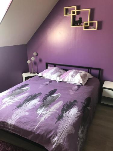
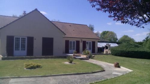
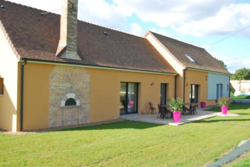
La Marchanderie : Bed and Breakfast near Spay
Bed and Breakfast : La Marchanderie
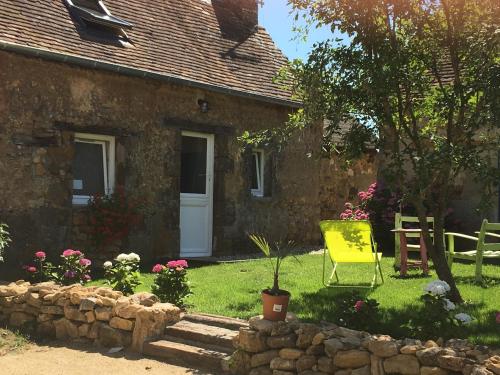
Boasting barbecue facilities, La Marchanderie features accommodation in Spay with free WiFi and garden views. This bed and breakfast offers a garden as well as a terrace. The b...
Rate : from 54.00 € to 80.00 €
Address : Chambre D'Hote La Marchanderie, Route de la vaudelle 72700 Spay
Distance Bed and Breakfast - Spay : 1.32 km

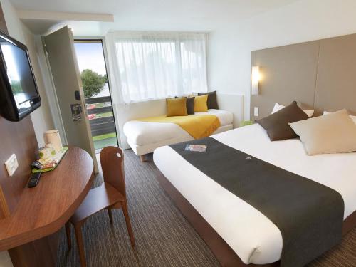
Campanile Le Mans - Arnage : Hotel near Spay
Hotel : Campanile Le Mans - Arnage
Conveniently located 2 km from town and close to the Le Mans race circuit, this hotel provides comfort and value in a convivial family atmosphere. Our managers and staff are de...
Price : from 41.30 € to 97.00 €
Contact : Rue de La Gêmerie 72230 Arnage
Distance Hotel - Spay : 3.01 km

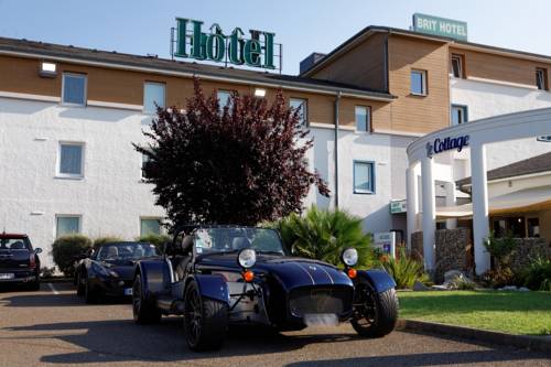
Brit Hotel Le Cottage Le Mans Sud : Hotel near Spay
Hotel : Brit Hotel Le Cottage Le Mans Sud
The Brit Hotel Le Cottage is ideally located in Arnage, close to Le Mans and its surroundings. It offers air-conditioned rooms with a private en suite bathroom, satellite TV and...
Prices : from 60.00 € to 150.00 €
Contact : Rue de la Gémerie 72230 Arnage
Distance Hotel - Spay : 3.03 km

Hôtel Inn Design Resto Novo Le Mans : Hotel near Spay
Hotel : Hôtel Inn Design Resto Novo Le Mans
Located next to Gémerie Lake, Hotel Inn Design Resto Novo is a 10-minute drive from Le Mans centre town. Free private parking is available on site and the hotel has a French res...
Rate : from 48.83 € to 98.16 €
Contact : 2 Rue Ernest Sylvain Bollee 72230 Arnage
Distance Hotel - Spay : 3.20 km

B&B Hôtel Le Mans Sud : Hotel near Spay
Hotel : B&B Hôtel Le Mans Sud
7 km from Antarès, B&B Hôtel Le Mans Sud is set in Arnage and provides air-conditioned rooms with free WiFi. All rooms boast a flat-screen TV with cable channels and a private b...
Price : from 57.00 € to 107.00 €
Address : 9 Rue Ernest-Sylvain Bollée 72230 Arnage
Distance Hotel - Spay : 3.22 km

Circuit : Guest accommodation near Spay
Guest accommodation : Circuit
Circuit features free WiFi and views of garden in Allonnes. All rooms boast a flat-screen TV with satellite channels and a shared bathroom. Le Mans is 8 km from the guest house...
Contact : 23 rue robespierre 72700 Allonnes
Distance Guest accommodation - Spay : 4.13 km

Maison pour les 24 heures automobiles du Mans : Bed and Breakfast near Spay
Bed and Breakfast : Maison pour les 24 heures automobiles du Mans
Located in Arnage, Maison pour les 24 heures automobiles du Mans offers free WiFi, 5 km from Antarès. Some units include a seating area and/or a terrace. A continental breakfa...
Contact : 151 Chemin des Bordages 72230 Arnage
Distance Bed and Breakfast - Spay : 4.40 km

Lodge de Saint Frambault : Bed and Breakfast near Spay
Bed and Breakfast : Lodge de Saint Frambault
Lodge de Saint Frambault is set in Roézé-sur-Sarthe. Free WiFi is featured. There is also a kitchenette in some of the units equipped with a microwave and a toaster. The bed a...
Contact : Route de Saint Frambault 72210 Roézé-sur-Sarthe
Distance Bed and Breakfast - Spay : 4.43 km

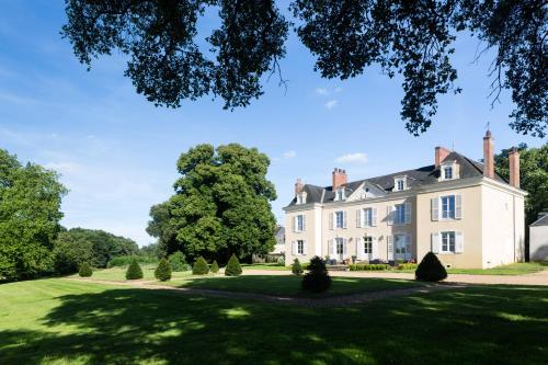
Chateau de Saint Frambault : Bed and Breakfast near Spay
Bed and Breakfast : Chateau de Saint Frambault
Chateau de Saint Frambault is situated in Roézé-sur-Sarthe. Free WiFi is offered. There is a private bathroom with shower in all units, along with free toiletries and a hair dr...
Address : Route De Saint Fraimbault 72210 Roézé-sur-Sarthe
Distance Bed and Breakfast - Spay : 4.44 km

Le temps d'une pause : Bed and Breakfast near Spay
Bed and Breakfast : Le temps d'une pause
Located in Monce en Belin, 6.5 km from Le Mans Race Track and 6 km from Le Mans Exhibition Centre, Le temps d'une pause is a property dedicated to your wellbeing. An infrared sa...
Rate : from 85.00 € to 140.00 €
Contact : 1 chemin des Pageottières 72230 Moncé-en-Belin
Distance Bed and Breakfast - Spay : 4.53 km


Find another hotel near Spay :

Spay hotels list


Map of Spay


Map of Spay :

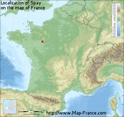
At right you can find the localization of Spay on the map of France. Below, this is the satellite map of Spay. A road map, and maps templates of Spay are available here : "road map of Spay". This map show Spay seen by the satellite of Google Map. To see the streets of Spay or move on another zone, use the buttons "zoom" and "map" on top of this dynamic map.

Search on the map of Spay :

To search hotels, housings, tourist information office, administrations or other services, use the Google search integrated to the map on the following page : "map Spay".
Hotels of Spay are listed on the map with the following icons: hotel Spay

The map of Spay is centred in the following coordinates :

Latitude :   Longitude :   

Spay on the map of France


Print the map of Spay


Print the map of Spay : map of Spay


Photos Spay

See all photos of Spay :

Other photos of Spay and nearby towns can be found here: photos Spay
These photos taken near the city of Spay can be shown in full screen clicking on the thumbnails. Photos are copyrighted by their owners.

classic2022 - 76 of 167 - Photo of Spay
classic2022 - 76 of 167

IMG_2798 - Photo of Spay
IMG_2798

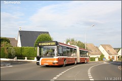
Renault Agora S – Setram (Société d-Économie Mixte des TRansports en commun de l-Agglomération Mancelle) n°606 - Photo of Spay
Renault Agora S – Setram (Société d-Économie Mixte des TRansports en commun de l-Agglomération Mancelle) n°606

Renault Agora S – Setram (Société d-Économie Mixte des TRansports en commun de l-Agglomération Mancelle) n°606 - Photo of Spay
Renault Agora S – Setram (Société d-Économie Mixte des TRansports en commun de l-Agglomération Mancelle) n°606

Renault Agora S – Setram (Société d-Économie Mixte des TRansports en commun de l-Agglomération Mancelle) n°608 - Photo of Spay
Renault Agora S – Setram (Société d-Économie Mixte des TRansports en commun de l-Agglomération Mancelle) n°608

Alstom Citadis 302 – Setram (Société d-Économie Mixte des TRansports en commun de l-Agglomération Mancelle) n°1012 (Yvré-l’Évêque) - Photo of Spay
Alstom Citadis 302 – Setram (Société d-Économie Mixte des TRansports en commun de l-Agglomération Mancelle) n°1012 (Yvré-l’Évêque)

Renault Agora S – Setram (Société d-Économie Mixte des TRansports en commun de l-Agglomération Mancelle) n°608 - Photo of Spay
Renault Agora S – Setram (Société d-Économie Mixte des TRansports en commun de l-Agglomération Mancelle) n°608

Alstom Citadis 302 – Setram (Société d-Économie Mixte des TRansports en commun de l-Agglomération Mancelle) n°1002 (Le Mans Métropole) - Photo of Spay
Alstom Citadis 302 – Setram (Société d-Économie Mixte des TRansports en commun de l-Agglomération Mancelle) n°1002 (Le Mans Métropole)

Renault Agora S – Setram (Société d-Économie Mixte des TRansports en commun de l-Agglomération Mancelle) n°610 - Photo of Spay
Renault Agora S – Setram (Société d-Économie Mixte des TRansports en commun de l-Agglomération Mancelle) n°610

Irisbus Agora S – Setram (Société d-Économie Mixte des TRansports en commun de l-Agglomération Mancelle) n°613 - Photo of Spay
Irisbus Agora S – Setram (Société d-Économie Mixte des TRansports en commun de l-Agglomération Mancelle) n°613

Irisbus Agora S – Setram (Société d-Économie Mixte des TRansports en commun de l-Agglomération Mancelle) n°611 - Photo of Spay
Irisbus Agora S – Setram (Société d-Économie Mixte des TRansports en commun de l-Agglomération Mancelle) n°611

Irisbus Citélis 12 – Setram (Société d-Économie Mixte des TRansports en commun de l-Agglomération Mancelle) n°111 - Photo of Spay
Irisbus Citélis 12 – Setram (Société d-Économie Mixte des TRansports en commun de l-Agglomération Mancelle) n°111

Irisbus Citélis 12 – Setram (Société d-Économie Mixte des TRansports en commun de l-Agglomération Mancelle) n°111 - Photo of Spay
Irisbus Citélis 12 – Setram (Société d-Économie Mixte des TRansports en commun de l-Agglomération Mancelle) n°111

Irisbus Citélis 12 – Setram (Société d-Économie Mixte des TRansports en commun de l-Agglomération Mancelle) n°122 - Photo of Spay
Irisbus Citélis 12 – Setram (Société d-Économie Mixte des TRansports en commun de l-Agglomération Mancelle) n°122


Spay weather forecast

Find next hours and 7 days weather forecast for Spay here : weather Spay (with english metrics)
This is the last weather forecast for Spay collected by the nearest observation station of La Suze-sur-Sarthe.

Week Forecast:


The latest weather data for Spay were collected Tuesday, 17 September 2024 at 15:06 from the nearest observation station of La Suze-sur-Sarthe.

Tuesday, September 17th

23°C     11°C

0%
 21%


Windy

Temperature Max: 23°C    Temperature Min: 11°C
Precipitation Probability: 0%
Percentage of sky occluded by clouds: 21%
Wind speed: 24 km/h Sout-East
Humidity: 68%°        UV Index: 5
Sunrise: 07:40     Sunset: 20:07

Wednesday, September 18th

24°C     13°C

0%
 35%


Mostly clear

Temperature Max: 24°C    Temperature Min: 13°C
Precipitation Probability: 0%
Percentage of sky occluded by clouds: 35%
Wind speed: 24 km/h Sout-East
Humidity: 67%°        UV Index: 4
Sunrise: 07:41     Sunset: 20:05

Thursday, September 19th

24°C     14°C

0%
 19%


Mostly clear

Temperature Max: 24°C    Temperature Min: 14°C
Precipitation Probability: 0%
Percentage of sky occluded by clouds: 19%
Wind speed: 20 km/h Sout-East
Humidity: 64%°        UV Index: 4
Sunrise: 07:43     Sunset: 20:03

Friday, September 20th

23°C     13°C

24%
 37%


Mostly clear

Temperature Max: 23°C    Temperature Min: 13°C
Precipitation Probability: 24% (Rain)
Percentage of sky occluded by clouds: 37%
Wind speed: 12 km/h West
Humidity: 68%°        UV Index: 4
Sunrise: 07:44     Sunset: 20:01

Attribution:             


Other maps, hotels and towns in france


Find another town, zip code, department, region, ...


Quick links Spay :


Make a link to this page of Spay with the following code :


Map of France | Regions | Departments | Cities | Partners | Terms | Contact