Map of France

Trentels photos


Find a town, a zip code,
a department, a region... in France
I like Map-France.com !


Trentels pictures


Here are the photos of the town of Trentels and nearby towns. Trentels is located in the department of Lot-et-Garonne in the region of Aquitaine. You will find the satellite map of Trentels under these photos.

To see photos of nearby towns of Trentels, you can try the following links :
   - Trémons photos : town located at 4.09 km
   - Saint-Aubin photos : town located at 4.70 km
   - Monségur photos : town located at 5.50 km
   - Saint-Georges photos : town located at 5.65 km
   - Saint-Sylvestre-sur-Lot photos : town located at 6.17 km
   - Dausse photos : town located at 6.19 km
   - Penne-d'Agenais photos : town located at 6.45 km
   - Cazideroque photos : town located at 6.74 km
   - Condezaygues photos : town located at 7.16 km
   - Saint-Vite photos : town located at 7.49 km
   - Savignac-sur-Leyze photos : town located at 7.66 km
   - Monsempron-Libos photos : town located at 8.40 km

 - photos of the department prefecture of Lot-et-Garonne : photos of Agen
 - pictures of others cities of Lot-et-Garonne : Lot-et-Garonne


To see Trentels from the sky, here is the satellite map of the town of Trentels : Trentels map.

I like Trentels !


Photos of the town of Trentels

These photos taken near the town of Trentels can be shown in full screen clicking on the thumbnails. Photos are copyrighted by their owners.

Photo of Trentels
Photo of Trentels

Temps de pluie - Photo of Trentels
Temps de pluie

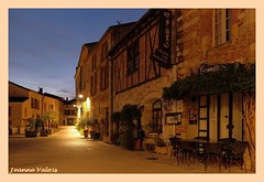
Penne d-Agenais à l-heure bleue - Photo of Trentels
Penne d-Agenais à l-heure bleue

Tournon d-Agenais_26juill178_ (19) - Photo of Trentels
Tournon d-Agenais_26juill178_ (19)

Chateau Le Stelsia. Une touche de modernité... :-) - Photo of Trentels
Chateau Le Stelsia. Une touche de modernité... :-)

River Lot - Barrage de St-Vite - Photo of Trentels
River Lot - Barrage de St-Vite

River Lot - Écluse de St-Vite - the old lock chamber is in use for hydro-electric generation - Photo of Trentels
River Lot - Écluse de St-Vite - the old lock chamber is in use for hydro-electric generation

River Lot - The heavily buoyed channel up to the current limit of navigation on the lower River Lot, the Barrage de St-Vite. - Photo of Trentels
River Lot - The heavily buoyed channel up to the current limit of navigation on the lower River Lot, the Barrage de St-Vite.

River Lot - Barrage de Fumel - Photo of Trentels
River Lot - Barrage de Fumel

River Lot - Photo of Trentels
River Lot

Photo of Trentels
Photo of Trentels

River Lot - Barrage de Fumel - incorporating the  remains of the écluse - Photo of Trentels
River Lot - Barrage de Fumel - incorporating the remains of the écluse

Photo of Trentels
Photo of Trentels

Photo of Trentels
Photo of Trentels


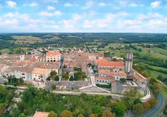
Trentels from the sky


Old photos of the town of Trentels

These photos taken near the town of Trentels can be shown in full screen clicking on the thumbnails. Photos are copyrighted by their owners.


Other maps, hotels and towns in france


Find another town, zip code, department, region, ...


Quick links Trentels :


Back to the menus Map of France :


Make a link to this page of Trentels with the following code :


Map of France | Regions | Departments | Cities | Partners | Terms | Contact