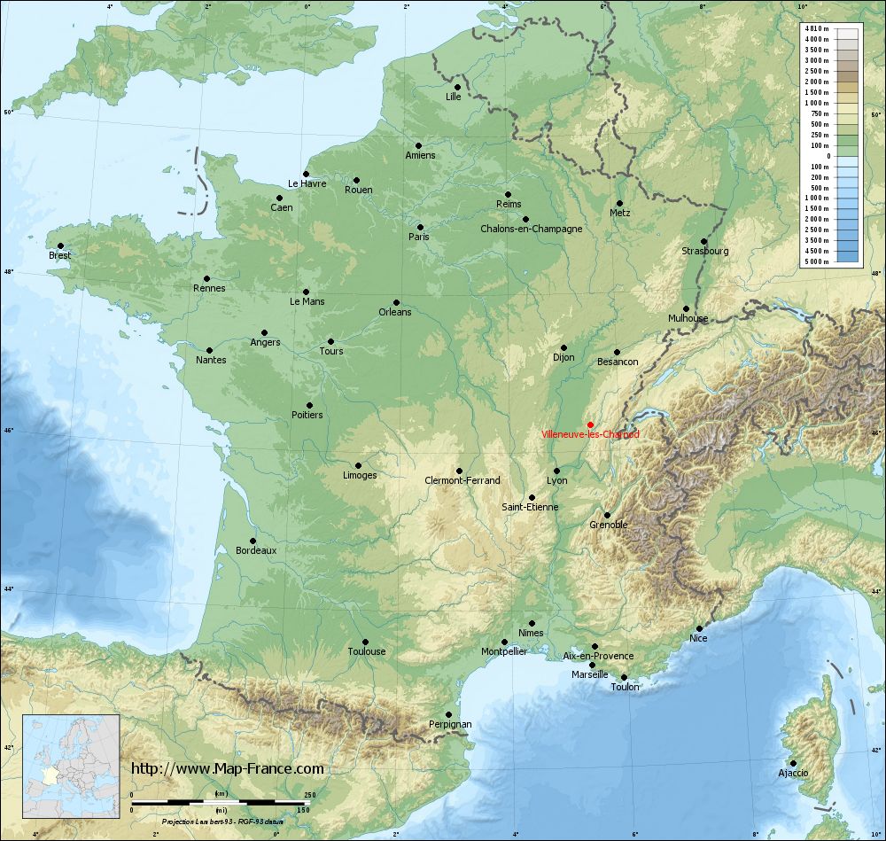
Villeneuve-lès-Charnod on the relief France map in Lambert 93 coordinates
|
See the map of Villeneuve-lès-Charnod in full screen (1000 x 949)
|
At left, here is the location of Villeneuve-lès-Charnod on the relief France map in Lambert 93 coordinates.
Here are the altitudes of Villeneuve-lès-Charnod :
- Town hall altitude of Villeneuve-lès-Charnod is 514 meters
- Minimum altitude of Villeneuve-lès-Charnod is 419 meters
- Maximum altitude of Villeneuve-lès-Charnod is 641 meters
- Medium altitude of Villeneuve-lès-Charnod is 530 meters
Here are the altitudes of Lons-le-Saunier, prefecture of Jura department:
- Town hall altitude of Lons-le-Saunier is 267 meters
- Minimum altitude of Lons-le-Saunier is 243 meters
- Maximum altitude of Lons-le-Saunier is 415 meters
- Medium altitude of Lons-le-Saunier is 329 meters
Here are the altitudes of the french biggest cities:
Paris : 33 meters
Marseille : 20 meters
Lyon : 237 meters
Toulouse : 146 meters
Nice : 10 meters
Nantes : 20 meters
Strasbourg : 144 meters
Montpellier : 35 meters
Bordeaux : 16 meters
Lille : 20 meters
Rennes : 35 meters
Reims : 83 meters
Click here for the terrain map of Villeneuve-lès-Charnod in full screen:
Relief map of Villeneuve-lès-Charnod
|
This relief map of Villeneuve-lès-Charnod is reusable and modifiable by making a link to this page of the Map-France.com website or by using the given code :
|
Terrain base map of Villeneuve-lès-Charnod
|

See the terrain base map of Villeneuve-lès-Charnod in full screen (1000 x 949)
|
Small relief base map of Villeneuve-lès-Charnod

|
This base map of Villeneuve-lès-Charnod is reusable and modifiable by making a link to this page of the Map-France.com website or by using the given code :
|
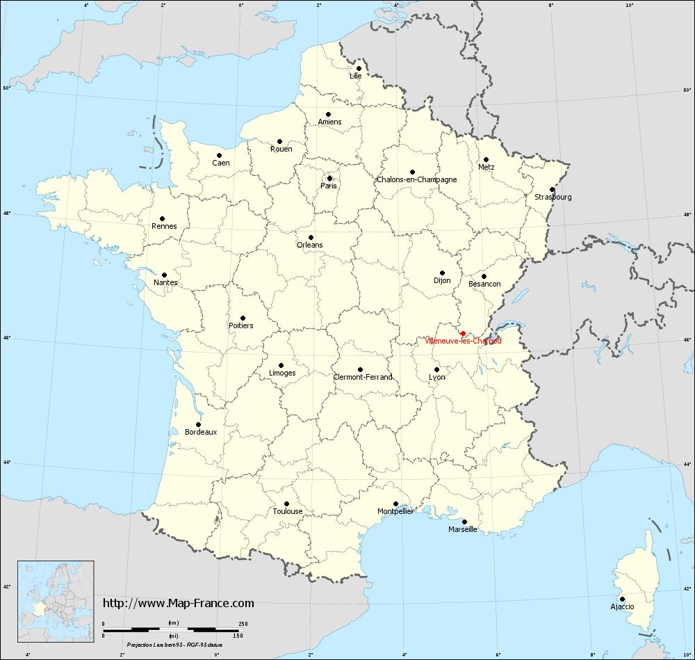
Map of Villeneuve-lès-Charnod with regions and prefectures
|
View the map of Villeneuve-lès-Charnod in full screen (1000 x 949)
|
You will find the location of Villeneuve-lès-Charnod on the map of France of regions in Lambert 93 coordinates. The town of Villeneuve-lès-Charnod is located in the department of Jura of the french region Franche-Comté.
Geographical sexagesimal coordinates / GPS (WGS84):
Latitude: 46° 20' 12'' North
Longitude: 05° 28' 42'' East
Geographical decimal coordinates :
Latitude: 46.336 degrees (46.336° North)
Longitude: 5.477 degrees (5.477° East)
Lambert 93 coordinates :
X: 8 906 hectometers
Y: 65 848 hectometers
Lambert 2 coordinates :
X: 8 418 hectometers
Y: 21 533 hectometers
Below, the geographical coordinates of Lons-le-Saunier, prefecture of the Jura department:
Geographical sexagesimal coordinates / GPS (WGS84):
Latitude: 46° 40' 28'' North
Longitude: 05° 33' 14'' East
Geographical decimal coordinates :
Latitude: 46.673 degrees (46.673° North)
Longitude: 5.552 degrees (5.552° East)
Lambert 93 coordinates :
X: 8 952 hectometers
Y: 66 225 hectometers
Lambert 2 coordinates :
X: 8 461 hectometers
Y: 21 911 hectometers
|
This map of Villeneuve-lès-Charnod is reusable and modifiable by making a link to this page of the Map-France.com website or by using the given code :
|
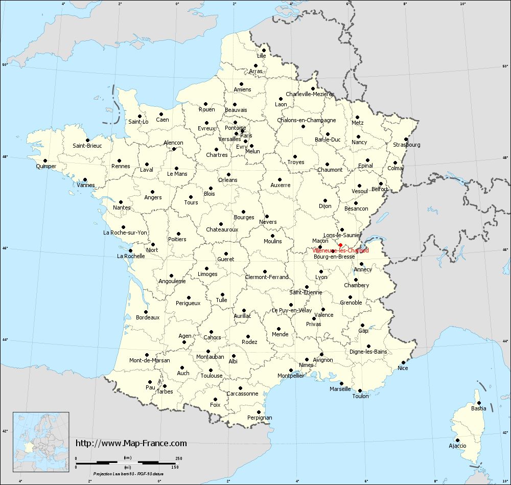
Map of Villeneuve-lès-Charnod with departments and prefectures
|
Voir la carte of Villeneuve-lès-Charnod en grand format (1000 x 949)
|
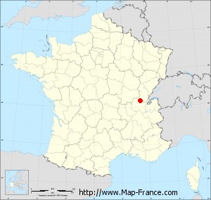
Here is the localization of Villeneuve-lès-Charnod on the France map of departments in Lambert 93 coordinates. The city of Villeneuve-lès-Charnod is shown on the map by a red point.
The town of Villeneuve-lès-Charnod is located in the department of Jura of the french region Franche-Comté.
The latitude of Villeneuve-lès-Charnod is 46.336 degrees North.
The longitude of Villeneuve-lès-Charnod is 5.477 degrees East.
Here the distance between Villeneuve-lès-Charnod and the biggest cities of France:
Distances are calculated as the crow flies (orthodromic distance)
Distance between Villeneuve-lès-Charnod and Paris : 365.58 kilometers
Distance between Villeneuve-lès-Charnod and Marseille : 337.7 kilometers
Distance between Villeneuve-lès-Charnod and Lyon : 80.96 kilometers
Distance between Villeneuve-lès-Charnod and Toulouse : 438.78 kilometers
Distance between Villeneuve-lès-Charnod and Nice : 324.11 kilometers
Distance between Villeneuve-lès-Charnod and Nantes : 543.69 kilometers
Distance between Villeneuve-lès-Charnod and Strasbourg : 302.77 kilometers
Distance between Villeneuve-lès-Charnod and Montpellier : 328.17 kilometers
Distance between Villeneuve-lès-Charnod and Bordeaux : 498.79 kilometers
Distance between Villeneuve-lès-Charnod and Lille : 509.29 kilometers
Distance between Villeneuve-lès-Charnod and Rennes : 574.55 kilometers
Distance between Villeneuve-lès-Charnod and Reims : 342.06 kilometers
Clic here to see the map of Villeneuve-lès-Charnod in full screen:
Villeneuve-lès-Charnod on the map of french departments
|
This administrative map of Villeneuve-lès-Charnod is reusable and modifiable by making a link to this page of the Map-France.com website or by using the given code :
|
Administrative base maps of Villeneuve-lès-Charnod
|

See the administrative base map of Villeneuve-lès-Charnod in full screen (1000 x 949)
|
Small administrative base map of Villeneuve-lès-Charnod
|
This base map administrative of Villeneuve-lès-Charnod is reusable and modifiable by making a link to this page of the Map-France.com website or by using the given code :
|
 French Version : http://www.cartesfrance.fr