|
The village of Chambérat is a small village located center of France. The town of Chambérat is located in the department of Allier of the french region Auvergne. The town of Chambérat is located in the township of Huriel part of the district of Montluçon. The area code for Chambérat is 03051 (also known as code INSEE), and the Chambérat zip code is 03370.
Geography and map of Chambérat :
The altitude of the city hall of Chambérat is approximately 407 meters. The Chambérat surface is 28.37 km ². The latitude and longitude of Chambérat are 46.418 degrees North and 2.414 degrees East.
Nearby cities and towns of Chambérat are :
Mesples (03370) at 4.45 km, Archignat (03380) at 5.24 km, Viplaix (03370) at 5.46 km, Courçais (03370) at 6.05 km, La Chapelaude (03380) at 6.87 km, Huriel (03380) at 7.06 km, Saint-Sauvier (03370) at 7.27 km, Saint-Éloy-d'Allier (03370) at 8.72 km.
(The distances to these nearby towns of Chambérat are calculated as the crow flies)
Population and housing of Chambérat :
The population of Chambérat was 306 in 1999, 312 in 2006 and 311 in 2007. The population density of Chambérat is 10.96 inhabitants per km². The number of housing of Chambérat was 195 in 2007. These homes of Chambérat consist of 141 main residences, 25 second or occasional homes and 29 vacant homes. |
|
|
Hotel Chambérat
|
|
|
Book now ! Best Price Guaranteed, no booking fees, pay at the hotel with our partner Booking.com, leader in online hotel reservation.
Find all hotels of Chambérat : Hotel Chambérat
| |
|
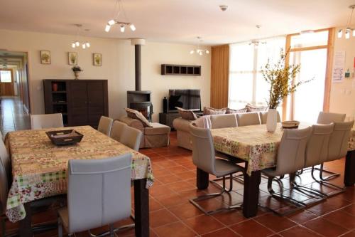
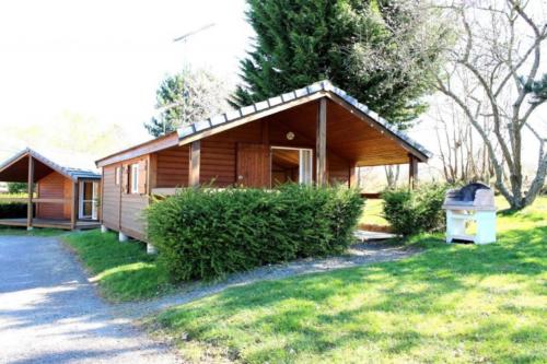
Guest accommodation : Gîte de groupe Les Dames Vertes

Situated in Mesples, Gîte de groupe Les Dames Vertes features accommodation with a terrace and free WiFi. The accommodation is 25 km from Montluçon. The holiday home is located...
Rate : from 270.00 €
Address : Le Bourg 03370 Mesples
Distance Guest accommodation - Chambérat : 4.32 km
|
|

|
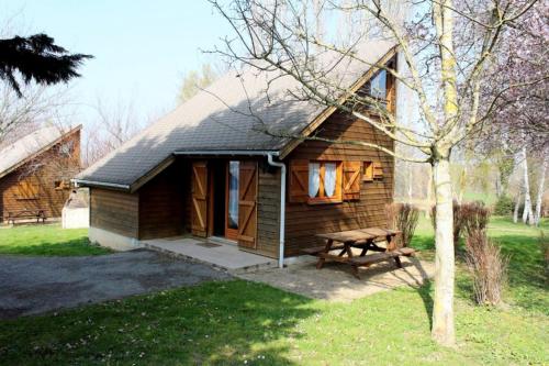
Guest accommodation : Chalet Thiennet
Situated in Mesples in the Auvergne region, Chalet Thiennet has a terrace. Guests staying at this chalet have access to a fully equipped kitchenette. The chalet features a flat...
Contact : Le Bourg 03370 Mesples
Distance Guest accommodation - Chambérat : 4.52 km
|
|
|
Guest accommodation : Chalet Thérence à Mesples
Set in Mesples in the Auvergne region, Chalet Thérence à Mesples has a terrace. Guests staying at this chalet have access to a fully equipped kitchenette. The chalet features a...
Contact : Le Bourg 03370 Mesples
Distance Guest accommodation - Chambérat : 4.53 km
|
|
|
Guest accommodation : Gîte La Brulette
Gîte La Brulette is situated in Saint-Rémy. The holiday home has garden views and is 27 km from Montluçon. This holiday home comes with 2 bedrooms, a living room and a fully eq...
Contact : 3 Saint-Rémy 03370 Saint-Rémy
Distance Guest accommodation - Chambérat : 6.39 km
|
|
|
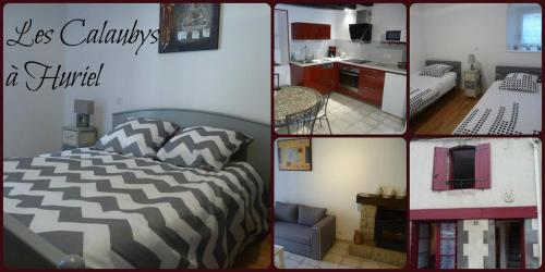
Guest accommodation : Les Calaubys
Offering free WiFi and city views, Les Calaubys is an accommodation set in Huriel. Guests staying at this holiday home have access to a fully equipped kitchen. This 2-bedroom h...
Price : from 55.00 €
to 95.00 €
Address : 35 grand rue 03380 Huriel
Distance Guest accommodation - Chambérat : 6.91 km
|
|
|
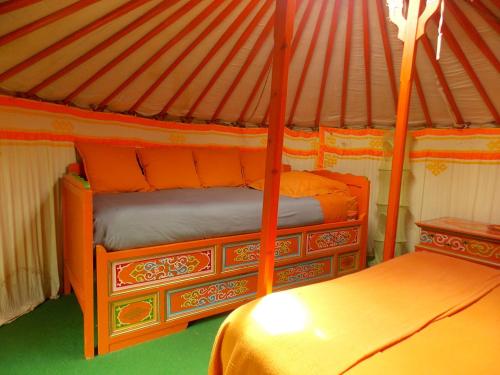
Guest accommodation : Yourte mongole
Yourte mongole is set in Huriel and offers free bikes. This tented camp features a garden. A continental or buffet breakfast can be enjoyed at the property. The tented camp of...
Prices : from 59.29 €
to 77.00 €
Contact : 20 rue de la patarianne 03380 Huriel
Distance Guest accommodation - Chambérat : 7.25 km
|
|
|
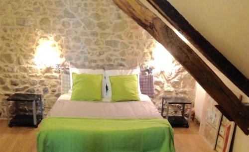
Bed and Breakfast : Les Maitres Sonneurs

Set in Huriel, Les Maitres Sonneurs features accommodation with a hot tub. Complimentary WiFi is available. There is also a kitchenette in some of the units equipped with a mic...
Rate : from 43.00 €
to 131.00 €
Contact : 20 rue de la Patarianne 03380 Huriel
Distance Bed and Breakfast - Chambérat : 7.26 km
|
|

|
Guest accommodation : Chalet La Petite Fadette
Offering free WiFi and garden views, Chalet La Petite Fadette is an accommodation set in Treignat. This property offers access to a terrace. The chalet is fitted with 2 separat...
Contact : Camping d'Herculat rue Le Grand Étang 03380 Treignat
Distance Guest accommodation - Chambérat : 7.82 km
|
|
|
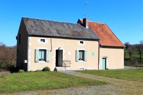
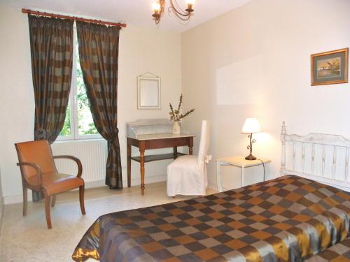
Bed and Breakfast : Les Malvaux
Set in a renovated farmhouse with a floral garden, this B&B is located a 10-minute drive from the medieval city of Montluçon. You can enjoy a continental breakfast on the terrac...
Prices : from 60.00 €
to 89.00 €
Address : 28 les malvaux 03380 Huriel
Distance Bed and Breakfast - Chambérat : 7.86 km
|
|
|
Guest accommodation : Chalet Les Maîtres Sonneurs
Situated in Herculat campsite on the shores of a pond, Chalet Les Maîtres Sonneurs is a chalet boasting a terrace and a barbecue. The unit is 20 km from Montluçon. Guests benefi...
Rate : from 60.00 €
Contact : Camping d'Herculat 03380 Herculat
Distance Guest accommodation - Chambérat : 8.46 km
|
|
Find another hotel near Chambérat : Chambérat hotels list
|
Map of Chambérat
|
|
Map of Chambérat :
At right you can find the localization of Chambérat on the map of France. Below, this is the satellite map of Chambérat. A road map, and maps templates of Chambérat are available here : "road map of Chambérat". This map show Chambérat seen by the satellite of Google Map. To see the streets of Chambérat or move on another zone, use the buttons "zoom" and "map" on top of this dynamic map.
Search on the map of Chambérat :
To search hotels, housings, tourist information office, administrations or other services, use the Google search integrated to the map on the following page : "map Chambérat".
Hotels of Chambérat are listed on the map with the following icons: 
The map of Chambérat is centred in the following coordinates :
|

|
|
|
|
Print the map of Chambérat

Print the map of Chambérat : map of Chambérat
|
Photos Chambérat
|
See all photos of Chambérat :
Other photos of Chambérat and nearby towns can be found here: photos Chambérat
|
|
Chambérat weather forecast
Find next hours and 7 days weather forecast for Chambérat here : weather Chambérat (with english metrics)
This is the last weather forecast for Chambérat collected by the nearest observation station of Huriel.
Week Forecast:
The latest weather data for Chambérat were collected Saturday, 01 August 2026 at 15:01 from the nearest observation station of Huriel.
| Saturday, August 1st |
28°C 17°C
46%
57%
|
Rain
Temperature Max: 28°C Temperature Min: 17°C
Precipitation Probability: 46% (Rain)
Percentage of sky occluded by clouds: 57%
Wind speed: 7 km/h South
Humidity: 64%° UV Index: 6
Sunrise: 06:31 Sunset: 21:21 |
|
| | Sunday, August 2nd |
30°C 17°C
14%
34%
|
Mostly clear
Temperature Max: 30°C Temperature Min: 17°C
Precipitation Probability: 14% (Rain)
Percentage of sky occluded by clouds: 34%
Wind speed: 6 km/h Sout-East
Humidity: 56%° UV Index: 7
Sunrise: 06:32 Sunset: 21:19 |
|
| | Monday, August 3rd |
31°C 19°C
28%
45%
|
Partly cloudy
Temperature Max: 31°C Temperature Min: 19°C
Precipitation Probability: 28% (Rain)
Percentage of sky occluded by clouds: 45%
Wind speed: 4 km/h North
Humidity: 54%° UV Index: 6
Sunrise: 06:33 Sunset: 21:18 |
|
| | Tuesday, August 4th |
30°C 20°C
50%
59%
|
Rain
Temperature Max: 30°C Temperature Min: 20°C
Precipitation Probability: 50% (Rain)
Percentage of sky occluded by clouds: 59%
Wind speed: 11 km/h East
Humidity: 62%° UV Index: 5
Sunrise: 06:34 Sunset: 21:16 |
|
|
Attribution: 
|
|
Other maps, hotels and towns in france
Find another town, zip code, department, region, ...
Quick links Chambérat :
Make a link to this page of Chambérat with the following code :
|
|
|
 French Version : http://www.cartesfrance.fr/carte-france-ville/03051_Chamberat.html