|
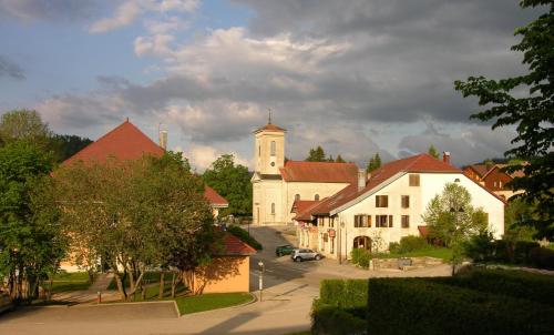
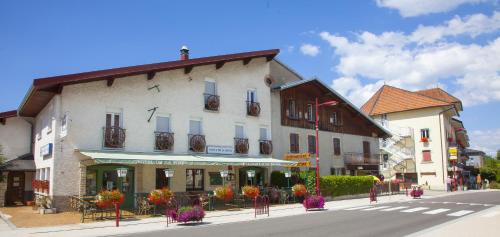
The village of Métabief is a small village located east of France. The town of Métabief is located in the department of Doubs of the french region Franche-Comté. The town of Métabief is located in the township of Mouthe part of the district of Pontarlier. The area code for Métabief is 25380 (also known as code INSEE), and the Métabief zip code is 25370.
Geography and map of Métabief :
The altitude of the city hall of Métabief is approximately 950 meters. The Métabief surface is 5.76 km ². The latitude and longitude of Métabief are 46.773 degrees North and 6.349 degrees East.
Nearby cities and towns of Métabief are :
Saint-Antoine (25370) at 0.98 km, Les Hôpitaux-Neufs (25370) at 1.94 km, Touillon-et-Loutelet (25370) at 2.13 km, Fourcatier-et-Maison-Neuve (25370) at 2.25 km, Les Hôpitaux-Vieux (25370) at 2.53 km, Longevilles-Mont-d'Or (25370) at 3.26 km, Jougne (25370) at 3.43 km, Malbuisson (25160) at 4.36 km.
(The distances to these nearby towns of Métabief are calculated as the crow flies)
Population and housing of Métabief :
The population of Métabief was 658 in 1999, 897 in 2006 and 888 in 2007. The population density of Métabief is 154.17 inhabitants per km². The number of housing of Métabief was 2 337 in 2007. These homes of Métabief consist of 424 main residences, 1 892 second or occasional homes and 21 vacant homes. |
|
|
Hotel Métabief
|
|
|
Book now ! Best Price Guaranteed, no booking fees, pay at the hotel with our partner Booking.com, leader in online hotel reservation.
Find all hotels of Métabief : Hotel Métabief
| |
|
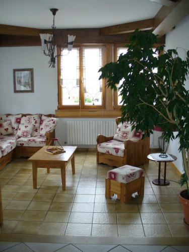
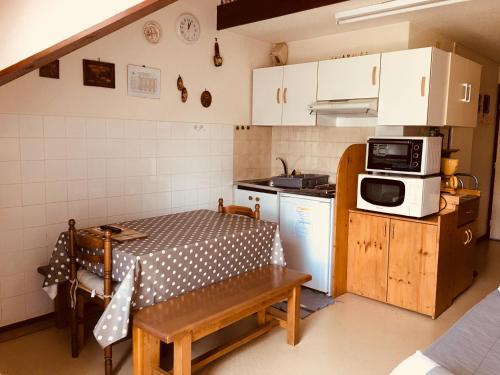
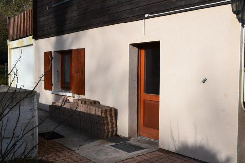
Apartment : La Source Du Pre Masset

Located in Métabief, La Souce Du Pré Masset is 9 km from the Swiss Border and 900 metres from Morond Ski Lift. This self-catering apartment offers free WiFi and a living room wi...
Address : 34 rue du Village 25370 Métabief
Distance Apartment - Métabief : 0.16 km
|
|
|
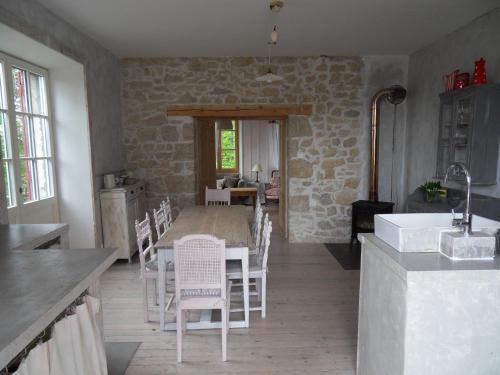
Guest accommodation : Le Bief Rouge
Offering a terrace, Le Bief Rouge is situated in Métabief, 800 metres from Télésiège du Morond. Free WiFi is offered and free private parking is available on site. Le Bief Roug...
Contact : 12 Rue Du Village 25370 Métabief
Distance Guest accommodation - Métabief : 0.30 km
|
|
|
Guest accommodation : La Marandine
La Marandine is situated in Métabief, 700 metres from Metabief Ski School, less than 1 km from Tetre, as well as a 12-minute walk from Télésiège du Morond. The property features...
Contact : 19 rue du village 25370 Métabief
Distance Guest accommodation - Métabief : 0.31 km
|
|
|
Apartment : duplex Métabief
Set 1.3 km from Metabief Ski School and 1.4 km from Liaison, duplex Métabief features accommodation situated in Métabief. This apartment provides accommodation with a balcony. ...
Contact : 3 rue du moulin 25370 Métabief
Distance Apartment - Métabief : 0.40 km
|
|
|
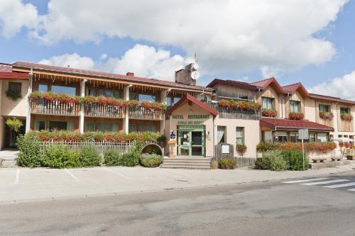
Hotel : Etoile des Neiges
Situated in Métabief, Etoile des Neiges has a terrace, bar and free WiFi. A sauna is available for guests, along with an indoor pool. Metabief Ski School is less than 1 km from ...
Price : from 72.00 €
to 91.00 €
Address : 4 rue du Village 25370 Métabief
Distance Hotel - Métabief : 0.50 km
|
|
|
Situated in Jougne, La Couronne provides free WiFi. Among the various facilities are a garden and ski storage space. Télésiège is 2.9 km from the property. At the hotel, every ...
Prices : from 82.00 €
to 143.00 €
Contact : 6 Rue de l'Église 25370 Jougne
Distance Hotel - Métabief : 3.46 km
|
|
|
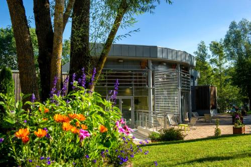
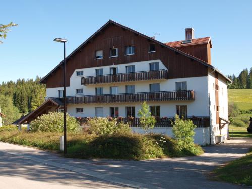
Guest accommodation : La Roche du Trésor Village Vacances
Located just 5 km from Métabief Mont d’Or ski resort in the Haut Jura Natural Regional Park, La Roche du Trésor provides guest rooms in a large chalet. Free Wi-Fi is provided in...
Rate : from 42.00 €
to 114.00 €
Contact : 20 rue du Doubs 25370 Longevilles-Mont-dʼOr
Distance Guest accommodation - Métabief : 3.86 km
|
|
|
Apartment : chalet
Featuring garden views, chalet is situated in Jougne, less than 1 km from Télésiège. The Chamois is within a 16-minute walk of the apartment. This apartment features a living r...
Contact : 5, rue de la cantine 25370 Jougne
Distance Apartment - Métabief : 3.88 km
|
|
|
Guest accommodation : La maison de Lilou
Located in Malbuisson, 8 km from Saint-Point Lake, La maison de Lilou features accommodation with free WiFi and access to a garden. The units feature a fireplace, a living room...
Address : 15 route du fort 25160 Malbuisson
Distance Guest accommodation - Métabief : 4.25 km
|
|
|
Hotel : Hôtel de la Poste
This hotel is set in Malbuisson village centre, 300 metres from Saint-Point Lake. Hôtel de la Poste invites guests to discover the regional cuisine of Franche-Comté in its resta...
Rate : from 52.70 €
to 102.00 €
Contact : 65, Grande Rue 25160 Malbuisson
Distance Hotel - Métabief : 4.43 km
|
|
Find another hotel near Métabief : Métabief hotels list
|
Map of Métabief
|
|
Map of Métabief :
At right you can find the localization of Métabief on the map of France. Below, this is the satellite map of Métabief. A road map, and maps templates of Métabief are available here : "road map of Métabief". This map show Métabief seen by the satellite of Google Map. To see the streets of Métabief or move on another zone, use the buttons "zoom" and "map" on top of this dynamic map.
Search on the map of Métabief :
To search hotels, housings, tourist information office, administrations or other services, use the Google search integrated to the map on the following page : "map Métabief".
Hotels of Métabief are listed on the map with the following icons: 
The map of Métabief is centred in the following coordinates :
|

|
|
|
|
Print the map of Métabief

Print the map of Métabief : map of Métabief
|
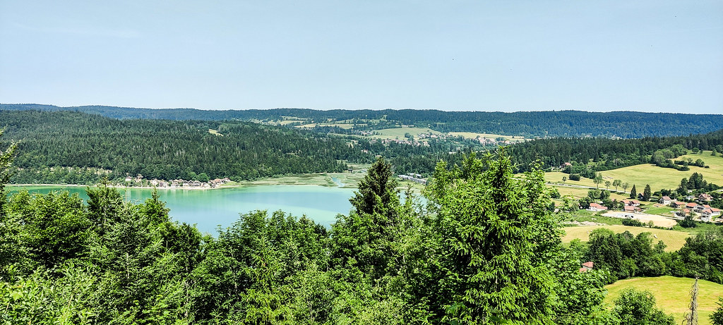
Photos Métabief
|
See all photos of Métabief :
Other photos of Métabief and nearby towns can be found here: photos Métabief
|
|
Métabief weather forecast
Find next hours and 7 days weather forecast for Métabief here : weather Métabief (with english metrics)
This is the last weather forecast for Métabief collected by the nearest observation station of Mouthe.
Week Forecast:
The latest weather data for Métabief were collected Friday, 31 July 2026 at 08:02 from the nearest observation station of Mouthe.
| Friday, July 31st |
27°C 16°C
63%
66%
|
Rain
Temperature Max: 27°C Temperature Min: 16°C
Precipitation Probability: 63% (Rain)
Percentage of sky occluded by clouds: 66%
Wind speed: 10 km/h North-East
Humidity: 48%° UV Index: 5
Sunrise: 06:14 Sunset: 21:08 |
|
| | Saturday, August 1st |
26°C 15°C
50%
49%
|
Drizzle
Temperature Max: 26°C Temperature Min: 15°C
Precipitation Probability: 50% (Rain)
Percentage of sky occluded by clouds: 49%
Wind speed: 8 km/h South-East
Humidity: 61%° UV Index: 6
Sunrise: 06:15 Sunset: 21:07 |
|
| | Sunday, August 2nd |
29°C 15°C
0%
22%
|
Mostly clear
Temperature Max: 29°C Temperature Min: 15°C
Precipitation Probability: 0%
Percentage of sky occluded by clouds: 22%
Wind speed: 5 km/h East
Humidity: 49%° UV Index: 8
Sunrise: 06:16 Sunset: 21:05 |
|
| | Monday, August 3rd |
30°C 18°C
43%
34%
|
Thunderstorms
Temperature Max: 30°C Temperature Min: 18°C
Precipitation Probability: 43% (Rain)
Percentage of sky occluded by clouds: 34%
Wind speed: 7 km/h North-East
Humidity: 42%° UV Index: 7
Sunrise: 06:17 Sunset: 21:04 |
|
|
Attribution: 
|
|
Other maps, hotels and towns in france
Find another town, zip code, department, region, ...
Quick links Métabief :
Make a link to this page of Métabief with the following code :
|
|
|
 French Version : http://www.cartesfrance.fr/carte-france-ville/25380_Metabief.html