|
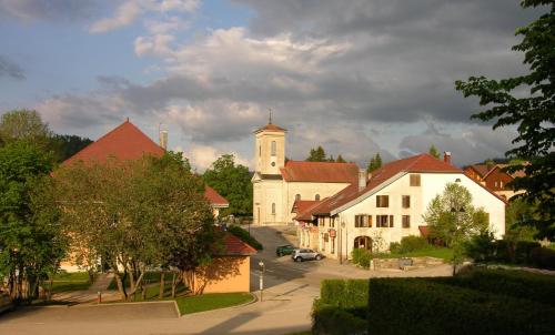
The village of Saint-Antoine is a small village located east of France. The town of Saint-Antoine is located in the department of Doubs of the french region Franche-Comté. The town of Saint-Antoine is located in the township of Mouthe part of the district of Pontarlier. The area code for Saint-Antoine is 25514 (also known as code INSEE), and the Saint-Antoine zip code is 25370.
Geography and map of Saint-Antoine :
The altitude of the city hall of Saint-Antoine is approximately 960 meters. The Saint-Antoine surface is 4.51 km ². The latitude and longitude of Saint-Antoine are 46.777 degrees North and 6.337 degrees East.
Nearby cities and towns of Saint-Antoine are :
Métabief (25370) at 0.98 km, Fourcatier-et-Maison-Neuve (25370) at 1.71 km, Touillon-et-Loutelet (25370) at 1.95 km, Les Hôpitaux-Neufs (25370) at 2.76 km, Les Hôpitaux-Vieux (25370) at 2.89 km, Longevilles-Mont-d'Or (25370) at 3.02 km, Malbuisson (25160) at 3.40 km, Labergement-Sainte-Marie (25160) at 4.01 km.
(The distances to these nearby towns of Saint-Antoine are calculated as the crow flies)
Population and housing of Saint-Antoine :
The population of Saint-Antoine was 276 in 1999, 278 in 2006 and 285 in 2007. The population density of Saint-Antoine is 63.19 inhabitants per km². The number of housing of Saint-Antoine was 151 in 2007. These homes of Saint-Antoine consist of 111 main residences, 25 second or occasional homes and 16 vacant homes. |
|
|
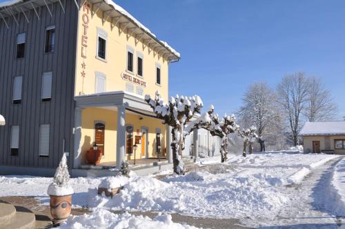
Hotel Saint-Antoine
|
|
|
Book now ! Best Price Guaranteed, no booking fees, pay at the hotel with our partner Booking.com, leader in online hotel reservation.
Find all hotels of Saint-Antoine : Hotel Saint-Antoine
| |
|
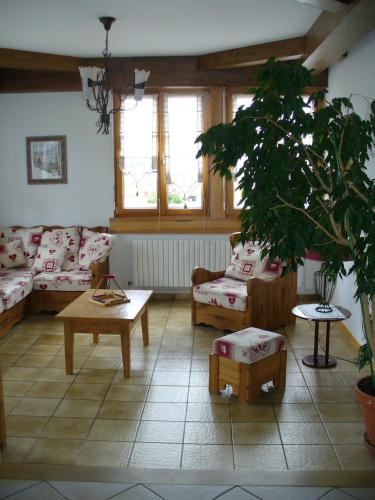
Apartment : La Source Du Pre Masset

Located in Métabief, La Souce Du Pré Masset is 9 km from the Swiss Border and 900 metres from Morond Ski Lift. This self-catering apartment offers free WiFi and a living room wi...
Address : 34 rue du Village 25370 Métabief
Distance Apartment - Saint-Antoine : 0.88 km
|
|
|
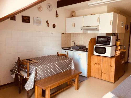
Apartment : duplex Métabief
Set 1.3 km from Metabief Ski School and 1.4 km from Liaison, duplex Métabief features accommodation situated in Métabief. This apartment provides accommodation with a balcony. ...
Contact : 3 rue du moulin 25370 Métabief
Distance Apartment - Saint-Antoine : 1.19 km
|
|
|
Guest accommodation : Le Bief Rouge
Offering a terrace, Le Bief Rouge is situated in Métabief, 800 metres from Télésiège du Morond. Free WiFi is offered and free private parking is available on site. Le Bief Roug...
Contact : 12 Rue Du Village 25370 Métabief
Distance Guest accommodation - Saint-Antoine : 1.20 km
|
|
|
Guest accommodation : La Marandine
La Marandine is situated in Métabief, 700 metres from Metabief Ski School, less than 1 km from Tetre, as well as a 12-minute walk from Télésiège du Morond. The property features...
Contact : 19 rue du village 25370 Métabief
Distance Guest accommodation - Saint-Antoine : 1.25 km
|
|
|
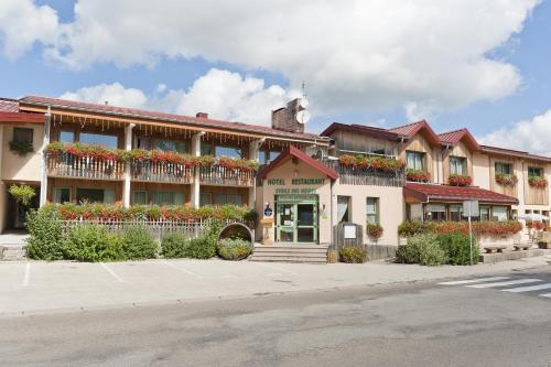
Hotel : Etoile des Neiges
Situated in Métabief, Etoile des Neiges has a terrace, bar and free WiFi. A sauna is available for guests, along with an indoor pool. Metabief Ski School is less than 1 km from ...
Price : from 72.00 €
to 91.00 €
Address : 4 rue du Village 25370 Métabief
Distance Hotel - Saint-Antoine : 1.36 km
|
|
|
Guest accommodation : La maison de Lilou
Located in Malbuisson, 8 km from Saint-Point Lake, La maison de Lilou features accommodation with free WiFi and access to a garden. The units feature a fireplace, a living room...
Contact : 15 route du fort 25160 Malbuisson
Distance Guest accommodation - Saint-Antoine : 3.33 km
|
|
|
Guest accommodation : La Roche du Trésor Village Vacances
Located just 5 km from Métabief Mont d’Or ski resort in the Haut Jura Natural Regional Park, La Roche du Trésor provides guest rooms in a large chalet. Free Wi-Fi is provided in...
Rate : from 42.00 €
to 114.00 €
Contact : 20 rue du Doubs 25370 Longevilles-Mont-dʼOr
Distance Guest accommodation - Saint-Antoine : 3.46 km
|
|
|
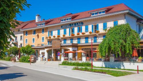
Hotel : Hôtel-Restaurant Le Lac
Set beside Lake Saint-Point, this hotel offers a seasonal outdoor swimming pool with panoramic views of the lake and free private parking on site. Decorated in a classic style,...
Price : from 52.70 €
to 194.00 €
Contact : 65 Grande Rue 25160 Malbuisson
Distance Hotel - Saint-Antoine : 3.49 km
|
|
|
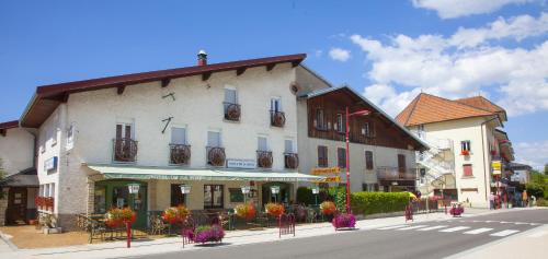
Hotel : Hôtel Beau Site
Situated by the Saint Point Lake in Malbuisson, this hotel offers a garden with a seasonal pool and lake views. Guests have free Wi-Fi and are invited to relax on the terrace. ...
Prices : from 52.70 €
to 127.00 €
Address : 65 Grande Rue 25160 Malbuisson
Distance Hotel - Saint-Antoine : 3.49 km
|
|
|
Hotel : Hôtel de la Poste
This hotel is set in Malbuisson village centre, 300 metres from Saint-Point Lake. Hôtel de la Poste invites guests to discover the regional cuisine of Franche-Comté in its resta...
Rate : from 52.70 €
to 102.00 €
Contact : 65, Grande Rue 25160 Malbuisson
Distance Hotel - Saint-Antoine : 3.49 km
|
|
Find another hotel near Saint-Antoine : Saint-Antoine hotels list
|
Map of Saint-Antoine
|
|
Map of Saint-Antoine :
At right you can find the localization of Saint-Antoine on the map of France. Below, this is the satellite map of Saint-Antoine. A road map, and maps templates of Saint-Antoine are available here : "road map of Saint-Antoine". This map show Saint-Antoine seen by the satellite of Google Map. To see the streets of Saint-Antoine or move on another zone, use the buttons "zoom" and "map" on top of this dynamic map.
Search on the map of Saint-Antoine :
To search hotels, housings, tourist information office, administrations or other services, use the Google search integrated to the map on the following page : "map Saint-Antoine".
Hotels of Saint-Antoine are listed on the map with the following icons: 
The map of Saint-Antoine is centred in the following coordinates :
|

|
|
|
|
Print the map of Saint-Antoine

Print the map of Saint-Antoine : map of Saint-Antoine
|
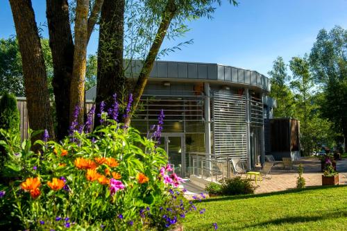
Photos Saint-Antoine
|
See all photos of Saint-Antoine :
Other photos of Saint-Antoine and nearby towns can be found here: photos Saint-Antoine
|
|
Saint-Antoine weather forecast
Find next hours and 7 days weather forecast for Saint-Antoine here : weather Saint-Antoine (with english metrics)
This is the last weather forecast for Saint-Antoine collected by the nearest observation station of Mouthe.
Week Forecast:
The latest weather data for Saint-Antoine were collected Friday, 31 July 2026 at 15:02 from the nearest observation station of Mouthe.
| Friday, July 31st |
28°C 16°C
64%
68%
|
Drizzle
Temperature Max: 28°C Temperature Min: 16°C
Precipitation Probability: 64% (Rain)
Percentage of sky occluded by clouds: 68%
Wind speed: 11 km/h North-East
Humidity: 46%° UV Index: 5
Sunrise: 06:14 Sunset: 21:08 |
|
| | Saturday, August 1st |
25°C 15°C
47%
46%
|
Drizzle
Temperature Max: 25°C Temperature Min: 15°C
Precipitation Probability: 47% (Rain)
Percentage of sky occluded by clouds: 46%
Wind speed: 8 km/h South-East
Humidity: 62%° UV Index: 6
Sunrise: 06:15 Sunset: 21:07 |
|
| | Sunday, August 2nd |
29°C 15°C
0%
39%
|
Partly cloudy
Temperature Max: 29°C Temperature Min: 15°C
Precipitation Probability: 0%
Percentage of sky occluded by clouds: 39%
Wind speed: 5 km/h North-East
Humidity: 48%° UV Index: 7
Sunrise: 06:16 Sunset: 21:05 |
|
| | Monday, August 3rd |
30°C 18°C
48%
43%
|
Thunderstorms
Temperature Max: 30°C Temperature Min: 18°C
Precipitation Probability: 48% (Rain)
Percentage of sky occluded by clouds: 43%
Wind speed: 7 km/h North
Humidity: 41%° UV Index: 7
Sunrise: 06:17 Sunset: 21:04 |
|
|
Attribution: 
|
|
Other maps, hotels and towns in france
Find another town, zip code, department, region, ...
Quick links Saint-Antoine :
Make a link to this page of Saint-Antoine with the following code :
|
|
|
 French Version : http://www.cartesfrance.fr/carte-france-ville/25514_Saint-Antoine.html


