|
The village of Saint-Vitte is a small village located center of France. The town of Saint-Vitte is located in the department of Cher of the french region Centre. The town of Saint-Vitte is located in the township of Saulzais-le-Potier part of the district of Saint-Amand-Montrond. The area code for Saint-Vitte is 18238 (also known as code INSEE), and the Saint-Vitte zip code is 18360.
Geography and map of Saint-Vitte :
The altitude of the city hall of Saint-Vitte is approximately 228 meters. The Saint-Vitte surface is 16.38 km ². The latitude and longitude of Saint-Vitte are 46.546 degrees North and 2.535 degrees East.
Nearby cities and towns of Saint-Vitte are :
Épineuil-le-Fleuriel (18360) at 3.98 km, Vallon-en-Sully (03190) at 5.51 km, Saulzais-le-Potier (18360) at 6.51 km, Chazemais (03370) at 7.13 km, Nassigny (03190) at 7.65 km, Vesdun (18360) at 8.12 km, Meaulne (03360) at 8.46 km, Saint-Désiré (03370) at 9.49 km.
(The distances to these nearby towns of Saint-Vitte are calculated as the crow flies)
Population and housing of Saint-Vitte :
The population of Saint-Vitte was 136 in 1999, 138 in 2006 and 138 in 2007. The population density of Saint-Vitte is 8.42 inhabitants per km². The number of housing of Saint-Vitte was 109 in 2007. These homes of Saint-Vitte consist of 66 main residences, 24 second or occasional homes and 18 vacant homes. |
|
|
Hotel Saint-Vitte
|
|
|
Book now ! Best Price Guaranteed, no booking fees, pay at the hotel with our partner Booking.com, leader in online hotel reservation.
Find all hotels of Saint-Vitte : Hotel Saint-Vitte
| |
|
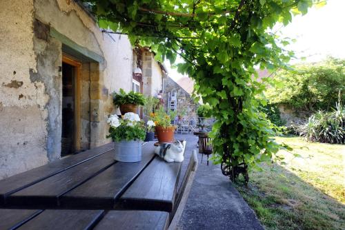
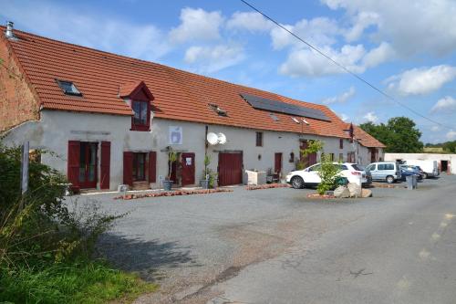
Guest accommodation : Maison du Fermier
Maison du Fermier is situated in Épineuil-le-Fleuriel. Guests staying at this holiday home have access to a fully equipped kitchen. Montluçon is 33 km from the holiday home, wh...
Address : feuilloux 18360 Épineuil-le-Fleuriel
Distance Guest accommodation - Saint-Vitte : 3.61 km
|
|
|
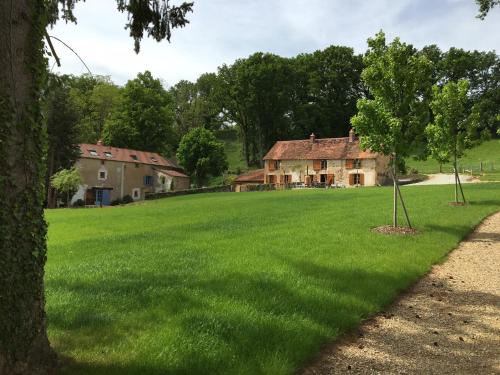
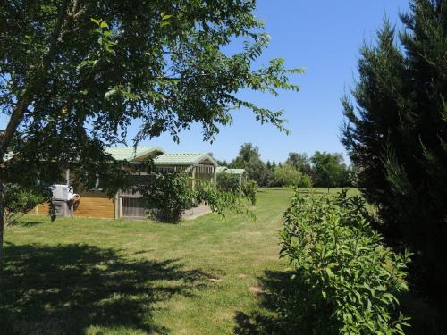
Guest accommodation : Domaine de Feuilloux
Domaine de Feuilloux is situated in La Bouchatte. The property features garden views and is 33 km from Montluçon. The holiday home includes 2 bedrooms and a kitchen with a micr...
Contact : Feuilloux 18360 La Bouchatte
Distance Guest accommodation - Saint-Vitte : 3.61 km
|
|
|
Guest accommodation : Sans Soucis
Samsuffit Aussi is a detached holiday home located in Epineuil-le-Fleuriel in the Centre-Val de Loire Region and is 30 km away from Montluçon. The property is 20 km from Orval ...
Contact : Grand Fond (Epineuil-le-Fleuriel) 18360 Épineuil-le-Fleuriel
Distance Guest accommodation - Saint-Vitte : 6.03 km
|
|
|
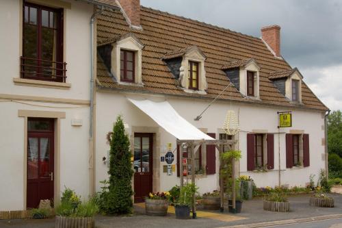
Bed and Breakfast : La Ressource
Offering garden views, La Ressource in Saint-Désiré provides accommodation and a garden. Free WiFi is available. A continental breakfast is available every morning at the bed a...
Rate : from 85.00 €
to 95.00 €
Contact : Moulin de la Fosse 03370 Saint-Désiré
Distance Bed and Breakfast - Saint-Vitte : 6.13 km
|
|

|
Guest accommodation : odyssee

Situated in Vallon-en-Sully, a 4-minute drive from the A71 motorway, odyssee provides 2-star accommodation with private terraces. This guest house offers free bikes and is 900 m...
Price : from 46.40 €
to 58.00 €
Address : 39 Rue Isidore Thivrier 03190 Vallon-en-Sully
Distance Guest accommodation - Saint-Vitte : 6.68 km
|
|
|
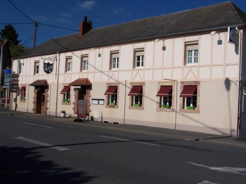
Hotel : le lichou
Situated in Vallon-en-Sully, le lichou features free bikes, a garden and a terrace. Featuring a restaurant, the property also has a bar. Free WiFi is at guests' disposal. The u...
Prices : from 47.00 €
to 61.00 €
Contact : 1, route de montlucon 03190 Vallon-en-Sully
Distance Hotel - Saint-Vitte : 6.71 km
|
|
|
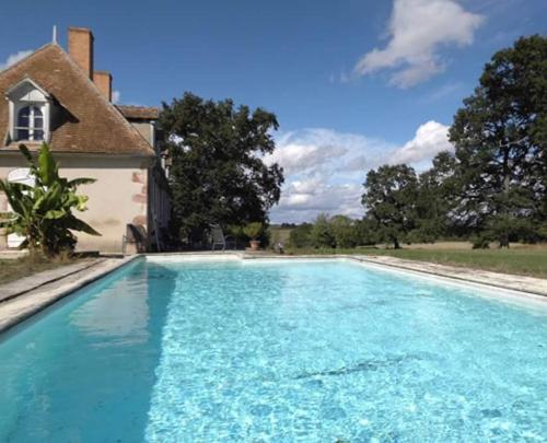
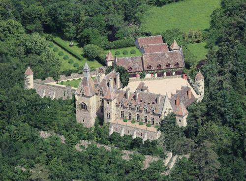
Bed and Breakfast : B&B Château de Peufeilhoux

Located 5 km from Vallon-en-Sully and set in a castle surrounded by 74 acres of forest, B&B Château de Peufeilhoux offers an outdoor pool as well as spacious rooms with a firepl...
Rate : from 120.00 €
to 240.00 €
Contact : Route de Paris 03190 Vallon-en-Sully
Distance Bed and Breakfast - Saint-Vitte : 6.71 km
|
|
|
Bed and Breakfast : Les Fruits du Passau
Located in Saint-Désiré, a 16-minute drive from the A71 motorway and a 21-minutes from the N145 motorway and Montluçon, this residence is in the countryside and has a terrace. ...
Price : from 91.00 €
to 99.00 €
Contact : LD Le Passau 03370 Saint-Désiré
Distance Bed and Breakfast - Saint-Vitte : 6.75 km
|
|
|
Guest accommodation : Domaine Maevag
Located in Chazemais at the exact centre point of France, Domaine Maevag offers an seasonal outdoor swimming pool, table tennis, pétanque facilities and bicycle rental. Montluço...
Address : La Croix Fayot, 21 route de St Désiré 03370 Chazemais
Distance Guest accommodation - Saint-Vitte : 7.17 km
|
|
|
Hotel : Au Coeur de Meaulne
Offering a garden and relaxation area, Au Coeur de Meaulne is a hotel located in Meaulne. Free WiFi access is available. Each room here will provide you with a flat-screen TV a...
Rate : from 65.10 €
to 70.00 €
Contact : 20 place de l'église 03360 Meaulne
Distance Hotel - Saint-Vitte : 8.37 km
|
|
Find another hotel near Saint-Vitte : Saint-Vitte hotels list
|
Map of Saint-Vitte
|
|
Map of Saint-Vitte :
At right you can find the localization of Saint-Vitte on the map of France. Below, this is the satellite map of Saint-Vitte. A road map, and maps templates of Saint-Vitte are available here : "road map of Saint-Vitte". This map show Saint-Vitte seen by the satellite of Google Map. To see the streets of Saint-Vitte or move on another zone, use the buttons "zoom" and "map" on top of this dynamic map.
Search on the map of Saint-Vitte :
To search hotels, housings, tourist information office, administrations or other services, use the Google search integrated to the map on the following page : "map Saint-Vitte".
Hotels of Saint-Vitte are listed on the map with the following icons: 
The map of Saint-Vitte is centred in the following coordinates :
|

|
|
|
|
Print the map of Saint-Vitte

Print the map of Saint-Vitte : map of Saint-Vitte
|
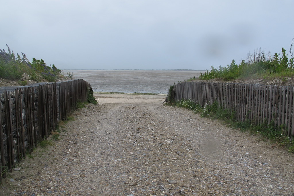
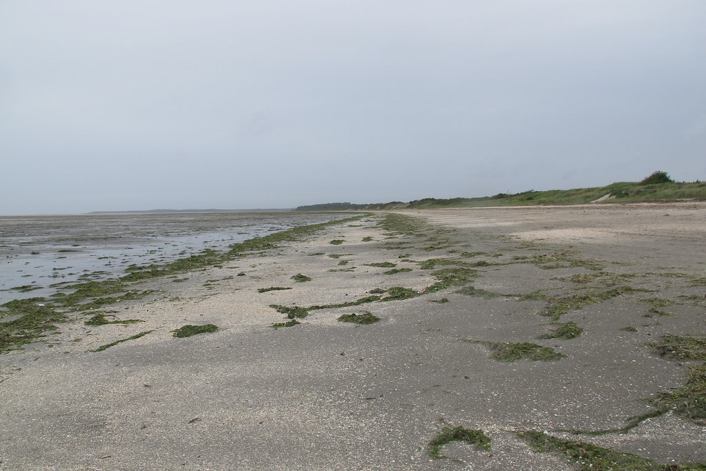
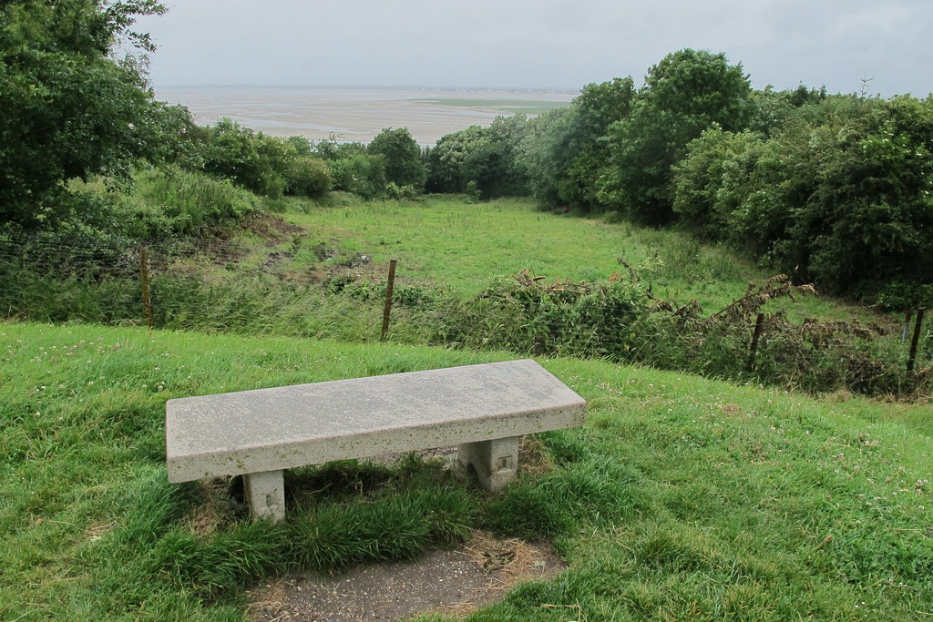
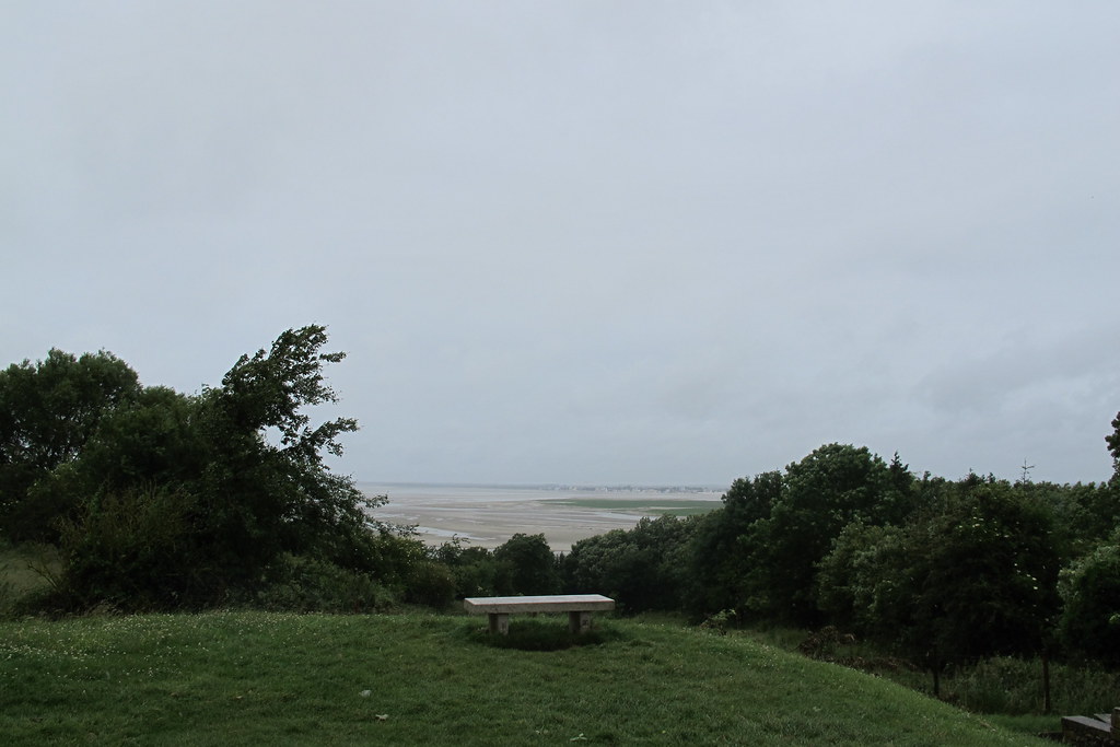
Photos Saint-Vitte
|
See all photos of Saint-Vitte :
Other photos of Saint-Vitte and nearby towns can be found here: photos Saint-Vitte
|
|
Saint-Vitte weather forecast
Find next hours and 7 days weather forecast for Saint-Vitte here : weather Saint-Vitte (with english metrics)
This is the last weather forecast for Saint-Vitte collected by the nearest observation station of Saulzais-le-Potier.
Week Forecast:
The latest weather data for Saint-Vitte were collected Friday, 31 July 2026 at 08:02 from the nearest observation station of Saulzais-le-Potier.
| Friday, July 31st |
28°C 18°C
62%
77%
|
Rain
Temperature Max: 28°C Temperature Min: 18°C
Precipitation Probability: 62% (Rain)
Percentage of sky occluded by clouds: 77%
Wind speed: 8 km/h East
Humidity: 67%° UV Index: 5
Sunrise: 06:29 Sunset: 21:22 |
|
| | Saturday, August 1st |
29°C 18°C
16%
45%
|
Partly cloudy
Temperature Max: 29°C Temperature Min: 18°C
Precipitation Probability: 16% (Rain)
Percentage of sky occluded by clouds: 45%
Wind speed: 8 km/h South
Humidity: 59%° UV Index: 7
Sunrise: 06:30 Sunset: 21:21 |
|
| | Sunday, August 2nd |
33°C 17°C
0%
18%
|
Mostly clear
Temperature Max: 33°C Temperature Min: 17°C
Precipitation Probability: 0%
Percentage of sky occluded by clouds: 18%
Wind speed: 8 km/h West
Humidity: 48%° UV Index: 8
Sunrise: 06:31 Sunset: 21:20 |
|
| | Monday, August 3rd |
32°C 20°C
37%
64%
|
Thunderstorms
Temperature Max: 32°C Temperature Min: 20°C
Precipitation Probability: 37% (Rain)
Percentage of sky occluded by clouds: 64%
Wind speed: 10 km/h North-East
Humidity: 52%° UV Index: 5
Sunrise: 06:33 Sunset: 21:18 |
|
|
Attribution: 
|
|
Other maps, hotels and towns in france
Find another town, zip code, department, region, ...
Quick links Saint-Vitte :
Make a link to this page of Saint-Vitte with the following code :
|
|
|
 French Version : http://www.cartesfrance.fr/carte-france-ville/18238_Saint-Vitte.html