|
|
|
|
|
|
Department of Cher - 18
|
|
Department of Cher
|
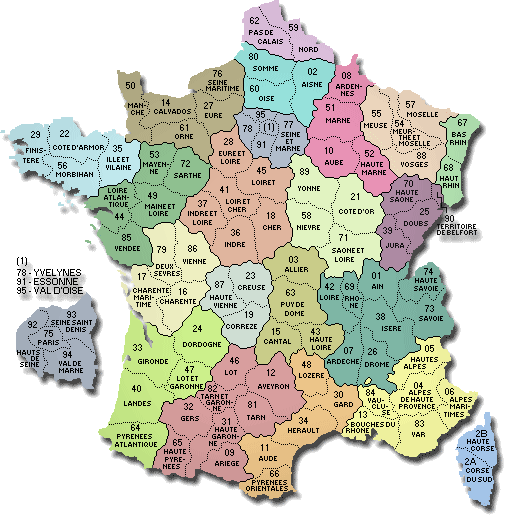
The department is the second level of administrative divisions on the map of France.
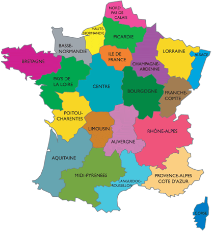
The department of Cher is located in the region of region of Centre.
The department of Cher has the number 18 and is divided into 3 districts , 35 townships and 290 municipalities. Below you will find the localization of Cher on the map of France, and the satellite map of Cher.
|
|
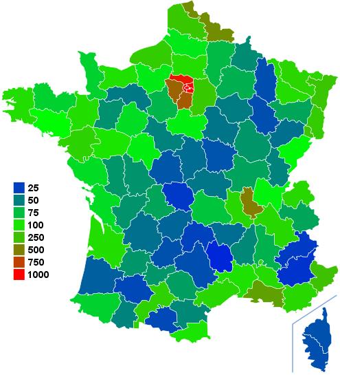
Inhabitants of Cher were 314 428 in the 1999 census and 314 675 in the 2006 census. Area of departement of Cher is 7 234,99 km ². Population density of Cher is 43,49 inhabitants per km².
Biggest cities of department of Cher, in number of inhabitants, are (2007 census):
Bourges, Vierzon, Saint-Amand-Montrond, Saint-Doulchard, Mehun-sur-Yèvre, Saint-Florent-sur-Cher, Aubigny-sur-Nère, Saint-Germain-du-Puy, Dun-sur-Auron, Trouy, La Guerche-sur-l'Aubois, La Chapelle-Saint-Ursin, Sancoins, Avord, Argent-sur-Sauldre, Méreau, Châteaumeillant, Saint-Martin-d'Auxigny.
You will find the towns list of Cher in the bottom on this page. You can consult the map of France, pictures, hotels, and all data of every town and village in the department of Cher clicking on these towns links.
|
|
|
I like the department of
Cher !
|
|
|
|
|
|
|
|
|
Statistics of department of Cher |
| Population 1999 |
314 428 inhabitants |
|
| Population 2006 |
314 675 inhabitants |
|
| Area |
7 234.99 km ² |
|
| Population density |
43.49 inhabs/km²
|

|
| Variation of density |
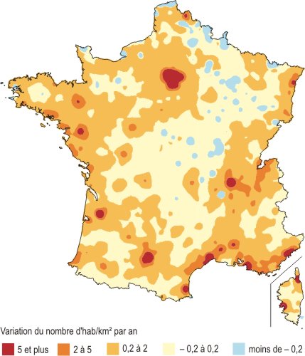
+0.01 %/year |

|
| |
|
|
Administration of department of Cher |
| Number |
18 |
|
| Prefecture |
Bourges |
|
| Subprefectures |
Saint-Amand-Montrond
Vierzon |

|
| Region |
Centre (24) |

|
| |
|
|
Subdivisions of the department of Cher |
| Districts |
3 |
|
| Townships |
35 |
|
| Municipalities |
290 |
|
|
Hotel Cher
|
Book now ! Best Price Guaranteed, no booking fees, pay at the hotel with our partner Booking.com, leader in online hotel reservation.
| |
|
Hotel Bourges
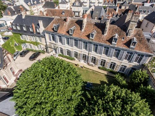
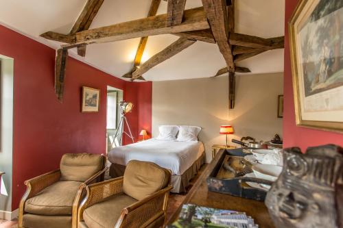
Hôtel de Panette - Un Château en Ville

Set in an 18th-century building with period furniture, L'Hôtel de Panette is surrounded by a 600-m² garden and is the former estate of the Spanish Charles V during his exile. It offers ...
Rate : from 129.60 € to 333.00 €
Address : 1, rue Henri Ducrot 18000 Bourges
|
|
|
Hotel Bourges
Hôtel de Panette, appartements de charme
Appartements L’Hôtel Panette are set in an 18th century building in the centre of Bourges, 200 metres from Cathédrale Saint-Etienne. The individually decorated studios and apartments ...
Price : from 79.00 € to 199.00 €
Contact : 1 rue Henri Ducrot 18000 Bourges
|
|

|
Hotel Saint-Amand-Montrond
Hôtel Le Saint Amand

This 2-star hotel is a 5-minute drive from the A71, which leads directly to Clermont-Ferrand and Montpellier. Set in Saint-Armand-Montrond town centre, it offers rooms with free WiFi acce...
Prices : from 55.00 € to 70.00 €
Contact : 80 rue fradet 18200 Saint-Amand-Montrond
|
|
|
Hotel Saint-Amand-Montrond
Melitine
Located in Saint-Amand-Montrond in the Centre region, Melitine has a terrace. The apartment, set in a building dating from 1980, provides free WiFi.
The 2-bedroom apartment features a li...
Rate : from 64.60 € to 140.00 €
Contact : 56 rue billeron 18200 Saint-Amand-Montrond
|
|

|
This designer hotel is set in the centre of Vierzon. Guests can enjoy a panoramic view of the Canal de Berry from the rooms, and free Wi-Fi.
This Arche Hotel features air-conditioned and...
Price : from 49.00 € to 127.00 €
Address : 13 rue du 11 Novembre 1918 18100 Vierzon
|
|
|
Hotel Vierzon
La Passerelle
Set in Vierzon, an 11-minute walk from Vierzon Hospital, La Passerelle features a garden and terrace. With a shared lounge, the property also features a bar. The hotel offers a French res...
Prices : from 65.00 € to 130.00 €
Contact : 8 Rue Pierre Debournou 18100 Vierzon
|
|
|
Map of Cher
MAP OF THE CHER DEPARTMENT
|
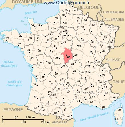
Where is located the Cher department ?
The department of Cher is located in the region of Centre. Cher is in red on the map of french departments.
What are the statistics and key data of Cher ?
The department of Cher has the number 18. It is composed of 3 districts ("arrondissements") , 35 townships ("cantons") and 290 towns ("communes").
The 3 districts of the department of Cher are :
Bourges, Saint-Amand-Montrond, Vierzon.
The inhabitants of of Cher were 314 428 in 1999 and 314 675 in 2006.
The area of the department of Cher is 7 234,99 km ². Population density of the department of Cher is 43,49 inhabitants per km².
What are the largest cities of the department of Cher ?
The largest cities of the department of Cher (compared to the number of inhabitants in 2007) are :
Bourges, Vierzon, Saint-Amand-Montrond, Saint-Doulchard, Mehun-sur-Yèvre, Saint-Florent-sur-Cher, Aubigny-sur-Nère, Saint-Germain-du-Puy, Dun-sur-Auron, Trouy, La Guerche-sur-l'Aubois, La Chapelle-Saint-Ursin, Sancoins, Avord, Argent-sur-Sauldre, Méreau, Châteaumeillant, Saint-Martin-d'Auxigny.
Interactive map of the Cher department
You can zoom the satellite map of Cher to see a village or a city, for example Bourges.
Search a town of departement of Cher
|
|
|
|
|
|
Records of the Cher department: Did you know ?
The town with the longest name of the department of Cher is: Saint-Christophe-le-Chaudry
The town with the shortest name of the department of Cher is: Azy
The municipality with the highest altitude of the department of Cher is: Préveranges with 419 m
The municipality with the lowest altitude of the department of Cher is: Thénioux with 90 m
The municipality with the largest area of the department of Cher is: Brinon-sur-Sauldre with 116.30 km ²
The municipality with the smallest area of the department of Cher is: Chaumont with 2.11 km ² |
Towns list of the Cher department
Follow the links of towns and cities of the Cher department and see photos, maps, and informations for these towns.
|
List of french departments
|
Other departments, regions, maps, hotels and towns in france
Find another town, zip code, department, region, ...
Back to the menus Map of France :
Make a link to this pageVouzeron with the following code :
|
Find a town in France by clicking on the following interactives maps :
|
Map of french regions
|
Map of french departments
|
|
Map of France | Regions | Departments | Cities | Partners | Terms | Contact
 French version : Cher | Carte de France French version : Cher | Carte de France
|