|
|
|
|
|
|
Department of Cantal - 15
|
|
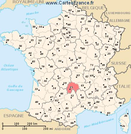
Department of Cantal
|
The department is the second level of administrative divisions on the map of France.
The department of Cantal is located in the region of region of Auvergne.
The department of Cantal has the number 15 and is divided into 3 districts , 27 townships and 260 municipalities. Below you will find the localization of Cantal on the map of France, and the satellite map of Cantal.
|
|
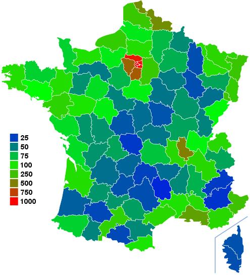
Inhabitants of Cantal were 150 778 in the 1999 census and 149 682 in the 2006 census. Area of departement of Cantal is 5 725,98 km ². Population density of Cantal is 26,14 inhabitants per km².
Biggest cities of department of Cantal, in number of inhabitants, are (2007 census):
Aurillac, Saint-Flour, Arpajon-sur-Cère, Mauriac, Ytrac, Riom-ès-Montagnes, Maurs, Murat, Vic-sur-Cère, Naucelles, Ydes, Massiac, Jussac, Pleaux, Saint-Mamet-la-Salvetat, Lanobre, Saint-Paul-des-Landes, Sansac-de-Marmiesse.
You will find the towns list of Cantal in the bottom on this page. You can consult the map of France, pictures, hotels, and all data of every town and village in the department of Cantal clicking on these towns links.
|
|
|
I like the department of
Cantal !
|
|
|
|
|
|
|
|
|
Statistics of department of Cantal |
| Population 1999 |
150 778 inhabitants |
|
| Population 2006 |
149 682 inhabitants |
|
| Area |
5 725.98 km ² |
|
| Population density |
26.14 inhabs/km²
|

|
| Variation of density |
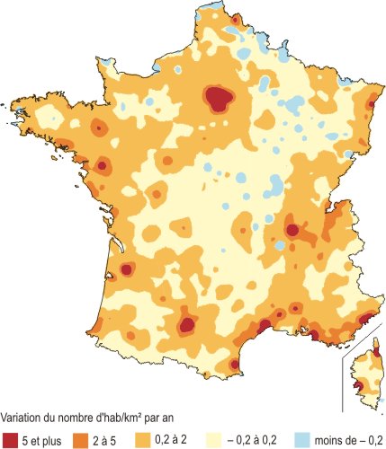
-0.10 %/year |

|
| |
|
|
Administration of department of Cantal |
| Number |
15 |
|
| Prefecture |
Aurillac |
|
| Subprefectures |
Mauriac
Saint-Flour |

|
| Region |
Auvergne (83) |

|
| |
|
|
Subdivisions of the department of Cantal |
| Districts |
3 |
|
| Townships |
27 |
|
| Municipalities |
260 |
|
|
Hotel Cantal
|
Book now ! Best Price Guaranteed, no booking fees, pay at the hotel with our partner Booking.com, leader in online hotel reservation.
| |
|
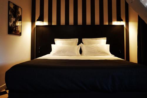
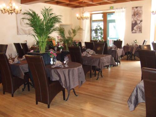
Hotel Aurillac
Hotel des Carmes

Hotel des Carmes is located in a semi-pedestrianied area of downtown Aurillac. It has a covered, heated swimming pool and a sauna.
The 23 rooms overlook the hotel’s sun deck in the int...
Rate : from 59.00 € to 380.00 €
Address : 20 Rue des Carmes 15000 Aurillac
|
|
|
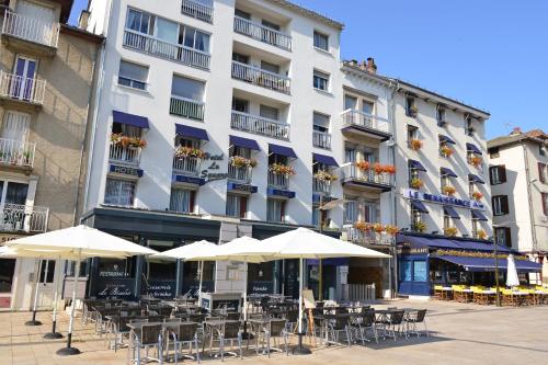
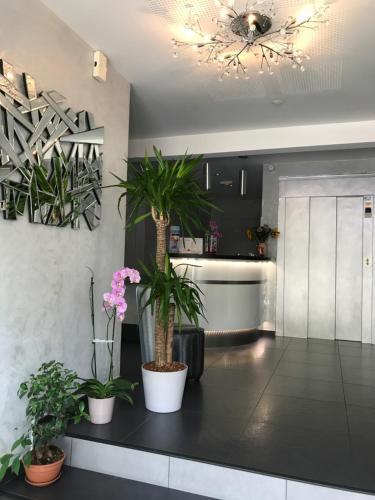
Hotel Aurillac
Hôtel Le Square
Set in the heart of Aurillac, this little hotel welcomes you near the historic city, in front of a beautiful park. The hotel was renovated in 2016.
Hotel Le Square features comfortable g...
Price : from 53.10 € to 70.00 €
Contact : 15 Place du Square 15000 Aurillac
|
|
|
Hotel Mauriac
Logis L'Ecu De France
The Logis L’Ecu de France is situated in the heart of Mauriac, a village in the north-west of the Cantal area.
The rooms are functional and comfortable, all equipped with private bathr...
Prices : from 65.00 € to 90.00 €
Contact : 6, Av. Charles Perie 15200 Mauriac
|
|
|
Hotel Mauriac
Logis Auv'hôtel
The logis Auv’hôtel is located in Mauriac, a small town in the north-west of the Cantal area between Salers and the Dordogne. It proposes 11 air-conditioned rooms.
All rooms at the Lo...
Rate : from 62.00 € to 140.00 €
Contact : 4, Rue Du 11 Novembre 15200 Mauriac
|
|
|
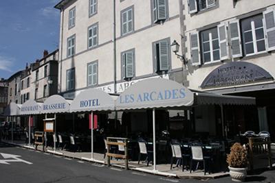
Hotel Saint-Flour
Hôtel des Roches
Featuring free WiFi and a terrace, Hôtel des Roches offers pet-friendly accommodation in Saint-Flour, 32 km from Blesle. Guests can enjoy the on-site bar.
All rooms are accessible by st...
Price : from 50.00 € to 71.00 €
Address : 7 Place d'Armes 15100 Saint-Flour
|
|
|
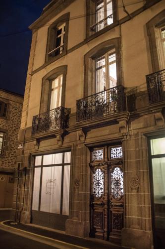
Hotel Saint-Flour
La Maison d'Adelaïde
La Maison d'Adelaïde is a B&B located in the medieval town of Saint-Flour. Free WiFi access is available.
Each room here will provide you with a TV with satellite channels and a desk. T...
Prices : from 85.00 € to 125.00 €
Contact : 12, rue de la Rollandie 15100 Saint-Flour
|
|
|
Map of Cantal
MAP OF THE CANTAL DEPARTMENT
|
Where is located the Cantal department ?
The department of Cantal is located in the region of Auvergne. Cantal is in red on the map of french departments.
What are the statistics and key data of Cantal ?
The department of Cantal has the number 15. It is composed of 3 districts ("arrondissements") , 27 townships ("cantons") and 260 towns ("communes").
The 3 districts of the department of Cantal are :
Aurillac, Mauriac, Saint-Flour.
The inhabitants of of Cantal were 150 778 in 1999 and 149 682 in 2006.
The area of the department of Cantal is 5 725,98 km ². Population density of the department of Cantal is 26,14 inhabitants per km².
What are the largest cities of the department of Cantal ?
The largest cities of the department of Cantal (compared to the number of inhabitants in 2007) are :
Aurillac, Saint-Flour, Arpajon-sur-Cère, Mauriac, Ytrac, Riom-ès-Montagnes, Maurs, Murat, Vic-sur-Cère, Naucelles, Ydes, Massiac, Jussac, Pleaux, Saint-Mamet-la-Salvetat, Lanobre, Saint-Paul-des-Landes, Sansac-de-Marmiesse.
Interactive map of the Cantal department
You can zoom the satellite map of Cantal to see a village or a city, for example Aurillac.
Search a town of departement of Cantal
|
|
|
|
|
|
Records of the Cantal department: Did you know ?
The town with the longest name of the department of Cantal is: Champs-sur-Tarentaine-Marchal
The town with the shortest name of the department of Cantal is: Ally
The municipality with the highest altitude of the department of Cantal is: Montgreleix with 1220 m
The municipality with the lowest altitude of the department of Cantal is: Vieillevie with 215 m
The municipality with the largest area of the department of Cantal is: Pleaux with 92.39 km ²
The municipality with the smallest area of the department of Cantal is: Escorailles with 2.79 km ² |
Towns list of the Cantal department
Follow the links of towns and cities of the Cantal department and see photos, maps, and informations for these towns.
|
List of french departments
|
Other departments, regions, maps, hotels and towns in france
Find another town, zip code, department, region, ...
Back to the menus Map of France :
Make a link to this pageYtrac with the following code :
|
Find a town in France by clicking on the following interactives maps :
|
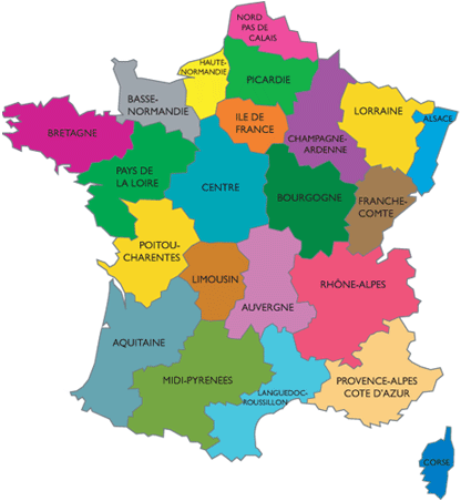
Map of french regions
|
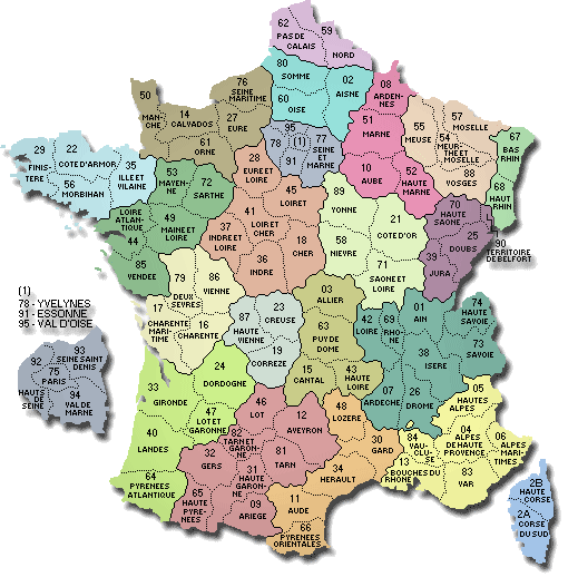
Map of french departments
|
|
Map of France | Regions | Departments | Cities | Partners | Terms | Contact
 French version : Cantal | Carte de France French version : Cantal | Carte de France
|